Aumont-Aubrac, Peyre en Aubrac, A pied : Les meilleures randonnées, itinéraires, parcours, balades et promenades

6 commentaires

Aumont-Aubrac : découvrez les meilleures randonnées : 5 a pied, 90 marche et 1 marche nordique. Tous ces circuits, parcours, itinéraires et activités en plein air sont disponibles dans nos applications SityTrail pour smartphones et tablettes.


Les meilleurs parcours (95)

Randonnée Marche Peyre en Aubrac - Aumont Aubrac Nasbinal Avril 2018 - Photo
Marche 27.153
Km
GUIDE

Marche

Difficile
Peyre en Aubrac, Occitanie, Lozère, France
27 km | 34 km-effort
7h 54min
529 m
401 m
Non
Kargil

• 5ème Etape depuis Le Puy L'étape sauvage par excellence

Randonnée Marche Peyre en Aubrac - Compostelle Aumont-Nasbinals - Photo
Marche 27.906
Km

Marche

Difficile
(1)
Peyre en Aubrac, Occitanie, Lozère, France
28 km | 36 km-effort
7h 37min
605 m
477 m
Non
c.chappuis

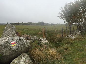
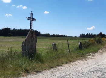
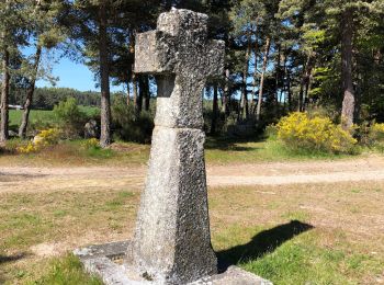
• Compostelle - Aumont - Aubrac / Nasbinals

Randonnée Marche Peyre en Aubrac - Étape 1 Saint Gilhem - Photo
Marche 17.149
Km
GUIDE

Marche

Très difficile
Peyre en Aubrac, Occitanie, Lozère, France
17,1 km | 21 km-effort
4h 48min
315 m
179 m
Non
Roger Philippe Wallez

Randonnée Marche Peyre en Aubrac - Mon chemin de St Guilhem étape 1 - Photo
Marche 17.166
Km
GUIDE

Marche

Moyen
Peyre en Aubrac, Occitanie, Lozère, France
17,2 km | 21 km-effort
4h 12min
317 m
180 m
Non
nadinebondoux

Randonnée Marche Peyre en Aubrac - Chemin de St Guilhem - Variante N° 03 - Photo
Marche 247.248
Km
GUIDE

Marche

Très difficile
Peyre en Aubrac, Occitanie, Lozère, France
247 km | 348 km-effort
72h 48min
7310 m
8256 m
Non
Kargil

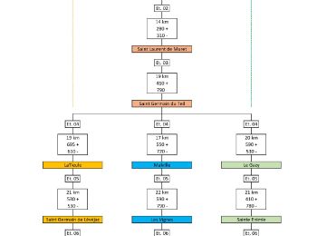
• C'est la variante la plus sportive qui passe par La Tieule et Saint Jean de Lévéjac. Tracée sur 14 jours Le détail de...

Randonnée Marche Peyre en Aubrac - Chemin de St Guilhem - Variante N° 02 - Photo
Marche 242.46
Km
GUIDE

Marche

Très difficile
Peyre en Aubrac, Occitanie, Lozère, France
242 km | 347 km-effort
72h 18min
7569 m
8515 m
Non
Kargil

• Variante par Malville et Les Vignes selon mon inspiration, plus sportive que l'itinéraire de base. Tracée sur 14 jour...

Randonnée Marche Peyre en Aubrac - Chemin de St Guilhem - Variante N° 01 - Photo
Marche 223.19
Km
GUIDE

Marche

Très difficile
Peyre en Aubrac, Occitanie, Lozère, France
223 km | 312 km-effort
65h 20min
6433 m
7379 m
Non
Kargil

• Tracé de base avec étapes plus courtes au départ. 13 étapes en passant par Le Gazy, Ste Eninie et Drigas. Le détail d...

Randonnée A pied Peyre en Aubrac - Etape05_1 - Aumont - Lasbros  par le chemin - Photo
A pied 6.827
Km

A pied

Très facile
(1)
Peyre en Aubrac, Occitanie, Lozère, France
6,8 km | 8,2 km-effort
Inconnu
117 m
69 m
Non
ghislainem

Randonnée Marche Peyre en Aubrac - Aumont Aubrac / Le Py auberge les gentianes  - Photo
Marche 15.608
Km

Marche

Facile
Peyre en Aubrac, Occitanie, Lozère, France
15,6 km | 19,3 km-effort
4h 9min
314 m
163 m
Non
guariso

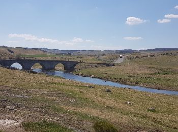
• sur le plateau de l'aubrac. Petite étape du chemin de saint Jacques

Randonnée Marche Peyre en Aubrac - Aumont Aubrac - Nasbinal - Photo
Marche 28.662
Km

Marche

Facile
Peyre en Aubrac, Occitanie, Lozère, France
29 km | 35 km-effort
7h 17min
536 m
411 m
Non
jib971

• Etape de la pluie

Randonnée Marche Peyre en Aubrac - aumont aubrac - gilbertes - Photo
Marche 25.419
Km

Marche

Très facile
Peyre en Aubrac, Occitanie, Lozère, France
25 km | 32 km-effort
6h 14min
504 m
395 m
Non
prv

• tour de l'aubrac

Randonnée Marche Peyre en Aubrac - De Aumont Aubrac à Prinsuejols - Photo
Marche 15.721
Km

Marche

Difficile
Peyre en Aubrac, Occitanie, Lozère, France
15,7 km | 19,8 km-effort
3h 40min
350 m
181 m
Non
tracegps

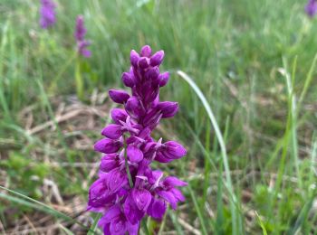
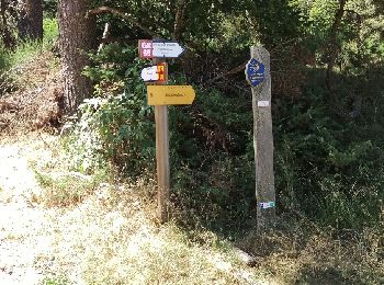
• Départ centre ville. Chemin commun avec les pèlerins de Compostelle, prairies intéressantes.

Randonnée Marche Peyre en Aubrac - Tour des Monts d'Aubrac - De Aumont Aubrac à Prinsuéjols - Photo
Marche 14.568
Km

Marche

Facile
Peyre en Aubrac, Occitanie, Lozère, France
14,6 km | 18,3 km-effort
4h 30min
321 m
167 m
Non
tracegps

• Belle randonnée de six jours et 100 km sans difficultés et peu de dénivelées au départ de Aumont-Aubrac en passant pa...

Randonnée Marche Peyre en Aubrac - Randoguide - Photo
Marche 27.852
Km

Marche

Très facile
(1)
Peyre en Aubrac, Occitanie, Lozère, France
28 km | 35 km-effort
7h 4min
544 m
418 m
Non
evdm

Randonnée Marche Peyre en Aubrac - GR65 j2 - Photo
Marche 17.662
Km

Marche

Moyen
Peyre en Aubrac, Occitanie, Lozère, France
17,7 km | 21 km-effort
6h 51min
311 m
188 m
Non
werth

Randonnée Marche Peyre en Aubrac - live Aumont Aubrac - Nasbinals  - Photo
Marche 23.819
Km

Marche

Difficile
Peyre en Aubrac, Occitanie, Lozère, France
24 km | 30 km-effort
6h 43min
475 m
314 m
Non
djeepee74

Randonnée Marche Peyre en Aubrac - le circuit des croix en partant de Aumont Aubrac  - Photo
Marche 17.483
Km

Marche

Moyen
Peyre en Aubrac, Occitanie, Lozère, France
17,5 km | 22 km-effort
5h 41min
364 m
353 m
Non
GILOU440

Randonnée Marche Peyre en Aubrac - Aumont à Finieyrols - Photo
Marche 15.59
Km

Marche

Peyre en Aubrac, Occitanie, Lozère, France
15,6 km | 19,2 km-effort
6h 2min
306 m
163 m
Non
dominiq

Randonnée Marche Peyre en Aubrac - Tour des Monts d'Aubrac 1 - Photo
Marche 14.568
Km
GUIDE

Marche

Facile
Peyre en Aubrac, Occitanie, Lozère, France
14,6 km | 18,3 km-effort
4h 2min
321 m
167 m
Non
randotines

• 1ère étape Aumont-Aubrac - Prinsuéjols

Randonnée Marche Peyre en Aubrac - Tour de l'Aubrac (partie sud) - Photo
Marche 117.381
Km

Marche

Très difficile
Peyre en Aubrac, Occitanie, Lozère, France
117 km | 150 km-effort
34h 12min
2483 m
2483 m
Oui
sgazaix

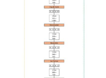
• 5 étapes - 117 km - 34 heures - 2483 m D+

20 randonnées affichées sur 95

Application GPS de randonnée GRATUITE

Logo SityTrail SityTrail

IGN / Instituts géographiques

Télécharger SityTrail sur l'App Store Télécharger SityTrail sur Google Play

Logo SityTrail SityTrail World

Le monde est à vous

Télécharger SityTrail sur l'App Store Télécharger SityTrail sur Google Play Télécharger SityTrail sur Huawei AppGallery

Activités

Fermer
Mes abonnements