


7,7 km | 20 km-effort
Bordes-Uchentein : découvrez les meilleures randonnées : 1 a pied, 56 marche et 3 course à pied. Tous ces circuits, parcours, itinéraires et activités en plein air sont disponibles dans nos applications SityTrail pour smartphones et tablettes.

Marche


• Jour 1 : Monter à l'étang Long par le col de Barlonguère. Bivouac au bout de l'étang. Source pas loin. Jour 2 : Monte...
Marche
• 1300m positif 1450 negatif 19km
A pied
Course à pied
• Ascension du mont Valier. Passage par la cascade de Nerech, le refuge des Estagnous, l’Étang Rond et retour.
Marche
• Ascension du mont Valier. Passage par la cascade de Nerech, le refuge des Estagnous, l’Étang Rond et retour.
Marche
• Itinéraire aisé concernant le trajet mais sur des pentes raides jusqu'au Tuc de Coucou. Le retour non balisé pour une...
Marche
• Aller retour au refuge des Estagnous, pas de possibilité ce jour là de monter au Vallier mauvaise météo, passage à l'...
Marche
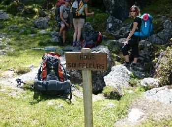
• Esbints Eylie
Marche
Marche
Marche

Course à pied
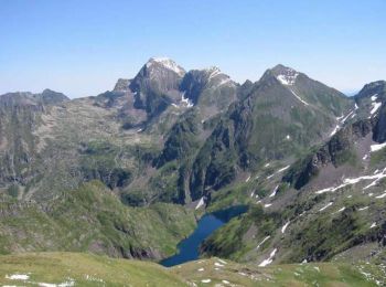
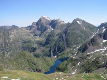
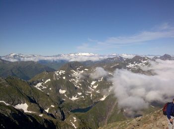
• Découvrez le toit du Couserans qui offre un panorama magnifique, (l'Anéto en fond sur la photo). Montez par la voie n...
Marche
• Découvrez le toit du Couserans qui offre un panorama magnifique, (l'Anéto en fond sur la photo). Montez par la voie n...
Marche
• rando Mont Valier Maison du Valier > Refuge des Estagnous > Mt Valier > Col de Pecouch > Etang de Milouga > Maison d...
Marche
• Départ Maison du Valier, montée au refuge d'Estagnous, Pic du Mont Valier. refuge Estagnous, Col Pecouch et descente ...
Marche
Marche
Marche
• Trek de 5 jours reliant la maison du Valier à Guzet.
Marche
• Cabane d'Aouen/Esbints
Marche
•
20 randonnées affichées sur 60
Application GPS de randonnée GRATUITE
 SityTrail
IGN / Instituts géographiques
SityTrail World
Le monde est à vous