![](/images/other/stat-length.png)
- Randonnées
- A pied
- France
- Occitanie
- Ariège
- Lieurac
Lieurac, Ariège, A pied : Les meilleures randonnées, itinéraires, parcours, balades et promenades
Lieurac : découvrez les meilleures randonnées : 1 a pied et 2 marche. Tous ces circuits, parcours, itinéraires et activités en plein air sont disponibles dans nos applications SityTrail pour smartphones et tablettes.
Les meilleurs parcours (3)
![Randonnée Marche Lieurac - lieurac -roquefort les cascades -Ilhac - Photo](https://media.geolcdn.com/t/350/260/b5583ffa-799a-4058-95cf-c2535d680836.jpg&format=jpg&maxdim=2)
![Marche Marche](https://static1.geolcdn.com/sitytour/trail-icons/101.png)
Km
#1 - lieurac -roquefort les cascades -Ilhac
Marche
Moyen
Lieurac,
Occitanie,
Ariège,
France
![](/images/other/stat-length.png)
15,7 km | 23 km-effort
4h 41min
![](https://static1.geolcdn.com/siteimages/upload/files/1508320355ic_sort_den_pos_24dp.png)
583 m
![](https://static1.geolcdn.com/siteimages/upload/files/1508320355ic_sort_den_neg_24dp.png)
586 m
![](https://static1.geolcdn.com/siteimages/upload/files/16400158638029165_repeat_loop_refresh_sync_direction_icon.png)
Oui
cappelle
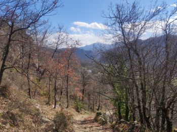
• belle rando avec des rampailloux -cascades malheureusement sans eau ,sécheresse intense cette année
![Randonnée Marche Lieurac - 09_Lieurac_reco - Photo](https://media.geolcdn.com/t/350/260/ext.jpg?maxdim=2&url=https%3A%2F%2Fstatic1.geolcdn.com%2Fsiteimages%2Fupload%2Ffiles%2F1553511878bg_sport_marche.png)
![Marche Marche](https://static1.geolcdn.com/sitytour/trail-icons/101.png)
Km
#2 - 09_Lieurac_reco
Marche
Moyen
Lieurac,
Occitanie,
Ariège,
France
![](/images/other/stat-length.png)
14,3 km | 21 km-effort
3h 54min
![](https://static1.geolcdn.com/siteimages/upload/files/1508320355ic_sort_den_pos_24dp.png)
537 m
![](https://static1.geolcdn.com/siteimages/upload/files/1508320355ic_sort_den_neg_24dp.png)
538 m
![](https://static1.geolcdn.com/siteimages/upload/files/16400158638029165_repeat_loop_refresh_sync_direction_icon.png)
Oui
jab31
![Randonnée A pied Lieurac - Tour de la vallée du douctouyre - Photo](https://media.geolcdn.com/t/350/260/ext.jpg?maxdim=2&url=https%3A%2F%2Fstatic1.geolcdn.com%2Fsiteimages%2Fupload%2Ffiles%2F1545311037marcheuse_200dpi.jpg)
![A pied A pied](https://static1.geolcdn.com/sitytour/trail-icons/100.png)
Km
#3 - Tour de la vallée du douctouyre
A pied
Moyen
Lieurac,
Occitanie,
Ariège,
France
![](/images/other/stat-length.png)
17,1 km | 25 km-effort
Inconnu
![](https://static1.geolcdn.com/siteimages/upload/files/1508320355ic_sort_den_pos_24dp.png)
596 m
![](https://static1.geolcdn.com/siteimages/upload/files/1508320355ic_sort_den_neg_24dp.png)
583 m
![](https://static1.geolcdn.com/siteimages/upload/files/16400158638029165_repeat_loop_refresh_sync_direction_icon.png)
Oui
bascait
3 randonnées affichées sur 3
Application GPS de randonnée GRATUITE