


9,2 km | 20 km-effort
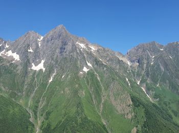
Seix : découvrez les meilleures randonnées : 1 a pied, 56 marche et 1 trail. Tous ces circuits, parcours, itinéraires et activités en plein air sont disponibles dans nos applications SityTrail pour smartphones et tablettes.
Marche


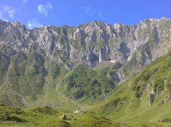
• Grand comme trois fois la ville de Paris, le Haut-Couserans se situe au coeur des Pyrénées Ariègeoises à 1h30 de Toul...

Marche
• 23km 1460 + 692 -

Marche
Marche
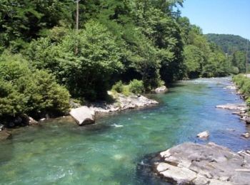
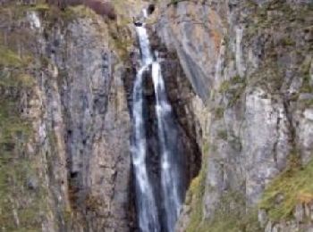
• Beau parcours avec petit détour par la cascade d'Arcouzan.
Marche
• 25 Km 1200 positif 2000 négatif
Marche
• Aller-Retour pour le Port d’Aula au cœur de la réserve du mont Valier à partir du col de Pause avec de superbes paysa...
Marche
• Grand comme trois fois la ville de Paris, le Haut-Couserans se situe au cœur des Pyrénées Ariègeoises à 1h30 de Toulo...
Marche
• Grand comme trois fois la ville de Paris, le Haut-Couserans se situe au coeur des Pyrénées Ariègeoises à 1h30 de Toul...
Marche
• Grand comme trois fois la ville de Paris, le Haut-Couserans se situe au coeur des Pyrénées Ariègeoises à 1h30 de Toul...
Marche
• Grand comme trois fois la ville de Paris, le Haut-Couserans se situe au coeur des Pyrénées Ariègeoises à 1h30 de Toul...
Marche
• Grand comme trois fois la ville de Paris, le Haut-Couserans se situe au coeur des Pyrénées Ariègeoises à 1h30 de Toul...
Marche
• Grand comme trois fois la ville de Paris, le Haut-Couserans se situe au coeur des Pyrénées Ariègeoises à 1h30 de Toul...
Marche
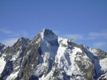
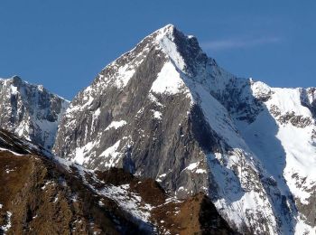
• Le Mont Valier. Grand comme trois fois la ville de Paris, le Haut-Couserans se situe au coeur des Pyrénées Ariègeoise...
Marche
• 3kms après Seix sur la D3 direction Guzet Neige. A Moulin Lauga tourner à droite direction Estours, passer devant une...
Marche
Marche
Marche
• Attention le sentier entre la cabane forestière de l'Artigue et le col de la Pause, n'est plus praticable dans la zon...
Marche
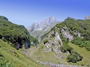
• Montée au Port d'Aula et ascension du Tuc de Bignau qui permet d'ouvrir la vue. Du port au sommet, pas de sentier bal...
Marche
• Ce parcours est super (je vais le nettoyer le temps que certains voient que des chemins n'existent plus), on commence...
Marche
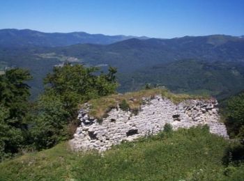
• Montée facile à ce beau belvedere qu'est le château de Mirabat. Hormis les 10 premières minutes raides, la sente est...
20 randonnées affichées sur 58
Application GPS de randonnée GRATUITE
 SityTrail
IGN / Instituts géographiques
SityTrail World
Le monde est à vous