


14,9 km | 19,4 km-effort
Aureville : découvrez les meilleures randonnées : 7 marche et 2 course à pied. Tous ces circuits, parcours, itinéraires et activités en plein air sont disponibles dans nos applications SityTrail pour smartphones et tablettes.
Marche


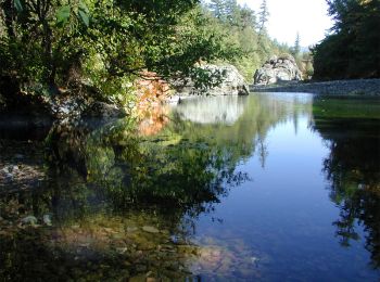
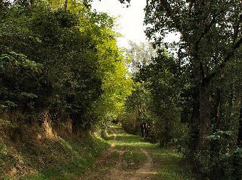
• Beau parcours vallonné autour de la rivière Ariège
Course à pied
• Circuit physique pour le runner le long de l'Ariège et de ses coteaux.

Marche
• Circuit physique pour le runner le long de l'Ariège et de ses coteaux.

Course à pied
• Beau parcours vallonné autour de la rivière Ariège

Marche
• balade facile de 6km 2h
Marche
• Tranquille
Marche
• http://www.rando-marche.fr/_38246_137_randonnees-aureville-clermont-le-fort-goyrans Descriptif Itinéraire aller jusq...
Marche
Marche
9 randonnées affichées sur 9
Application GPS de randonnée GRATUITE
 SityTrail
IGN / Instituts géographiques
SityTrail World
Le monde est à vous