


5,9 km | 12,8 km-effort
Cirès : découvrez les meilleures randonnées : 7 marche. Tous ces circuits, parcours, itinéraires et activités en plein air sont disponibles dans nos applications SityTrail pour smartphones et tablettes.
Marche


• Départ/arrivée dans le premier virage de la route du port de Balés. On monte d'abord sur la crête, puis dans le vallo...

Marche
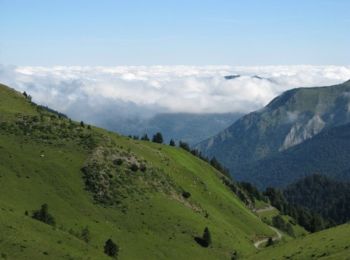
• Très belle balade
Marche
Marche
• Cires,Bourg d'Oueil,Cabane de la Coume de Baqué,Col de Louron,Pouy-Louby(2091m)Port de Pinate,Cap de la Lit,Clots de ...
Marche
Marche
Marche
7 randonnées affichées sur 7
Application GPS de randonnée GRATUITE
 SityTrail
IGN / Instituts géographiques
SityTrail World
Le monde est à vous