


12,4 km | 14,5 km-effort
Pompignan : découvrez les meilleures randonnées : 18 marche. Tous ces circuits, parcours, itinéraires et activités en plein air sont disponibles dans nos applications SityTrail pour smartphones et tablettes.
Marche


Marche
Marche
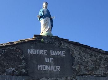
• Bois de monnier
Marche

Marche
• facile
Marche
• Sentier des garrigues
Marche
• Demi randonnée du tour de la montagne St Jean
Marche
• 03/02/2018
Marche
• Départ devant l'église de Pompignan, parking à proximité.
Marche
• Circuit mi plaine mi vignes fait le 10 juillet 2016 entre 8h30 et 10h30 par 30° à l'ombre. Peut se faire à vélo.
Marche
• Tour de la montagne voie haute. Pas de difficultés particulière si ce n'est un peu de hors piste pour éviter la carr...
Marche
• Tour de la montagne voie haute. Pas de difficultés particuliere si ce n'est un peu de hors piste pour éviter la carr...
Marche
• Tour de la montagne voie haute.
Marche
Marche
Marche
Marche
Marche
18 randonnées affichées sur 18
Application GPS de randonnée GRATUITE
 SityTrail
IGN / Instituts géographiques
SityTrail World
Le monde est à vous