Chamborigaud, Gard, A pied : Les meilleures randonnées, itinéraires, parcours, balades et promenades

Chamborigaud : découvrez les meilleures randonnées : 1 a pied et 10 marche. Tous ces circuits, parcours, itinéraires et activités en plein air sont disponibles dans nos applications SityTrail pour smartphones et tablettes.


Les meilleurs parcours (11)

Randonnée Marche Chamborigaud - Ronde des crêtes - Photo
Marche 21.213
Km
GUIDE

Marche

Moyen
Chamborigaud, Occitanie, Gard, France
21 km | 30 km-effort
5h 39min
663 m
664 m
Oui
nadinebondoux

• départ de Chamborigaud

Randonnée Marche Chamborigaud - Vallée du Luech et vallée de l’Homol - Photo
Marche 19.936
Km
GUIDE

Marche

Très difficile
Chamborigaud, Occitanie, Gard, France
19,9 km | 29 km-effort
6h 31min
656 m
655 m
Oui
Roger Philippe Wallez

Randonnée Marche Chamborigaud - rando Cévenole 3 - Photo
Marche 19.411
Km

Marche

Facile
Chamborigaud, Occitanie, Gard, France
19,4 km | 28 km-effort
7h 0min
664 m
663 m
Oui
Robert Jousset

Randonnée Marche Chamborigaud - J 5  Chamborigaud(Alès)  Génolhac La Regordane - Photo
Marche 7.74
Km

Marche

Facile
Chamborigaud, Occitanie, Gard, France
7,7 km | 10,7 km-effort
2h 25min
264 m
95 m
Non
jeanneruols

• journée particulière on prend le train ou le bus à ALES jusqu'à Chambotrigaud . ARRET. On marche de CHAMBORIGAUD à G...

Randonnée Marche Chamborigaud - LA RONDE DES CRETES - Photo
Marche 19.197
Km

Marche

Difficile
Chamborigaud, Occitanie, Gard, France
19,2 km | 28 km-effort
6h 1min
625 m
624 m
Oui
genevieve

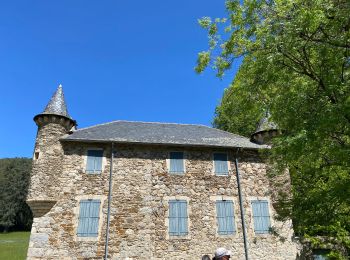
• vallon de la ribeyrette, le château de Crouzas perdu au milieu des châtaigniers, on rejoins la voie romaine et le bel...

Randonnée Marche Chamborigaud - Regordane : Etape 6 - Photo
Marche 18.8
Km

Marche

Moyen
Chamborigaud, Occitanie, Gard, France
18,8 km | 25 km-effort
5h 29min
505 m
452 m
Non
Jean-MarieFaux

• de Chamborigaud au Mas Dieu

Randonnée Marche Chamborigaud - VICTOR_chamborigaud_beaulieu - Photo
Marche 48.77
Km

Marche

Très difficile
Chamborigaud, Occitanie, Gard, France
49 km | 63 km-effort
14h 25min
1053 m
1249 m
Non
chevauxhommesterritoires

Randonnée A pied Chamborigaud - tour de la haute  vallée du buech - Photo
A pied 48.918
Km

A pied

Difficile
Chamborigaud, Occitanie, Gard, France
49 km | 73 km-effort
16h 35min
1806 m
1809 m
Oui
Dessalien

Randonnée Marche Chamborigaud - chamborigaut - Photo
Marche 4.664
Km

Marche

Facile
Chamborigaud, Occitanie, Gard, France
4,7 km | 5,4 km-effort
58min
55 m
56 m
Oui
GuySimonin

Randonnée Marche Chamborigaud - Les tunnels chamborigaud - Photo
Marche 3.726
Km

Marche

Facile
Chamborigaud, Occitanie, Gard, France
3,7 km | 5,4 km-effort
1h 13min
124 m
125 m
Oui
paull

Randonnée Marche Chamborigaud - de Chamborigaud au Pradel GR700 - Photo
Marche 16.148
Km

Marche

Très difficile
Chamborigaud, Occitanie, Gard, France
16,1 km | 21 km-effort
4h 33min
394 m
411 m
Non
BrassensJC

11 randonnées affichées sur 11

Application GPS de randonnée GRATUITE

Logo SityTrail SityTrail

IGN / Instituts géographiques

Télécharger SityTrail sur l'App Store Télécharger SityTrail sur Google Play

Logo SityTrail SityTrail World

Le monde est à vous

Télécharger SityTrail sur l'App Store Télécharger SityTrail sur Google Play Télécharger SityTrail sur Huawei AppGallery

Activités

Fermer
Mes abonnements