


9,7 km | 14,5 km-effort
Ansignan : découvrez les meilleures randonnées : 20 marche. Tous ces circuits, parcours, itinéraires et activités en plein air sont disponibles dans nos applications SityTrail pour smartphones et tablettes.
Marche


Marche
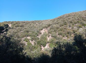
• On peut éviter les éboulis en revenant sur ses pas depuis le sommet
Marche
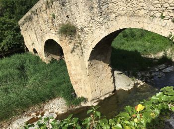
• Pont romain
Marche

Marche
• pont aqueduc romain
Marche
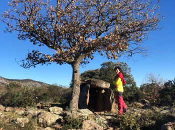
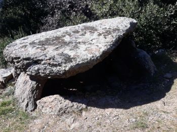
• J'ai suivi le sentier des dolmens mais j'ai raccourci de 2km sans aller à Trilla, je vous conseille de bien suivre ma...
Marche
• depuis le parking, à coté de la départementale, allez visiter l'aqueduc puis parcourez le sentier des oiseaux et reve...
Marche
• moyen
Marche
• Une montée de 180m sans difficulté, un menhir, visite de la Chapelle de Trilla, descente vers bord de l'Agly, remonté...
Marche
• Romarins
Marche
• vers st arnac
Marche
• RP66 ANSIGNAN - aqueduc - rec de la Piquière - ST ARNAC - les Pujals - RD77 - col de Lacroix - piste DFCI53 - Sarrat ...
Marche
• Page 12 Balades en pays catalan 2017
Marche
Marche
Marche
Marche
Marche
Marche
Marche
20 randonnées affichées sur 20
Application GPS de randonnée GRATUITE
 SityTrail
IGN / Instituts géographiques
SityTrail World
Le monde est à vous