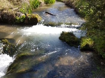
Saint-Martin-de-Brômes, Alpes-de-Haute-Provence, A pied : Les meilleures randonnées, itinéraires, parcours, balades et promenades

1 commentaires

Saint-Martin-de-Brômes : découvrez les meilleures randonnées : 28 marche. Tous ces circuits, parcours, itinéraires et activités en plein air sont disponibles dans nos applications SityTrail pour smartphones et tablettes.


Les meilleurs parcours (28)

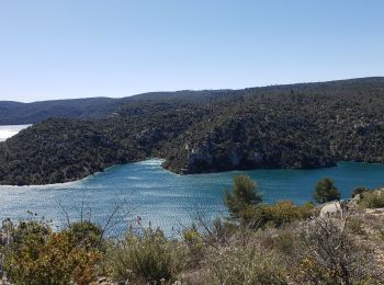
Randonnée Marche Saint-Martin-de-Brômes - Entre lac et rivière.Saint Martin de Brômes - Photo
Marche 11.713
Km

Marche

Difficile
Saint-Martin-de-Brômes, Provence-Alpes-Côte d'Azur, Alpes-de-Haute-Provence, France
11,7 km | 16 km-effort
4h 24min
325 m
325 m
Oui
boulinevelyne

• Au niveau de l'oppidum il est difficile de rejoindre le "Colostre". La descente parait raide et vertigineuse. Peut êt...
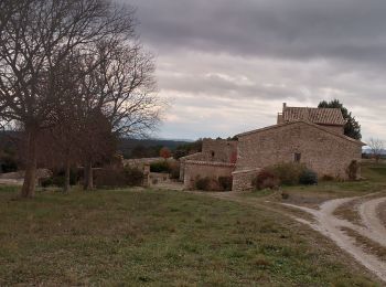
Randonnée Marche Saint-Martin-de-Brômes - Saint Martin de brome. la draille de la partie. peire amare  - Photo
Marche 10.924
Km

Marche

Moyen
Saint-Martin-de-Brômes, Provence-Alpes-Côte d'Azur, Alpes-de-Haute-Provence, France
10,9 km | 14,3 km-effort
3h 38min
253 m
252 m
Oui
Roger

• très belle vue sur la montagne provençale et les lavandins
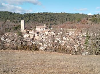
Randonnée Marche Saint-Martin-de-Brômes - st Martin de brome. la garenne  - Photo
Marche 5.189
Km

Marche

Facile
Saint-Martin-de-Brômes, Provence-Alpes-Côte d'Azur, Alpes-de-Haute-Provence, France
5,2 km | 7,4 km-effort
1h 41min
166 m
166 m
Oui
Roger

• à faire l été. finir par la route
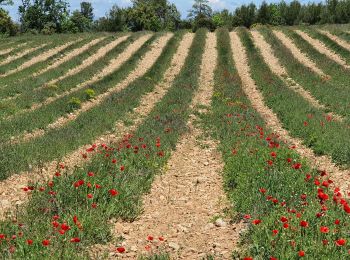
Randonnée Marche Saint-Martin-de-Brômes - GR4 Jour 3 Saint Martin de Brômes - La Chérine 19-05-2021 - Photo
Marche 20.259
Km

Marche

Difficile
Saint-Martin-de-Brômes, Provence-Alpes-Côte d'Azur, Alpes-de-Haute-Provence, France
20 km | 27 km-effort
5h 13min
575 m
389 m
Non
Aux croisées des GR

Randonnée Marche Saint-Martin-de-Brômes - St.martin de brome.  la plaine du paravis  - Photo
Marche 8.063
Km

Marche

Facile
Saint-Martin-de-Brômes, Provence-Alpes-Côte d'Azur, Alpes-de-Haute-Provence, France
8,1 km | 9,8 km-effort
2h 25min
127 m
128 m
Oui
Roger

• faire à la floraison du lavandîn

Randonnée Marche Saint-Martin-de-Brômes - St Martin a Allemagne  - Photo
Marche 11.99
Km

Marche

Difficile
Saint-Martin-de-Brômes, Provence-Alpes-Côte d'Azur, Alpes-de-Haute-Provence, France
12 km | 16 km-effort
3h 21min
298 m
299 m
Non
cocojean

• 13.5 kms

Randonnée Marche Saint-Martin-de-Brômes - Gréoux St Martin de Brôme Retour Le Colosse - Photo
Marche 7.636
Km

Marche

Facile
Saint-Martin-de-Brômes, Provence-Alpes-Côte d'Azur, Alpes-de-Haute-Provence, France
7,6 km | 9,9 km-effort
2h 9min
169 m
169 m
Oui
Migueldefrance

• Montée raide et paumatoire au départ. Retour sympa en sous bois le long de la rivière.

Randonnée Marche Saint-Martin-de-Brômes - Le Colostre et Buffe-Arnaud - Photo
Marche 7.995
Km

Marche

Moyen
Saint-Martin-de-Brômes, Provence-Alpes-Côte d'Azur, Alpes-de-Haute-Provence, France
8 km | 10,2 km-effort
2h 11min
165 m
169 m
Oui
aubr

• Boucle au départ de Saint-Martin de Brôme, départ possible depuis le parking du pont canal près du Verdon.

Randonnée Marche Saint-Martin-de-Brômes - Circuit le long du Colostre - Photo
Marche 7.691
Km

Marche

Facile
Saint-Martin-de-Brômes, Provence-Alpes-Côte d'Azur, Alpes-de-Haute-Provence, France
7,7 km | 10 km-effort
2h 19min
171 m
170 m
Oui
lviallet

• Déniv Visorando: 140m

Randonnée Marche Saint-Martin-de-Brômes - Le Payanet au Castrum, Colostre - Photo
Marche 7.711
Km

Marche

Facile
Saint-Martin-de-Brômes, Provence-Alpes-Côte d'Azur, Alpes-de-Haute-Provence, France
7,7 km | 10,7 km-effort
2h 22min
221 m
221 m
Oui
martinemarie

Randonnée Marche Saint-Martin-de-Brômes - Gréoux Colostre 22.11.15 - Photo
Marche 12.73
Km
GUIDE

Marche

Moyen
(1)
Saint-Martin-de-Brômes, Provence-Alpes-Côte d'Azur, Alpes-de-Haute-Provence, France
12,7 km | 17,4 km-effort
3h 41min
350 m
350 m
Oui
fredetpascale

Randonnée Marche Saint-Martin-de-Brômes - Circuit du Colostre - Photo
Marche 9.383
Km

Marche

Difficile
Saint-Martin-de-Brômes, Provence-Alpes-Côte d'Azur, Alpes-de-Haute-Provence, France
9,4 km | 12,9 km-effort
Inconnu
263 m
258 m
Oui
vacances83

• Depart sur la route menant de Greoux à Esparron, au confluent du Colostre et du Verdon. Le chemin remonte le Colostre...

Randonnée Marche Saint-Martin-de-Brômes - greoux - Photo
Marche 16.279
Km

Marche

Très difficile
Saint-Martin-de-Brômes, Provence-Alpes-Côte d'Azur, Alpes-de-Haute-Provence, France
16,3 km | 23 km-effort
6h 18min
508 m
508 m
Oui
patgri2

Randonnée Marche Saint-Martin-de-Brômes - Saint Martin de Brôme - Photo
Marche 9.433
Km

Marche

Difficile
Saint-Martin-de-Brômes, Provence-Alpes-Côte d'Azur, Alpes-de-Haute-Provence, France
9,4 km | 12,3 km-effort
2h 59min
213 m
213 m
Oui
darranger

Randonnée Marche Saint-Martin-de-Brômes - Le long du colostre - Photo
Marche 8.252
Km

Marche

Moyen
Saint-Martin-de-Brômes, Provence-Alpes-Côte d'Azur, Alpes-de-Haute-Provence, France
8,3 km | 10,6 km-effort
2h 17min
176 m
178 m
Oui
christian blond

Randonnée Marche Saint-Martin-de-Brômes - gorges Colostre, Verdon, Payanet - Photo
Marche 8.345
Km

Marche

Facile
Saint-Martin-de-Brômes, Provence-Alpes-Côte d'Azur, Alpes-de-Haute-Provence, France
8,3 km | 11,1 km-effort
2h 37min
210 m
211 m
Oui
rgoujon

Randonnée Marche Saint-Martin-de-Brômes - De Manosque à Castellane - jour 2 - Saint Martin de Bromes à Quinson - Photo
Marche 22.035
Km

Marche

Très difficile
Saint-Martin-de-Brômes, Provence-Alpes-Côte d'Azur, Alpes-de-Haute-Provence, France
22 km | 29 km-effort
6h 7min
547 m
528 m
Non
mrcat

Randonnée Marche Saint-Martin-de-Brômes - Le barrage de Gréoux et le Colostre - Photo
Marche 11.542
Km

Marche

Moyen
Saint-Martin-de-Brômes, Provence-Alpes-Côte d'Azur, Alpes-de-Haute-Provence, France
11,5 km | 16,2 km-effort
3h 40min
347 m
348 m
Oui
boulinevelyne

Randonnée Marche Saint-Martin-de-Brômes - Greoux  - Photo
Marche 5.622
Km

Marche

Moyen
Saint-Martin-de-Brômes, Provence-Alpes-Côte d'Azur, Alpes-de-Haute-Provence, France
5,6 km | 7,3 km-effort
1h 56min
124 m
126 m
Oui
phugues

Randonnée Marche Saint-Martin-de-Brômes - colostre - Photo
Marche 14.983
Km

Marche

Très difficile
Saint-Martin-de-Brômes, Provence-Alpes-Côte d'Azur, Alpes-de-Haute-Provence, France
15 km | 19,7 km-effort
4h 41min
363 m
338 m
Non
Jemasa9

20 randonnées affichées sur 28

Application GPS de randonnée GRATUITE

Logo SityTrail SityTrail

IGN / Instituts géographiques

Télécharger SityTrail sur l'App Store Télécharger SityTrail sur Google Play

Logo SityTrail SityTrail World

Le monde est à vous

Télécharger SityTrail sur l'App Store Télécharger SityTrail sur Google Play Télécharger SityTrail sur Huawei AppGallery

Activités

Fermer
Mes abonnements