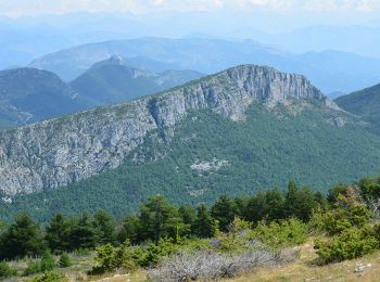
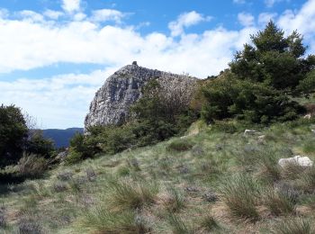
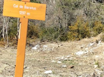
Saint-Auban, Alpes-Maritimes, A pied : Les meilleures randonnées, itinéraires, parcours, balades et promenades

3 commentaires

Saint-Auban : découvrez les meilleures randonnées : 28 marche, 1 course à pied, 1 marche nordique et 7 a pied. Tous ces circuits, parcours, itinéraires et activités en plein air sont disponibles dans nos applications SityTrail pour smartphones et tablettes.


Les meilleurs parcours (37)

Randonnée A pied Saint-Auban - Grand tour du haut Estéron - Etape 1 - Photo
A pied 11.476
Km
GUIDE+

A pied

Facile
Saint-Auban, Provence-Alpes-Côte d'Azur, Alpes-Maritimes, France
11,5 km | 17,8 km-effort
4h 3min
388 m
746 m
Non
SityTrail - itinéraires balisés pédestres

• Randonnée pédestre - Au départ de Saint-Auban (1 100 m) Site web: https://randoxygene.departement06.fr/traversees/gr...

Randonnée Marche Saint-Auban - Le Beausset - St Auban - Clue de St Auban - Photo
Marche 3.726
Km

Marche

Moyen
Saint-Auban, Provence-Alpes-Côte d'Azur, Alpes-Maritimes, France
3,7 km | 7,5 km-effort
1h 23min
285 m
283 m
Oui
LtZIP

• IBP Bleu 42

Randonnée Marche Saint-Auban - Les Lattes - Chauvet - Pensiers Occidental et Oriental - Photo
Marche 11.366
Km

Marche

Moyen
Saint-Auban, Provence-Alpes-Côte d'Azur, Alpes-Maritimes, France
11,4 km | 18,6 km-effort
3h 39min
544 m
548 m
Oui
LtZIP

• IBP Orange 59

Randonnée Marche Saint-Auban - L'arpille près de Sausses - Photo
Marche 12.857
Km

Marche

Moyen
Saint-Auban, Provence-Alpes-Côte d'Azur, Alpes-Maritimes, France
12,9 km | 20 km-effort
3h 55min
570 m
569 m
Oui
GrouGary

• Boucle sans difficultés techniques et retour dans la forêt. Nombreuses fleurs, Narcisses, Fritillaires, primevères, h...
Randonnée Marche Saint-Auban - Col de l'Escouissier - Photo
Marche 9.106
Km

Marche

Moyen
Saint-Auban, Provence-Alpes-Côte d'Azur, Alpes-Maritimes, France
9,1 km | 13,7 km-effort
2h 47min
341 m
344 m
Oui
cswilly

Randonnée Marche Saint-Auban - Saint Auban - Photo
Marche 17.185
Km

Marche

Moyen
Saint-Auban, Provence-Alpes-Côte d'Azur, Alpes-Maritimes, France
17,2 km | 26 km-effort
4h 53min
656 m
701 m
Oui
cswilly

Randonnée A pied Saint-Auban - Grand tour du haut Estéron - Photo
A pied 79.672
Km
GUIDE+

A pied

Très difficile
Saint-Auban, Provence-Alpes-Côte d'Azur, Alpes-Maritimes, France
80 km | 136 km-effort
30h 57min
4240 m
4240 m
Oui
SityTrail - itinéraires balisés pédestres

• Randonnée pédestre - Au départ de Saint-Auban (1 100 m) Site web: https://randoxygene.departement06.fr/traversees/gr...
Randonnée Marche Saint-Auban - Tous les 4 à St Auban - Photo
Marche 10.65
Km

Marche

Difficile
Saint-Auban, Provence-Alpes-Côte d'Azur, Alpes-Maritimes, France
10,7 km | 18,8 km-effort
6h 1min
612 m
611 m
Oui
verotrail

Randonnée Marche Saint-Auban - st-auban lu 22-07-24 - Photo
Marche 16.498
Km

Marche

Très difficile
Saint-Auban, Provence-Alpes-Côte d'Azur, Alpes-Maritimes, France
16,5 km | 24 km-effort
4h 34min
595 m
595 m
Oui
annehc

Randonnée Marche Saint-Auban - 2cols di sem1 - Photo
Marche 10.309
Km

Marche

Difficile
Saint-Auban, Provence-Alpes-Côte d'Azur, Alpes-Maritimes, France
10,3 km | 15,2 km-effort
2h 58min
365 m
361 m
Oui
annehc

Randonnée Marche Saint-Auban - Colette st auban  - Photo
Marche 12.321
Km

Marche

Difficile
Saint-Auban, Provence-Alpes-Côte d'Azur, Alpes-Maritimes, France
12,3 km | 17,1 km-effort
6h 8min
360 m
363 m
Oui
adetotto

Randonnée Marche Saint-Auban - Porte du ciel grand circuit du tracastel  - Photo
Marche 1.172
Km

Marche

Moyen
(1)
Saint-Auban, Provence-Alpes-Côte d'Azur, Alpes-Maritimes, France
1,2 km | 2,3 km-effort
1h 0min
94 m
44 m
Non
56jj

• rando moyenne dans les bois

Randonnée Marche Saint-Auban - Baou Mouriou - Photo
Marche 13.442
Km

Marche

Difficile
Saint-Auban, Provence-Alpes-Côte d'Azur, Alpes-Maritimes, France
13,4 km | 19,1 km-effort
5h 51min
421 m
421 m
Oui
Lemarchand06

Randonnée Marche nordique Saint-Auban - colle de bleine  - Photo
Marche nordique 6.631
Km

Marche nordique

Très facile
Saint-Auban, Provence-Alpes-Côte d'Azur, Alpes-Maritimes, France
6,6 km | 9,8 km-effort
2h 55min
238 m
242 m
Oui
17jc06

• raquette neige

Randonnée A pied Saint-Auban - Les Pensiers de Saint Auban 3542 ET - Photo
A pied 10.196
Km

A pied

Difficile
Saint-Auban, Provence-Alpes-Côte d'Azur, Alpes-Maritimes, France
10,2 km | 17,8 km-effort
Inconnu
570 m
570 m
Oui
verotrail

• Entre 6,000 et 6,500 km prendre petit sentier cairné à gauche pour rattraper la piste (on quitte le GR) A 8 km dans l...

Randonnée Marche Saint-Auban - RL L'Arpille - Photo
Marche 10.415
Km

Marche

Difficile
Saint-Auban, Provence-Alpes-Côte d'Azur, Alpes-Maritimes, France
10,4 km | 18,1 km-effort
3h 40min
576 m
576 m
Oui
Les Animateurs de l'ANRAM

• Départ balise 113

Randonnée Marche Saint-Auban - Col de Bleine et pic de l'Aiglo - Photo
Marche 7.513
Km

Marche

Très facile
Saint-Auban, Provence-Alpes-Côte d'Azur, Alpes-Maritimes, France
7,5 km | 11,9 km-effort
2h 26min
327 m
325 m
Oui
Palimpseste

• Ballade facile donnant accès a des panoramas exceptionnels sur les Alpes du Sud.

Randonnée Course à pied Saint-Auban - Trail de l'Escouissier - Photo
Course à pied 20.795
Km

Course à pied

Difficile
Saint-Auban, Provence-Alpes-Côte d'Azur, Alpes-Maritimes, France
21 km | 38 km-effort
3h 23min
1302 m
1302 m
Oui
chrisrando

Randonnée Marche Saint-Auban - Saint Auban tracastel  - Photo
Marche 11.084
Km

Marche

Moyen
Saint-Auban, Provence-Alpes-Côte d'Azur, Alpes-Maritimes, France
11,1 km | 20 km-effort
3h 47min
695 m
696 m
Oui
SaintEloi4

Randonnée A pied Saint-Auban - 000🥾St Auban pique-nique 20-Sep-2022 - Photo
A pied 5.48
Km

A pied

Facile
Saint-Auban, Provence-Alpes-Côte d'Azur, Alpes-Maritimes, France
5,5 km | 7,9 km-effort
1h 48min
183 m
187 m
Oui
VagabondTOP25

20 randonnées affichées sur 37

Application GPS de randonnée GRATUITE

Logo SityTrail SityTrail

IGN / Instituts géographiques

Télécharger SityTrail sur l'App Store Télécharger SityTrail sur Google Play

Logo SityTrail SityTrail World

Le monde est à vous

Télécharger SityTrail sur l'App Store Télécharger SityTrail sur Google Play Télécharger SityTrail sur Huawei AppGallery

Activités

Fermer
Mes abonnements