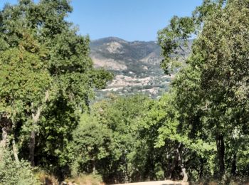
Le Plan-de-la-Tour, Var, A pied : Les meilleures randonnées, itinéraires, parcours, balades et promenades

3 commentaires

Le Plan-de-la-Tour : découvrez les meilleures randonnées : 32 marche. Tous ces circuits, parcours, itinéraires et activités en plein air sont disponibles dans nos applications SityTrail pour smartphones et tablettes.


Les meilleurs parcours (32)

Randonnée Marche Le Plan-de-la-Tour - Plan de la Tour - Piste de colle Dure - Col de Vignon - Photo
Marche 18.189
Km

Marche

Moyen
Le Plan-de-la-Tour, Provence-Alpes-Côte d'Azur, Var, France
18,2 km | 25 km-effort
4h 16min
501 m
504 m
Oui
LtZIP

• IBP

Randonnée Marche Le Plan-de-la-Tour - Le Plan de la Tour - Photo
Marche 7.73
Km

Marche

Moyen
(1)
Le Plan-de-la-Tour, Provence-Alpes-Côte d'Azur, Var, France
7,7 km | 10,6 km-effort
2h 16min
212 m
210 m
Oui
Chantheys

• Départ sur la D44, depuis Le Plan de la Tour vers Grimaud. Au hameau de Coriolan, lorsque vous arrivez au bout du ch...

Randonnée Marche Le Plan-de-la-Tour - PLAN DE LA TOUR - AUTOUR DE SAN PEÏRE ET SAINT SEBASTIEN - Photo
Marche 14.248
Km

Marche

Facile
Le Plan-de-la-Tour, Provence-Alpes-Côte d'Azur, Var, France
14,2 km | 18,8 km-effort
5h 4min
340 m
343 m
Oui
jean-marie.parachini

• randonnée autour du Plan de la Tour par piste de Suane.
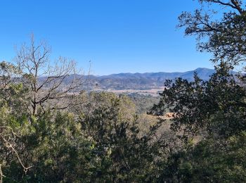
Randonnée Marche Le Plan-de-la-Tour - plan de la tour - Reverdi  les vernades - Photo
Marche 8.004
Km

Marche

Moyen
Le Plan-de-la-Tour, Provence-Alpes-Côte d'Azur, Var, France
8 km | 10,8 km-effort
2h 55min
208 m
213 m
Oui
jean-marie.parachini

Randonnée Marche Le Plan-de-la-Tour - plan de la tour San peire St Sébastien  - Photo
Marche 14.176
Km

Marche

Moyen
Le Plan-de-la-Tour, Provence-Alpes-Côte d'Azur, Var, France
14,2 km | 18,7 km-effort
5h 6min
340 m
341 m
Oui
jean-marie.parachini

Randonnée Marche Le Plan-de-la-Tour - Reverdi Ffrs - Photo
Marche 9.07
Km

Marche

Très facile
Le Plan-de-la-Tour, Provence-Alpes-Côte d'Azur, Var, France
9,1 km | 12,3 km-effort
2h 35min
246 m
243 m
Oui
Sugg

Randonnée Marche Le Plan-de-la-Tour - la colle dure - Photo
Marche 13.385
Km

Marche

Moyen
Le Plan-de-la-Tour, Provence-Alpes-Côte d'Azur, Var, France
13,4 km | 20 km-effort
3h 50min
525 m
520 m
Oui
herveschmitt

Randonnée Marche Le Plan-de-la-Tour - Plan de la tour. Col du Vignon - Photo
Marche 15.408
Km

Marche

Moyen
Le Plan-de-la-Tour, Provence-Alpes-Côte d'Azur, Var, France
15,4 km | 21 km-effort
5h 0min
445 m
444 m
Oui
Sugg

• Projet de rando RF à reconnaître pour le 12 juin 2019

Randonnée Marche Le Plan-de-la-Tour - 20160801 Le Reverdi San Peïre - Photo
Marche 5.23
Km

Marche

Moyen
(1)
Le Plan-de-la-Tour, Provence-Alpes-Côte d'Azur, Var, France
5,2 km | 8,8 km-effort
1h 52min
266 m
266 m
Oui
xtof_ts

• Balade agréable en partie dans la forêt. Bell vue sur une partie du golfe depuis le sommet. Ca grimpe un peu.

Randonnée Marche Le Plan-de-la-Tour - pratbourdin  - Photo
Marche 11.03
Km

Marche

Très facile
Le Plan-de-la-Tour, Provence-Alpes-Côte d'Azur, Var, France
11 km | 14,5 km-effort
2h 12min
266 m
248 m
Non
gbertin59

• Ballade mi ombre jolie vue sur le golfe de saint Tropez

Randonnée Marche Le Plan-de-la-Tour - La plan de la tour - Photo
Marche 6.87
Km

Marche

Facile
Le Plan-de-la-Tour, Provence-Alpes-Côte d'Azur, Var, France
6,9 km | 8,9 km-effort
1h 47min
131 m
219 m
Non
JPA GRS

Randonnée Marche Le Plan-de-la-Tour - Peire Reverdi - Photo
Marche 6.544
Km

Marche

Moyen
Le Plan-de-la-Tour, Provence-Alpes-Côte d'Azur, Var, France
6,5 km | 10,2 km-effort
2h 4min
276 m
271 m
Oui
JPA GRS

Randonnée Marche Le Plan-de-la-Tour - FZ Plan de la Tour Anc. mines ? - Photo
Marche 5.448
Km

Marche

Moyen
Le Plan-de-la-Tour, Provence-Alpes-Côte d'Azur, Var, France
5,4 km | 9 km-effort
1h 47min
265 m
263 m
Oui
ColetteDocteur

Randonnée Marche Le Plan-de-la-Tour - Sainte-Maxime - Circuit du Catalugno - Photo
Marche 7.847
Km

Marche

Moyen
Le Plan-de-la-Tour, Provence-Alpes-Côte d'Azur, Var, France
7,8 km | 10,9 km-effort
2h 28min
226 m
226 m
Oui
GSananes

Randonnée Marche Le Plan-de-la-Tour - PLAN DE LA TOUR COL VIGNON - Photo
Marche 20.684
Km

Marche

Moyen
Le Plan-de-la-Tour, Provence-Alpes-Côte d'Azur, Var, France
21 km | 28 km-effort
7h 35min
578 m
573 m
Non
BACCOT

Randonnée Marche Le Plan-de-la-Tour - RANDONNEE PLAN DE LA TOUR 3 - Photo
Marche 19.076
Km

Marche

Très difficile
Le Plan-de-la-Tour, Provence-Alpes-Côte d'Azur, Var, France
19,1 km | 26 km-effort
5h 57min
535 m
536 m
Oui
louventouletdu04@hotmail.fr

Randonnée Marche Le Plan-de-la-Tour - randonnée plan de la tour 2 - Photo
Marche 20.774
Km

Marche

Très difficile
Le Plan-de-la-Tour, Provence-Alpes-Côte d'Azur, Var, France
21 km | 28 km-effort
4h 58min
569 m
562 m
Oui
louventouletdu04@hotmail.fr

Randonnée Marche Le Plan-de-la-Tour - Plan de la tour colle dure - Photo
Marche 14.785
Km

Marche

Moyen
Le Plan-de-la-Tour, Provence-Alpes-Côte d'Azur, Var, France
14,8 km | 22 km-effort
4h 45min
522 m
522 m
Oui
SaintEloi4

Randonnée Marche Le Plan-de-la-Tour - 220312 pdlT - Photo
Marche 14.119
Km

Marche

Moyen
Le Plan-de-la-Tour, Provence-Alpes-Côte d'Azur, Var, France
14,1 km | 21 km-effort
3h 26min
489 m
489 m
Oui
bebenoit83

Randonnée Marche Le Plan-de-la-Tour - 220307 les mines de Vallauri PDLT - Photo
Marche 6.759
Km

Marche

Moyen
Le Plan-de-la-Tour, Provence-Alpes-Côte d'Azur, Var, France
6,8 km | 10,7 km-effort
1h 46min
296 m
286 m
Oui
bebenoit83

20 randonnées affichées sur 32

Application GPS de randonnée GRATUITE

Logo SityTrail SityTrail

IGN / Instituts géographiques

Télécharger SityTrail sur l'App Store Télécharger SityTrail sur Google Play

Logo SityTrail SityTrail World

Le monde est à vous

Télécharger SityTrail sur l'App Store Télécharger SityTrail sur Google Play Télécharger SityTrail sur Huawei AppGallery

Activités

Fermer
Mes abonnements