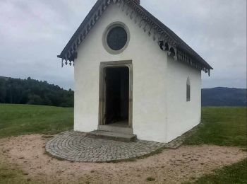
Le Thillot, Vosges, A pied : Les meilleures randonnées, itinéraires, parcours, balades et promenades

4 commentaires

Le Thillot : découvrez les meilleures randonnées : 1 a pied, 27 marche, 2 marche nordique et 1 trail. Tous ces circuits, parcours, itinéraires et activités en plein air sont disponibles dans nos applications SityTrail pour smartphones et tablettes.


Les meilleurs parcours (31)
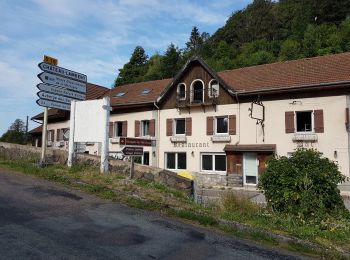
Randonnée Marche Le Thillot - Col des Croix - Vierge des Neiges - Hautes Mines - Tête des Noirs Étangs - Château Lambert - Photo
Marche 10.535
Km

Marche

Facile
Le Thillot, Grand Est, Vosges, France
10,5 km | 16 km-effort
2h 23min
407 m
407 m
Oui
Bart2015

• Suggestion : démarrer balade par visite des mines. Sinon passer avant 10h. Belle vue depuis la Vierge des Neiges. En ...

Randonnée Marche Le Thillot - le tour de la tête des corbeaux - Photo
Marche 16.797
Km

Marche

Facile
Le Thillot, Grand Est, Vosges, France
16,8 km | 24 km-effort
5h 12min
507 m
508 m
Oui
margotte

• parcours roulant avec de beaux points de vue sur la haute vallée de la Moselle, le col de bussang,la vallée des Grang...
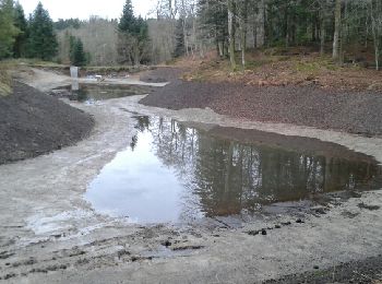
Randonnée Marche Le Thillot - les noirs étangs  - Photo
Marche 11.096
Km

Marche

Facile
(1)
Le Thillot, Grand Est, Vosges, France
11,1 km | 15,5 km-effort
2h 33min
333 m
333 m
Oui
margotte

• pour tous

Randonnée Marche Le Thillot - Le thillot La chapelle des Vés, l he haut de la lochère - Photo
Marche 14.105
Km

Marche

Très difficile
Le Thillot, Grand Est, Vosges, France
14,1 km | 23 km-effort
5h 18min
693 m
692 m
Oui
lacote

Randonnée Marche Le Thillot - col des croix haut du thème château Lambert clos ded croix - Photo
Marche 11.063
Km

Marche

Moyen
Le Thillot, Grand Est, Vosges, France
11,1 km | 17 km-effort
3h 46min
441 m
461 m
Non
Christian Pethe

• rando dans la forêt et prairie avec des passages goudronnées

Randonnée Marche Le Thillot - Le Thillot 17 770m +784m - Photo
Marche 17.764
Km

Marche

Très difficile
Le Thillot, Grand Est, Vosges, France
17,8 km | 28 km-effort
6h 24min
784 m
786 m
Oui
DanielROLLET

• 2023 06 09 - 9h35 à 16h00 - Avec Marie - Grand beau temps Départ/retour cimetière du Thillot > Etang du Chaillon > Pi...
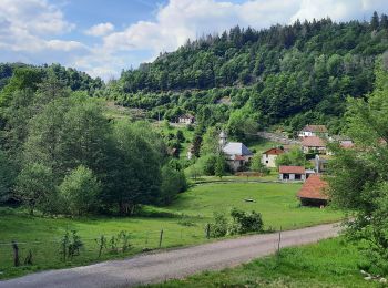
Randonnée Marche Le Thillot - Mines Thylllot - Photo
Marche 9.213
Km

Marche

Difficile
Le Thillot, Grand Est, Vosges, France
9,2 km | 13,7 km-effort
3h 23min
333 m
354 m
Non
STjmd300945

Randonnée Marche Le Thillot - Le Thillot (Haut-du-Them - Château-Lambert) 18 600m +762m - Photo
Marche 18.606
Km

Marche

Moyen
Le Thillot, Grand Est, Vosges, France
18,6 km | 29 km-effort
7h 0min
762 m
758 m
Oui
DanielROLLET

• 2022 04 05 avec Marie - 10h00 à 17h00 13h15 à 14h30 repas à l'Auberge de la Source. Temps frais et humide

Randonnée Marche Le Thillot - Chapelle des Vés - Le Ménil - Photo
Marche 6.047
Km
GUIDE

Marche

Facile
Le Thillot, Grand Est, Vosges, France
6 km | 9,3 km-effort
1h 31min
243 m
243 m
Oui
Michel1963

Randonnée Marche Le Thillot - Le Thillot (Château-Lambert) 17 200m +595m - Photo
Marche 16.639
Km

Marche

Moyen
(1)
Le Thillot, Grand Est, Vosges, France
16,6 km | 25 km-effort
5h 15min
595 m
594 m
Oui
DanielROLLET

• 2018 03 26 9h20 à 16h30 Rando avec MM, MJ, Henri et moi Repas grenouilles à l'auberge des sources à Château-Lambert. ...

Randonnée Marche Le Thillot - D57 - circuit 1 RS - Photo
Marche 3.862
Km

Marche

Facile
Le Thillot, Grand Est, Vosges, France
3,9 km | 5,7 km-effort
1h 19min
134 m
140 m
Oui
marcel.F

• Départ col des Croix variante RS

Randonnée Marche Le Thillot - les Vés  - Photo
Marche 8.434
Km

Marche

Facile
Le Thillot, Grand Est, Vosges, France
8,4 km | 13,4 km-effort
2h 30min
372 m
370 m
Oui
danou56

• randonnée facile mais demande des notions d'orientation: parcours sur d'anciens sentiers non balisés et sur sentiers ...

Randonnée Marche Le Thillot - le thillot - Photo
Marche 7.825
Km

Marche

Facile
Le Thillot, Grand Est, Vosges, France
7,8 km | 12,7 km-effort
2h 45min
368 m
369 m
Oui
jeanluc59

• la chapelle des ves

Randonnée Marche Le Thillot - les Vés  - Photo
Marche 8.435
Km

Marche

Facile
Le Thillot, Grand Est, Vosges, France
8,4 km | 13,4 km-effort
2h 30min
372 m
370 m
Oui
margotte

• randonnée facile mais demande des notions d'orientation: parcours sur d'anciens sentiers non balisés et sur sentiers ...

Randonnée Marche Le Thillot - le tour de la tête des renards - Photo
Marche 8.901
Km

Marche

Très facile
Le Thillot, Grand Est, Vosges, France
8,9 km | 13,6 km-effort
Inconnu
357 m
351 m
Oui
chesnelt

Randonnée A pied Le Thillot - t38554785_circuit le thillot - Photo
A pied 20.831
Km

A pied

Difficile
Le Thillot, Grand Est, Vosges, France
21 km | 32 km-effort
7h 17min
845 m
845 m
Oui
Emmanuel Remy

Randonnée Marche Le Thillot - Boucle_des_etangs_depuis_Le_Thillot - Photo
Marche 9.082
Km

Marche

Difficile
Le Thillot, Grand Est, Vosges, France
9,1 km | 13,9 km-effort
3h 9min
360 m
361 m
Oui
Emmanuel Remy

Randonnée Marche Le Thillot - Le Ballon de Servance depuis les Mynes - Photo
Marche 19.644
Km

Marche

Moyen
Le Thillot, Grand Est, Vosges, France
19,6 km | 30 km-effort
4h 41min
746 m
744 m
Oui
margotte

Randonnée Marche Le Thillot - Parking Cimetière de Le Thillot - Chaillon - Col de Foigneux - La Revanche - Pic des Corbeaux et retour - Photo
Marche 7.935
Km

Marche

Moyen
(1)
Le Thillot, Grand Est, Vosges, France
7,9 km | 12,5 km-effort
2h 50min
345 m
344 m
Oui
patrickbeyrath

Randonnée Marche nordique Le Thillot - le tour de la Lochère  - Photo
Marche nordique 3.533
Km

Marche nordique

Facile
Le Thillot, Grand Est, Vosges, France
3,5 km | 6 km-effort
41min
170 m
218 m
Non
margotte

20 randonnées affichées sur 31

Application GPS de randonnée GRATUITE

Logo SityTrail SityTrail

IGN / Instituts géographiques

Télécharger SityTrail sur l'App Store Télécharger SityTrail sur Google Play

Logo SityTrail SityTrail World

Le monde est à vous

Télécharger SityTrail sur l'App Store Télécharger SityTrail sur Google Play Télécharger SityTrail sur Huawei AppGallery

Activités

Fermer
Mes abonnements