![](/images/other/stat-length.png)
- Randonnées
- A pied
- France
- Auvergne-Rhône-Alpes
- Haute-Savoie
- Arâches-la-Frasse
Arâches-la-Frasse, Haute-Savoie, A pied : Les meilleures randonnées, itinéraires, parcours, balades et promenades
Arâches-la-Frasse : découvrez les meilleures randonnées : 61 marche, 3 course à pied et 1 trail. Tous ces circuits, parcours, itinéraires et activités en plein air sont disponibles dans nos applications SityTrail pour smartphones et tablettes.
Les meilleurs parcours (65)
![Randonnée Marche Arâches-la-Frasse - Les Tronchets - Photo](https://media.geolcdn.com/t/350/260/1b22eca5-4d03-4493-9ac5-2c90d211f1bc.jpg&format=jpg&maxdim=2)
![Marche Marche](https://static1.geolcdn.com/sitytour/trail-icons/101.png)
Km
Marche
![](/images/other/stat-length.png)
![](https://static1.geolcdn.com/siteimages/upload/files/1508320355ic_sort_den_pos_24dp.png)
![](https://static1.geolcdn.com/siteimages/upload/files/1508320355ic_sort_den_neg_24dp.png)
![](https://static1.geolcdn.com/siteimages/upload/files/16400158638029165_repeat_loop_refresh_sync_direction_icon.png)
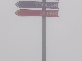
• Petite randonnée des CARROZ vers les Tronchets, 2h boucle partielle
![Randonnée Marche Arâches-la-Frasse - Vernant Grands Vans par le col de Véret - Photo](https://media.geolcdn.com/t/350/260/06ee9b71-5751-4664-80a4-c98989797b70.jpg&format=jpg&maxdim=2)
![Marche Marche](https://static1.geolcdn.com/sitytour/trail-icons/101.png)
Km
Marche
![](/images/other/stat-length.png)
![](https://static1.geolcdn.com/siteimages/upload/files/1508320355ic_sort_den_pos_24dp.png)
![](https://static1.geolcdn.com/siteimages/upload/files/1508320355ic_sort_den_neg_24dp.png)
![](https://static1.geolcdn.com/siteimages/upload/files/16400158638029165_repeat_loop_refresh_sync_direction_icon.png)
• boucle au départ du parking de Vernant, montée vers le la puis le col de Véret, ensuite l'arrête praticable en ce déb...
![Randonnée Marche Arâches-la-Frasse - Les Carroz l'Arbaron en boucle - Photo](https://media.geolcdn.com/t/350/260/360e8a6b-b503-4616-ba4d-4d21ae7c55c0.jpg&format=jpg&maxdim=2)
![Marche Marche](https://static1.geolcdn.com/sitytour/trail-icons/101.png)
Km
Marche
![](/images/other/stat-length.png)
![](https://static1.geolcdn.com/siteimages/upload/files/1508320355ic_sort_den_pos_24dp.png)
![](https://static1.geolcdn.com/siteimages/upload/files/1508320355ic_sort_den_neg_24dp.png)
![](https://static1.geolcdn.com/siteimages/upload/files/16400158638029165_repeat_loop_refresh_sync_direction_icon.png)
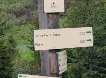
• Montée par les Feux, puis plaine Joux, La montée à travers les barres rocheuses en cette fin mai est délicate par end...
![Randonnée Marche Arâches-la-Frasse - les Carroz, tête de Saix boucle - Photo](https://media.geolcdn.com/t/350/260/fc10eab2-e7d0-43c5-ba5e-76349cca3bdc.jpg&format=jpg&maxdim=2)
![Marche Marche](https://static1.geolcdn.com/sitytour/trail-icons/101.png)
Km
Marche
![](/images/other/stat-length.png)
![](https://static1.geolcdn.com/siteimages/upload/files/1508320355ic_sort_den_pos_24dp.png)
![](https://static1.geolcdn.com/siteimages/upload/files/1508320355ic_sort_den_neg_24dp.png)
![](https://static1.geolcdn.com/siteimages/upload/files/16400158638029165_repeat_loop_refresh_sync_direction_icon.png)
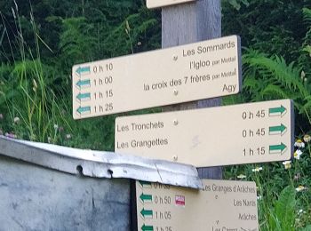
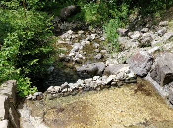
• les Mazots, Timalets par la forêt, corniche de Molliets, Kedeuze, Molliets, tête des Saix. Retour par la combe de Gro...
![Randonnée Marche Arâches-la-Frasse - Mont Jovy pierre à Laya - Photo](https://media.geolcdn.com/t/350/260/f39bd061-a8cf-4891-84d8-c02820fed170.jpg&format=jpg&maxdim=2)
![Marche Marche](https://static1.geolcdn.com/sitytour/trail-icons/101.png)
Km
Marche
![](/images/other/stat-length.png)
![](https://static1.geolcdn.com/siteimages/upload/files/1508320355ic_sort_den_pos_24dp.png)
![](https://static1.geolcdn.com/siteimages/upload/files/1508320355ic_sort_den_neg_24dp.png)
![](https://static1.geolcdn.com/siteimages/upload/files/16400158638029165_repeat_loop_refresh_sync_direction_icon.png)
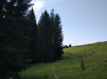
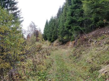
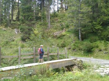
• Petite randonnée très facile en forêt avec points de vue sur la vallée de l'Arve Le départ se fait au parking en bas ...
![Randonnée Marche Arâches-la-Frasse - randonnée en forêt, les Carroz, Araches, la Frasse - Photo](https://media.geolcdn.com/t/350/260/266ab88b-3ecc-4762-b4ff-c648b0c4392c.jpg&format=jpg&maxdim=2)
![Marche Marche](https://static1.geolcdn.com/sitytour/trail-icons/101.png)
Km
Marche
![](/images/other/stat-length.png)
![](https://static1.geolcdn.com/siteimages/upload/files/1508320355ic_sort_den_pos_24dp.png)
![](https://static1.geolcdn.com/siteimages/upload/files/1508320355ic_sort_den_neg_24dp.png)
![](https://static1.geolcdn.com/siteimages/upload/files/16400158638029165_repeat_loop_refresh_sync_direction_icon.png)
• Randonnée forestière en boucle sur les hauteurs des Carroz, Araches et la Frasse : D+ D- 660m, 14km, 5 heures. Au dép...
![Randonnée Marche Arâches-la-Frasse - Les crêtes des Carroz, l'Airon - Photo](https://media.geolcdn.com/t/350/260/e57bb8ac-af5b-4ac0-b2fc-b8511a63d005.jpg&format=jpg&maxdim=2)
![Marche Marche](https://static1.geolcdn.com/sitytour/trail-icons/101.png)
Km
Marche
![](/images/other/stat-length.png)
![](https://static1.geolcdn.com/siteimages/upload/files/1508320355ic_sort_den_pos_24dp.png)
![](https://static1.geolcdn.com/siteimages/upload/files/1508320355ic_sort_den_neg_24dp.png)
![](https://static1.geolcdn.com/siteimages/upload/files/16400158638029165_repeat_loop_refresh_sync_direction_icon.png)
• Randonnée les crêtes des Carroz Au départ des Carroz, la montée se fait en forêt par la Pestaz et praz rôti. Ensuite ...
![Randonnée Marche Arâches-la-Frasse - Vernant Grands Vans Pelouse col pierre carrée - Photo](https://media.geolcdn.com/t/350/260/e9b01e7d-367b-4845-b508-861027ddd49d.jpg&format=jpg&maxdim=2)
![Marche Marche](https://static1.geolcdn.com/sitytour/trail-icons/101.png)
Km
Marche
![](/images/other/stat-length.png)
![](https://static1.geolcdn.com/siteimages/upload/files/1508320355ic_sort_den_pos_24dp.png)
![](https://static1.geolcdn.com/siteimages/upload/files/1508320355ic_sort_den_neg_24dp.png)
![](https://static1.geolcdn.com/siteimages/upload/files/16400158638029165_repeat_loop_refresh_sync_direction_icon.png)
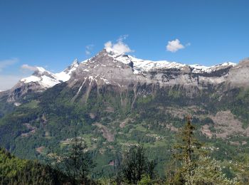
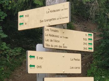
• Départ du parking de Vernant. On monte vers le lac de Vernant, puis vers les grands Vans. Superbe vue sur le Mont Bl...
![Randonnée Marche Arâches-la-Frasse - Les Carroz tête des Saix boucle - Photo](https://media.geolcdn.com/t/350/260/29c56adc-b157-4bb6-9b15-6c7748a3e58d.jpg&format=jpg&maxdim=2)
![Marche Marche](https://static1.geolcdn.com/sitytour/trail-icons/101.png)
Km
Marche
![](/images/other/stat-length.png)
![](https://static1.geolcdn.com/siteimages/upload/files/1508320355ic_sort_den_pos_24dp.png)
![](https://static1.geolcdn.com/siteimages/upload/files/1508320355ic_sort_den_neg_24dp.png)
![](https://static1.geolcdn.com/siteimages/upload/files/16400158638029165_repeat_loop_refresh_sync_direction_icon.png)
• Au départ des Carroz, on descend vers le Lays, et on monte par le chemin forestier vers les Tronchets. Très belle vue...
![Randonnée Marche Arâches-la-Frasse - Col de ColonnEy et Tête de Monthieu. - Photo](https://media.geolcdn.com/t/350/260/6cb6ce04-a996-482d-947a-883961a406f5.jpg&format=jpg&maxdim=2)
![Marche Marche](https://static1.geolcdn.com/sitytour/trail-icons/101.png)
Km
Marche
![](/images/other/stat-length.png)
![](https://static1.geolcdn.com/siteimages/upload/files/1508320355ic_sort_den_pos_24dp.png)
![](https://static1.geolcdn.com/siteimages/upload/files/1508320355ic_sort_den_neg_24dp.png)
![](https://static1.geolcdn.com/siteimages/upload/files/16400158638029165_repeat_loop_refresh_sync_direction_icon.png)
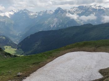
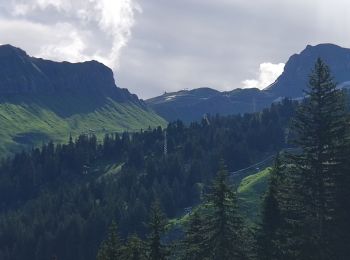
• Randonnée au départ de Flaine vers le col de Colonnay, puis direction tête de Monthieu. Encore de long névés vers le ...
![Randonnée Marche Arâches-la-Frasse - Carroz les Grangettes pra rôti - Photo](https://media.geolcdn.com/t/350/260/fe9c1674-7632-40e7-bc91-441761a7c185.jpg&format=jpg&maxdim=2)
![Marche Marche](https://static1.geolcdn.com/sitytour/trail-icons/101.png)
Km
Marche
![](/images/other/stat-length.png)
![](https://static1.geolcdn.com/siteimages/upload/files/1508320355ic_sort_den_pos_24dp.png)
![](https://static1.geolcdn.com/siteimages/upload/files/1508320355ic_sort_den_neg_24dp.png)
![](https://static1.geolcdn.com/siteimages/upload/files/16400158638029165_repeat_loop_refresh_sync_direction_icon.png)
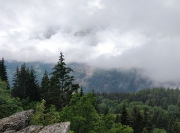
• petite randonnée sous la pluie en fôret, juste au-dessus des Carroz.
![Randonnée Marche Arâches-la-Frasse - boucle les Carroz, la forêt d'Araches, Cretoral, retour par la pierre a Laya - Photo](https://media.geolcdn.com/t/350/260/1f8b8676-81d1-4387-920a-d53a196e6ca7.jpg&format=jpg&maxdim=2)
![Marche Marche](https://static1.geolcdn.com/sitytour/trail-icons/101.png)
Km
Marche
![](/images/other/stat-length.png)
![](https://static1.geolcdn.com/siteimages/upload/files/1508320355ic_sort_den_pos_24dp.png)
![](https://static1.geolcdn.com/siteimages/upload/files/1508320355ic_sort_den_neg_24dp.png)
![](https://static1.geolcdn.com/siteimages/upload/files/16400158638029165_repeat_loop_refresh_sync_direction_icon.png)
• boucle de randonnée majoritairement en forêt sur les hauteurs d'Araches
![Randonnée Marche Arâches-la-Frasse - Flaine, col Pelouse par la cabane de Balacha - Photo](https://media.geolcdn.com/t/350/260/3110fed2-8cbe-4dd7-aa45-5bd8d32f2d28.jpg&format=jpg&maxdim=2)
![Marche Marche](https://static1.geolcdn.com/sitytour/trail-icons/101.png)
Km
Marche
![](/images/other/stat-length.png)
![](https://static1.geolcdn.com/siteimages/upload/files/1508320355ic_sort_den_pos_24dp.png)
![](https://static1.geolcdn.com/siteimages/upload/files/1508320355ic_sort_den_neg_24dp.png)
![](https://static1.geolcdn.com/siteimages/upload/files/16400158638029165_repeat_loop_refresh_sync_direction_icon.png)
• Aller retour de Flaine au col de Pelouse. La montée se fait la plupart du temps en suivant la piste, avec de petites ...
![Randonnée Marche Arâches-la-Frasse - De Vernant aux Grands Vans - Photo](https://media.geolcdn.com/t/350/260/a3be7b4e-23a2-47fe-8908-689e66b805c6.jpg&format=jpg&maxdim=2)
![Marche Marche](https://static1.geolcdn.com/sitytour/trail-icons/101.png)
Km
Marche
![](/images/other/stat-length.png)
![](https://static1.geolcdn.com/siteimages/upload/files/1508320355ic_sort_den_pos_24dp.png)
![](https://static1.geolcdn.com/siteimages/upload/files/1508320355ic_sort_den_neg_24dp.png)
![](https://static1.geolcdn.com/siteimages/upload/files/16400158638029165_repeat_loop_refresh_sync_direction_icon.png)
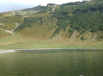
• aller retour par le lac puis le col de Vernant. par beau temps, il est possible de faire la boucle par l'arrête et le...
![Randonnée Marche Arâches-la-Frasse - Boucle les Carroz Pointe de Cupoire - Photo](https://media.geolcdn.com/t/350/260/bf48466d-e052-4165-a390-516fa78f57cf.jpg&format=jpg&maxdim=2)
![Marche Marche](https://static1.geolcdn.com/sitytour/trail-icons/101.png)
Km
Marche
![](/images/other/stat-length.png)
![](https://static1.geolcdn.com/siteimages/upload/files/1508320355ic_sort_den_pos_24dp.png)
![](https://static1.geolcdn.com/siteimages/upload/files/1508320355ic_sort_den_neg_24dp.png)
![](https://static1.geolcdn.com/siteimages/upload/files/16400158638029165_repeat_loop_refresh_sync_direction_icon.png)
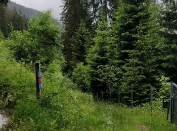
• au départ du parking de la télécabine, on suit le chemin qui longe la piste. On rejoint le ruisseau de Gron qu'on tra...
![Randonnée Marche Arâches-la-Frasse - La Grasse les granges, l'Artoche, la combe, les sommaires, retour par la Presse, la mouille - Photo](https://media.geolcdn.com/t/350/260/cbd8adb3-8387-4e48-bdfe-f2c41676da90.jpg&format=jpg&maxdim=2)
![Marche Marche](https://static1.geolcdn.com/sitytour/trail-icons/101.png)
Km
Marche
![](/images/other/stat-length.png)
![](https://static1.geolcdn.com/siteimages/upload/files/1508320355ic_sort_den_pos_24dp.png)
![](https://static1.geolcdn.com/siteimages/upload/files/1508320355ic_sort_den_neg_24dp.png)
![](https://static1.geolcdn.com/siteimages/upload/files/16400158638029165_repeat_loop_refresh_sync_direction_icon.png)
• boucle sur les hauteurs de La Grasse et Araches
![Randonnée Marche Arâches-la-Frasse - Les 2 lacs départ Vernan - Photo](https://media.geolcdn.com/t/350/260/ext.jpg?maxdim=2&url=https%3A%2F%2Fservices.sitytrail.com%2FGeolivesWS%2FDownloadMedia.ashx%3FTrailID%3D1036975%26Media%3Dfix__20180909162014.jpg)
![Marche Marche](https://static1.geolcdn.com/sitytour/trail-icons/101.png)
Km
Marche
![](/images/other/stat-length.png)
![](https://static1.geolcdn.com/siteimages/upload/files/1508320355ic_sort_den_pos_24dp.png)
![](https://static1.geolcdn.com/siteimages/upload/files/1508320355ic_sort_den_neg_24dp.png)
![](https://static1.geolcdn.com/siteimages/upload/files/16400158638029165_repeat_loop_refresh_sync_direction_icon.png)
• Difficile
![Randonnée Marche Arâches-la-Frasse - la croix des 7 frères - Photo](https://media.geolcdn.com/t/350/260/ext.jpg?maxdim=2&url=https%3A%2F%2Fservices.sitytrail.com%2FGeolivesWS%2FDownloadMedia.ashx%3FTrailID%3D1035756%26Media%3Dfix__20180907171848.jpg)
![Marche Marche](https://static1.geolcdn.com/sitytour/trail-icons/101.png)
Km
Marche
![](/images/other/stat-length.png)
![](https://static1.geolcdn.com/siteimages/upload/files/1508320355ic_sort_den_pos_24dp.png)
![](https://static1.geolcdn.com/siteimages/upload/files/1508320355ic_sort_den_neg_24dp.png)
![](https://static1.geolcdn.com/siteimages/upload/files/16400158638029165_repeat_loop_refresh_sync_direction_icon.png)
• difficultés moyennes
![Randonnée Marche Arâches-la-Frasse - Le lac de Flaine par Les Carroz d'Arâches - Photo](https://media.geolcdn.com/t/350/260/ext.jpg?maxdim=2&url=https%3A%2F%2Fservices.sitytrail.com%2FGeolivesWS%2FDownloadMedia.ashx%3FTrailID%3D104713%26Media%3D8125_5.jpg)
![Marche Marche](https://static1.geolcdn.com/sitytour/trail-icons/101.png)
Km
Marche
![](/images/other/stat-length.png)
![](https://static1.geolcdn.com/siteimages/upload/files/1508320355ic_sort_den_pos_24dp.png)
![](https://static1.geolcdn.com/siteimages/upload/files/1508320355ic_sort_den_neg_24dp.png)
![](https://static1.geolcdn.com/siteimages/upload/files/16400158638029165_repeat_loop_refresh_sync_direction_icon.png)
• Un bonne petite balade qui peut être entreprise en famille. On monte jusqu'au lac et on redescend avec, aux trois qua...
![Randonnée Marche Arâches-la-Frasse - Lac d'Airon - Photo](https://media.geolcdn.com/t/350/260/435aa705-e12e-46c9-9fff-114e390fb5c6.jpg&format=jpg&maxdim=2)
![Marche Marche](https://static1.geolcdn.com/sitytour/trail-icons/101.png)
Km
Marche
![](/images/other/stat-length.png)
![](https://static1.geolcdn.com/siteimages/upload/files/1508320355ic_sort_den_pos_24dp.png)
![](https://static1.geolcdn.com/siteimages/upload/files/1508320355ic_sort_den_neg_24dp.png)
![](https://static1.geolcdn.com/siteimages/upload/files/16400158638029165_repeat_loop_refresh_sync_direction_icon.png)
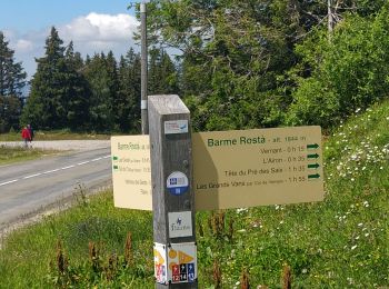
• Courte boucle depuis le parking de l'Airon, en passant par la forêt à l'aller.
20 randonnées affichées sur 65
Application GPS de randonnée GRATUITE