


5,3 km | 7,2 km-effort
Monsols : découvrez les meilleures randonnées : 5 a pied et 22 marche. Tous ces circuits, parcours, itinéraires et activités en plein air sont disponibles dans nos applications SityTrail pour smartphones et tablettes.
Marche


• Circuit proposé par l’office de tourisme du Haut-Beaujolais. Un petit circuit familial de 5 km environ, autour du mon...

A pied
• Randonnée créée par Office du Tourisme du Haut Beaujolais.
A pied
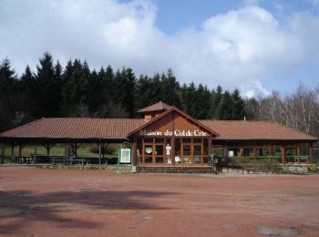
• D/A : Parking du Col de Crie
Marche
• Circuit proposé par l’office de tourisme du Haut-Beaujolais. Le circuit du Viaduc suit le tracé de l'ancien "tacot" e...
Marche
• Circuit proposé par l’office de tourisme du Haut-Beaujolais. Découvrez ce circuit de 16 km faisant le tour du massif ...
Marche
• Circuit proposé par l’office de tourisme du Haut-Beaujolais. Un circuit intermédiaire de 12 km environ dont le départ...

A pied
• Randonnée créée par Office de Tourisme Beaujolais Monts et Vignoble.
A pied
• Randonnée créée par Office du Tourisme du Haut Beaujolais. Symbole: Tête de loup sur fond orange
A pied
• Randonnée créée par Office du Tourisme du Haut Beaujolais.
Marche
• Départ de Monsols. Direction Nord Ouest col de Champ Juin puis GR7 Direction Mont Rigaud point géodésique remarquable...
Marche

Marche
• D/A : Parking du Col de Crie Randonnée Bien ombragée.
Marche
• Départ de Monsols. Direction Nord Ouest col de Champ Juin puis GR7 Direction Mont Rigaud point géodésique remarquabl...
Marche
Marche
• Découvrez ce circuit de 16 km faisant le tour du massif au départ du Col de crie, vous ferez l'ascension du plus haut...
Marche
•
Marche
Marche
Marche
Marche
20 randonnées affichées sur 27
Application GPS de randonnée GRATUITE
 SityTrail
IGN / Instituts géographiques
SityTrail World
Le monde est à vous