


18,4 km | 27 km-effort
Chalmazel : découvrez les meilleures randonnées : 19 marche, 1 course à pied et 3 trail. Tous ces circuits, parcours, itinéraires et activités en plein air sont disponibles dans nos applications SityTrail pour smartphones et tablettes.
Marche


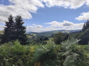
• Très bon parcours mi ombragé. Beaux points de vue sur les montagnes du Livradois Forez. Peu de monde.
Course à pied
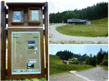
• Parking et départ du panneau du circuit de la station de Chalmazel, devant le Télésiège des Jasseries. Très belle ran...

Marche
• Parking et départ du panneau du circuit de la station de Chalmazel, devant le Télésiège des Jasseries. Très belle ran...

Marche
• Belle rando qui permets d'atteindre le col du Béal et Pierre sur haute (radar), point culminant du département de la ...
Marche
• Départ sur la place du château à coté de la poste.
Marche
• Auberge de Garnier Jasseries de Garnier, Saint-Bonnet-le-Courreau, France 04 77 76 83 86
Marche
• Auberge des Granges Les Bois, Chalmazel, France 04 77 24 80 62
Marche
Marche
Marche
Marche
Marche
Marche
Marche

Trail
Trail
Trail
Marche
Marche
Marche
20 randonnées affichées sur 23
Application GPS de randonnée GRATUITE
 SityTrail
IGN / Instituts géographiques
SityTrail World
Le monde est à vous