Plan-de-Baix, Drôme, A pied : Les meilleures randonnées, itinéraires, parcours, balades et promenades

Plan-de-Baix : découvrez les meilleures randonnées : 2 a pied et 33 marche. Tous ces circuits, parcours, itinéraires et activités en plein air sont disponibles dans nos applications SityTrail pour smartphones et tablettes.


Les meilleurs parcours (35)

Randonnée Marche Plan-de-Baix - Canyon des Gueulards - Plateau du Vellan  - Photo
Marche 18.662
Km

Marche

Moyen
Plan-de-Baix, Auvergne-Rhône-Alpes, Drôme, France
18,7 km | 28 km-effort
4h 55min
717 m
714 m
Oui
Philindy26

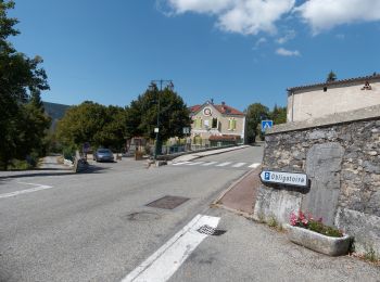
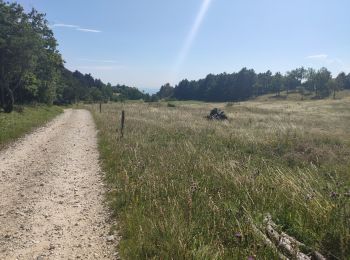
• Départ du village de Plan-de-Baix... Géolocalisation (Google Maps) : https://goo.gl/maps/jQueNbyGpCkkKiNJ6 En partan...

Randonnée Marche Plan-de-Baix - Le Canyon des Gueulards - Photo
Marche 14.244
Km

Marche

Difficile
Plan-de-Baix, Auvergne-Rhône-Alpes, Drôme, France
14,2 km | 22 km-effort
4h 27min
585 m
588 m
Oui
AIGUIER

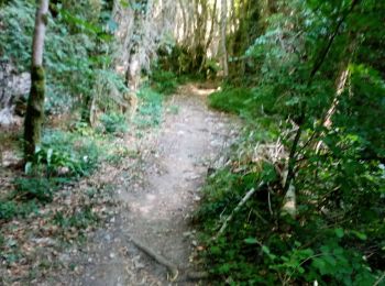
• Splendide randonnée, très beaux sentiers, pistes forestières à l'ombre. Magnifique que la traversée du Canyon des Gue...

Randonnée Marche Plan-de-Baix - F26 Plan de Baix Vélan - Photo
Marche 10.89
Km

Marche

Moyen
Plan-de-Baix, Auvergne-Rhône-Alpes, Drôme, France
10,9 km | 16,1 km-effort
4h 14min
395 m
391 m
Oui
ageo

• LCV ANIM rando orientation

Randonnée Marche Plan-de-Baix - Le Canyon des Gueulards 9km - Photo
Marche 9.108
Km
GUIDE

Marche

Moyen
Plan-de-Baix, Auvergne-Rhône-Alpes, Drôme, France
9,1 km | 14,1 km-effort
3h 0min
372 m
372 m
Oui
thonyc

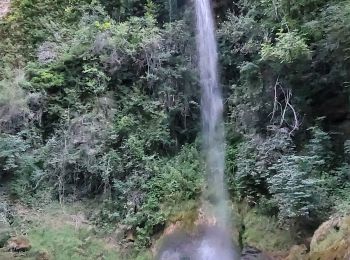
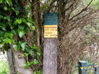
• Randonnée atypique dans les gorges d’Omblèze où vous pourrez contempler les parois abruptes du défilé, les eaux limpi...

Randonnée Marche Plan-de-Baix - 050823 Canyon des gueulards  - Photo
Marche 10.662
Km

Marche

Difficile
Plan-de-Baix, Auvergne-Rhône-Alpes, Drôme, France
10,7 km | 16,1 km-effort
2h 56min
410 m
395 m
Non
mzonzon05

Randonnée Marche Plan-de-Baix - ferme de sauzy canyon des guelards retour par le velan - Photo
Marche 17.897
Km

Marche

Moyen
Plan-de-Baix, Auvergne-Rhône-Alpes, Drôme, France
17,9 km | 27 km-effort
4h 47min
676 m
688 m
Oui
marcagif

Randonnée Marche Plan-de-Baix - Le plateau du Vellan 14km - Photo
Marche 14.001
Km
GUIDE

Marche

Moyen
Plan-de-Baix, Auvergne-Rhône-Alpes, Drôme, France
14 km | 22 km-effort
4h 58min
587 m
600 m
Oui
thonyc

Randonnée Marche Plan-de-Baix - canyon des gueulards   - Photo
Marche 10.162
Km

Marche

Difficile
Plan-de-Baix, Auvergne-Rhône-Alpes, Drôme, France
10,2 km | 17 km-effort
3h 54min
517 m
508 m
Non
hugo26

• Rando au canyon des geulards . casse croute au hameau en ruine du Chaffal. En boucle depuis les gorges d'Omblèze.

Randonnée Marche Plan-de-Baix - canyon des gueulards depuis le moulin de la pipe - Photo
Marche 9.454
Km

Marche

Difficile
Plan-de-Baix, Auvergne-Rhône-Alpes, Drôme, France
9,5 km | 16,6 km-effort
3h 45min
534 m
531 m
Oui
hugo26

• Très belle balade en boucle pas très difficile mais à faire de préférence quand le ruisseau ne coule pas trop.

Randonnée Marche Plan-de-Baix - canyon des gueulards  - Photo
Marche 10.665
Km

Marche

Très facile
Plan-de-Baix, Auvergne-Rhône-Alpes, Drôme, France
10,7 km | 16,3 km-effort
5h 5min
421 m
432 m
Oui
Joel26400

Randonnée Marche Plan-de-Baix - canyon du gueulard - Photo
Marche 10.169
Km

Marche

Moyen
Plan-de-Baix, Auvergne-Rhône-Alpes, Drôme, France
10,2 km | 15,5 km-effort
3h 18min
424 m
324 m
Non
meillon

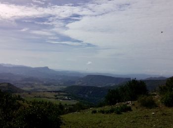
• on découvre quelques passages sublimes de crocs et de falaises...à voir absolument

Randonnée Marche Plan-de-Baix - gervane druise croix du velan  - Photo
Marche 18.419
Km

Marche

Moyen
Plan-de-Baix, Auvergne-Rhône-Alpes, Drôme, France
18,4 km | 29 km-effort
6h 59min
829 m
828 m
Oui
guyzinz

• Attention porter des chaussettes de rechange il faut traverser plusieurs fois la gervane sinon super rando moyenne

Randonnée Marche Plan-de-Baix - les trois perles de la gervane  - Photo
Marche 20.273
Km

Marche

Très facile
Plan-de-Baix, Auvergne-Rhône-Alpes, Drôme, France
20 km | 31 km-effort
8h 17min
839 m
836 m
Non
Joel26400

• cite super rando raprechissante

Randonnée Marche Plan-de-Baix - des gueulards - Photo
Marche 9.507
Km

Marche

Moyen
Plan-de-Baix, Auvergne-Rhône-Alpes, Drôme, France
9,5 km | 13,3 km-effort
3h 3min
281 m
297 m
Non
Cricounet84

Randonnée Marche Plan-de-Baix - Plan de Baix 15 02 24 - Photo
Marche 14.785
Km

Marche

Moyen
Plan-de-Baix, Auvergne-Rhône-Alpes, Drôme, France
14,8 km | 23 km-effort
3h 46min
651 m
651 m
Oui
nordan

Randonnée Marche Plan-de-Baix - la blache  - Photo
Marche 10.998
Km

Marche

Difficile
Plan-de-Baix, Auvergne-Rhône-Alpes, Drôme, France
11 km | 15,9 km-effort
2h 53min
369 m
370 m
Oui
panetJeanLuc

Randonnée Marche Plan-de-Baix - Là gervanne  - Photo
Marche 4.293
Km

Marche

Facile
Plan-de-Baix, Auvergne-Rhône-Alpes, Drôme, France
4,3 km | 5,1 km-effort
1h 24min
33 m
131 m
Non
raygautier

Randonnée Marche Plan-de-Baix - Cote Blanche - Photo
Marche 16.706
Km

Marche

Moyen
Plan-de-Baix, Auvergne-Rhône-Alpes, Drôme, France
16,7 km | 26 km-effort
5h 54min
698 m
689 m
Oui
collot

Randonnée Marche Plan-de-Baix - gueulards - Photo
Marche 10.985
Km

Marche

Difficile
Plan-de-Baix, Auvergne-Rhône-Alpes, Drôme, France
11 km | 18,2 km-effort
5h 27min
546 m
536 m
Non
lerouge8726

Randonnée Marche Plan-de-Baix - velan - Photo
Marche 16.951
Km

Marche

Très difficile
Plan-de-Baix, Auvergne-Rhône-Alpes, Drôme, France
17 km | 26 km-effort
6h 34min
677 m
676 m
Non
lerouge8726

20 randonnées affichées sur 35

Application GPS de randonnée GRATUITE

Logo SityTrail SityTrail

IGN / Instituts géographiques

Télécharger SityTrail sur l'App Store Télécharger SityTrail sur Google Play

Logo SityTrail SityTrail World

Le monde est à vous

Télécharger SityTrail sur l'App Store Télécharger SityTrail sur Google Play Télécharger SityTrail sur Huawei AppGallery

Activités

Fermer
Mes abonnements