


10,5 km | 12,5 km-effort
Coucy-le-Château-Auffrique : découvrez les meilleures randonnées : 10 marche et 1 marche nordique. Tous ces circuits, parcours, itinéraires et activités en plein air sont disponibles dans nos applications SityTrail pour smartphones et tablettes.
Marche


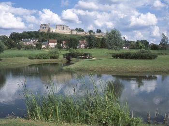
• Au départ de Coucy, ce circuit permet d'admirer les vestiges de son château fort. En longeant les remparts autour de ...

Marche
Marche
• Départ de la Place de l'Hôtel de Ville de Coucy-le-Château Auffrique.
Marche
• Départ de la place de l'Hôtel de Ville, N49°31'13,15" /E003°19'28,3". Itinéraire tiré de la fiche "Le Circuit d'Engue...
Marche
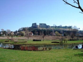
• Sur le plateau de Coucy, en éperon au-dessus du passage de la vallée de l'Ailette à la vallée de l'Oise, se dressent ...
Marche
Marche
Marche
Marche

Marche nordique

Marche
• Sur le plateau de Coucy, en éperon au-dessus du passage de la vallée de l'Ailette à la vallée de l'Oise, se dressent ...
11 randonnées affichées sur 11
Application GPS de randonnée GRATUITE
 SityTrail
IGN / Instituts géographiques
SityTrail World
Le monde est à vous