![](/images/other/stat-length.png)
- Randonnées
- A pied
- France
- Hauts-de-France
- Somme
- Oresmaux
Oresmaux, Somme, A pied : Les meilleures randonnées, itinéraires, parcours, balades et promenades
1 commentaires
Oresmaux : découvrez les meilleures randonnées : 3 marche. Tous ces circuits, parcours, itinéraires et activités en plein air sont disponibles dans nos applications SityTrail pour smartphones et tablettes.
Les meilleurs parcours (3)
![Randonnée Marche Oresmaux - Oresmaux - Photo](https://media.geolcdn.com/t/350/260/2cdfc2ad-f0ea-45e6-9c73-31839e48462c.jpg&format=jpg&maxdim=2)
![Marche Marche](https://static1.geolcdn.com/sitytour/trail-icons/101.png)
Km
#1 - Oresmaux
Marche
Très difficile
(1)
Oresmaux,
Hauts-de-France,
Somme,
France
![](/images/other/stat-length.png)
22 km | 25 km-effort
5h 35min
![](https://static1.geolcdn.com/siteimages/upload/files/1508320355ic_sort_den_pos_24dp.png)
256 m
![](https://static1.geolcdn.com/siteimages/upload/files/1508320355ic_sort_den_neg_24dp.png)
256 m
![](https://static1.geolcdn.com/siteimages/upload/files/16400158638029165_repeat_loop_refresh_sync_direction_icon.png)
Oui
fitz2014
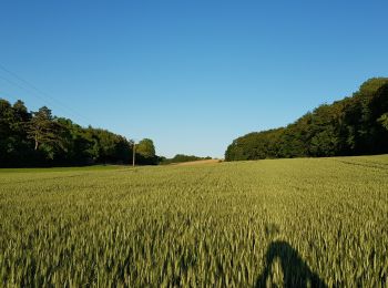
• À partir d'Oresmaux, découverte du larris de Grattepanche en passant par le Fond de l'Absous. Le retour vers Oresmaux...
![Randonnée Marche Oresmaux - Fonds de L'absous 2 - Photo](https://media.geolcdn.com/t/350/260/ext.jpg?maxdim=2&url=https%3A%2F%2Fstatic1.geolcdn.com%2Fsiteimages%2Fupload%2Ffiles%2F1553511878bg_sport_marche.png)
![Marche Marche](https://static1.geolcdn.com/sitytour/trail-icons/101.png)
Km
#2 - Fonds de L'absous 2
Marche
Moyen
Oresmaux,
Hauts-de-France,
Somme,
France
![](/images/other/stat-length.png)
10,5 km | 12,1 km-effort
2h 30min
![](https://static1.geolcdn.com/siteimages/upload/files/1508320355ic_sort_den_pos_24dp.png)
121 m
![](https://static1.geolcdn.com/siteimages/upload/files/1508320355ic_sort_den_neg_24dp.png)
121 m
![](https://static1.geolcdn.com/siteimages/upload/files/16400158638029165_repeat_loop_refresh_sync_direction_icon.png)
Oui
sulcata80
![Randonnée Marche Oresmaux - Oresmaux - Photo](https://media.geolcdn.com/t/350/260/ext.jpg?maxdim=2&url=https%3A%2F%2Fstatic1.geolcdn.com%2Fsiteimages%2Fupload%2Ffiles%2F1553511878bg_sport_marche.png)
![Marche Marche](https://static1.geolcdn.com/sitytour/trail-icons/101.png)
Km
#3 - Oresmaux
Marche
Moyen
Oresmaux,
Hauts-de-France,
Somme,
France
![](/images/other/stat-length.png)
13,5 km | 15,5 km-effort
3h 24min
![](https://static1.geolcdn.com/siteimages/upload/files/1508320355ic_sort_den_pos_24dp.png)
149 m
![](https://static1.geolcdn.com/siteimages/upload/files/1508320355ic_sort_den_neg_24dp.png)
148 m
![](https://static1.geolcdn.com/siteimages/upload/files/16400158638029165_repeat_loop_refresh_sync_direction_icon.png)
Oui
sulcata80
3 randonnées affichées sur 3
Application GPS de randonnée GRATUITE