


10,5 km | 12,1 km-effort
Uusimaa : découvrez les meilleures randonnées : 20 a pied et 2 marche. Tous ces circuits, parcours, itinéraires et activités en plein air sont disponibles dans nos applications SityTrail pour smartphones et tablettes.
A pied


• Site web: https://www.hyvinkaa.fi/kulttuuri-ja-vapaa-aika/liikunta/virkistys-ja-ulkoilu1/opastetut-reitit/kytaja-us...
A pied
• Randonnée créée par Torpparinmäen peruskoulu. https://www.hs.fi/lastenuutiset/art-2000006115708.html Site web: ht...
A pied
• Randonnée créée par Metsähallitus. Symbole: yellow diamond
A pied
• Pohjois-Helsingin Haltialassa on kolme luontopolkua ja lisäksi Niskalassa puulajipuisto. Site web: https://www.hel.f...
A pied
• Randonnée créée par Helsingin kaupungin liikuntavirasto. Symbole: Yellow symbol
A pied
• Randonnée créée par Helsingin kaupungin liikuntavirasto. Symbole: Blue symbol
A pied
• mileposts tagged with information=milepost, some are still missing so the route is still partly incomplete Symbole: ...
A pied
• Maunulan maja on ulkoilijan keidas Keskuspuiston siimeksessä. Majalla järjestetään yhdistyksen tilaisuuksia, lauluilt...
A pied
• Randonnée créée par Metsahallitus.
A pied
• Symbole: white/green diamond
A pied
A pied
A pied

A pied
• Randonnée créée par Metsähallitus. Symbole: green diamond
A pied
• Site web: https://www.kirkkonummi.fi/meikon-luonnonsuojelualueet
A pied
• Site web: https://www.kirkkonummi.fi/meikon-luonnonsuojelualueet
A pied
• Symbole: Green diamond Site web: https://www.kirkkonummi.fi/meikon-luonnonsuojelualueet
A pied
• Randonnée créée par Vihtijärven kyläyhdistys.
A pied
• Symbole: purple diamond

Marche
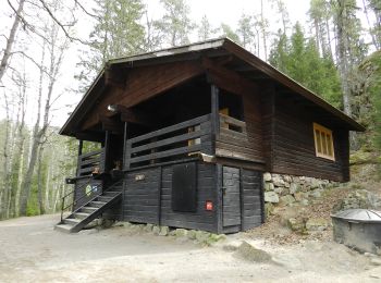
• Village en bois
20 randonnées affichées sur 22
 SityTrail