![](/images/other/stat-length.png)
- Randonnées
- A pied
- Espagne
- Aragon
- Saragosse
Saragosse, Aragon, A pied : Les meilleures randonnées, itinéraires, parcours, balades et promenades
Saragosse : découvrez les meilleures randonnées : 19 a pied et 10 marche. Tous ces circuits, parcours, itinéraires et activités en plein air sont disponibles dans nos applications SityTrail pour smartphones et tablettes.
Les meilleurs parcours (29)
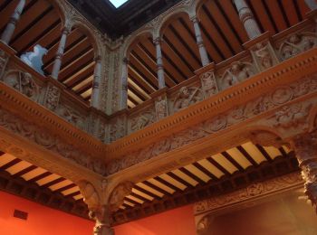
![Randonnée A pied Saragosse - Ruta de los Parques - Photo](https://media.geolcdn.com/t/350/260/20c2e90a-8d27-4f43-b0ba-c8e3ce82099e.jpeg&format=jpg&maxdim=2)
![A pied A pied](https://static1.geolcdn.com/sitytour/trail-icons/100.png)
Km
A pied
![](/images/other/stat-length.png)
![](https://static1.geolcdn.com/siteimages/upload/files/1508320355ic_sort_den_pos_24dp.png)
![](https://static1.geolcdn.com/siteimages/upload/files/1508320355ic_sort_den_neg_24dp.png)
![](https://static1.geolcdn.com/siteimages/upload/files/16400158638029165_repeat_loop_refresh_sync_direction_icon.png)
• Randonnée créée par Ayuntamiento de Zaragoza. Site web: https://www.zaragoza.es/sede/portal/medioambiente/infraest...
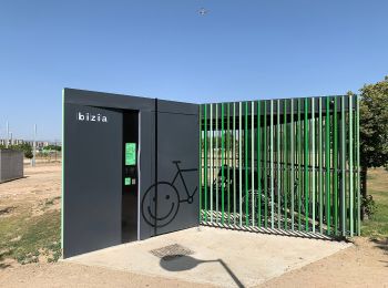
![Randonnée A pied Saragosse - Valdespartera-Plaza - Photo](https://media.geolcdn.com/t/350/260/da5a88d4-7e53-40ac-bf12-348905ee1929.jpeg&format=jpg&maxdim=2)
![A pied A pied](https://static1.geolcdn.com/sitytour/trail-icons/100.png)
Km
A pied
![](/images/other/stat-length.png)
![](https://static1.geolcdn.com/siteimages/upload/files/1508320355ic_sort_den_pos_24dp.png)
![](https://static1.geolcdn.com/siteimages/upload/files/1508320355ic_sort_den_neg_24dp.png)
![](https://static1.geolcdn.com/siteimages/upload/files/16400158638029165_repeat_loop_refresh_sync_direction_icon.png)
• Randonnée créée par Zaragoza Deporte. Site web: https://zaragozanda.zaragozadeporte.com/Ruta11.asp
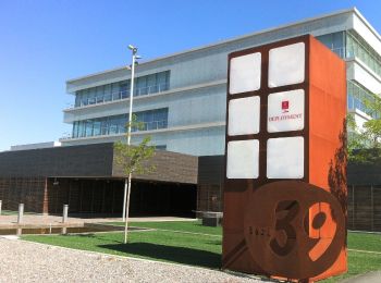
![Randonnée A pied Saragosse - Valdefierro-Plaza - Photo](https://media.geolcdn.com/t/350/260/9374466b-ac68-4991-b37d-cc4da7c2c961.jpeg&format=jpg&maxdim=2)
![A pied A pied](https://static1.geolcdn.com/sitytour/trail-icons/100.png)
Km
A pied
![](/images/other/stat-length.png)
![](https://static1.geolcdn.com/siteimages/upload/files/1508320355ic_sort_den_pos_24dp.png)
![](https://static1.geolcdn.com/siteimages/upload/files/1508320355ic_sort_den_neg_24dp.png)
![](https://static1.geolcdn.com/siteimages/upload/files/16400158638029165_repeat_loop_refresh_sync_direction_icon.png)
• Randonnée créée par Zaragoza Deporte. Site web: https://zaragozanda.zaragozadeporte.com/Ruta10.asp
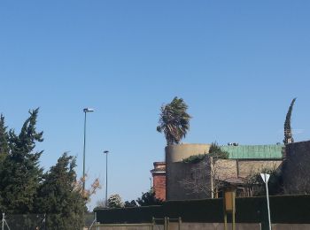
![Randonnée A pied Saragosse - Ruta Alto Canal: Valdefierro-Torrero - Photo](https://media.geolcdn.com/t/350/260/757742e9-8375-4040-a123-38f838a3baf4.jpeg&format=jpg&maxdim=2)
![A pied A pied](https://static1.geolcdn.com/sitytour/trail-icons/100.png)
Km
A pied
![](/images/other/stat-length.png)
![](https://static1.geolcdn.com/siteimages/upload/files/1508320355ic_sort_den_pos_24dp.png)
![](https://static1.geolcdn.com/siteimages/upload/files/1508320355ic_sort_den_neg_24dp.png)
![](https://static1.geolcdn.com/siteimages/upload/files/16400158638029165_repeat_loop_refresh_sync_direction_icon.png)
• Randonnée créée par Zaragoza Deporte. Site web: https://zaragozanda.zaragozadeporte.com/Ruta9.asp
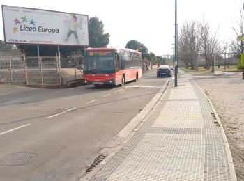
![Randonnée A pied Saragosse - Estación Goya-La Junquera - Photo](https://media.geolcdn.com/t/350/260/06c7be34-b44f-4670-b02e-9b4120c0ec3b.jpeg&format=jpg&maxdim=2)
![A pied A pied](https://static1.geolcdn.com/sitytour/trail-icons/100.png)
Km
A pied
![](/images/other/stat-length.png)
![](https://static1.geolcdn.com/siteimages/upload/files/1508320355ic_sort_den_pos_24dp.png)
![](https://static1.geolcdn.com/siteimages/upload/files/1508320355ic_sort_den_neg_24dp.png)
![](https://static1.geolcdn.com/siteimages/upload/files/16400158638029165_repeat_loop_refresh_sync_direction_icon.png)
• Randonnée créée par Zaragoza Deporte. Site web: https://zaragozanda.zaragozadeporte.com/Ruta7.asp
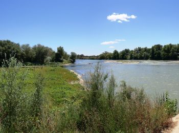
![Randonnée A pied Saragosse - Desembocadura del Gállego - Photo](https://media.geolcdn.com/t/350/260/c4e5fbee-ba95-4f95-a62d-76c502ba0314.jpeg&format=jpg&maxdim=2)
![A pied A pied](https://static1.geolcdn.com/sitytour/trail-icons/100.png)
Km
A pied
![](/images/other/stat-length.png)
![](https://static1.geolcdn.com/siteimages/upload/files/1508320355ic_sort_den_pos_24dp.png)
![](https://static1.geolcdn.com/siteimages/upload/files/1508320355ic_sort_den_neg_24dp.png)
![](https://static1.geolcdn.com/siteimages/upload/files/16400158638029165_repeat_loop_refresh_sync_direction_icon.png)
• Randonnée créée par Zaragoza Deporte. Site web: https://zaragozanda.zaragozadeporte.com/Ruta3.asp
![Randonnée A pied Saragosse - Paseando por los tres ríos - Photo](https://media.geolcdn.com/t/350/260/be816433-4bfc-43ba-98d2-a7158e283d93.jpeg&format=jpg&maxdim=2)
![A pied A pied](https://static1.geolcdn.com/sitytour/trail-icons/100.png)
Km
A pied
![](/images/other/stat-length.png)
![](https://static1.geolcdn.com/siteimages/upload/files/1508320355ic_sort_den_pos_24dp.png)
![](https://static1.geolcdn.com/siteimages/upload/files/1508320355ic_sort_den_neg_24dp.png)
![](https://static1.geolcdn.com/siteimages/upload/files/16400158638029165_repeat_loop_refresh_sync_direction_icon.png)
• Randonnée créée par Zaragoza Deporte. Site web: https://zaragozanda.zaragozadeporte.com/Ruta2.asp
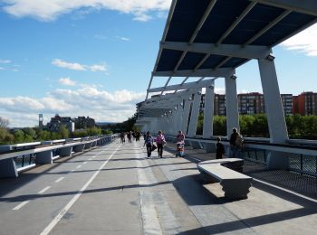
![Randonnée A pied Saragosse - La margen izquierda, entre puentes - Photo](https://media.geolcdn.com/t/350/260/005040ae-58df-41b3-a633-d40a9669220b.jpeg&format=jpg&maxdim=2)
![A pied A pied](https://static1.geolcdn.com/sitytour/trail-icons/100.png)
Km
A pied
![](/images/other/stat-length.png)
![](https://static1.geolcdn.com/siteimages/upload/files/1508320355ic_sort_den_pos_24dp.png)
![](https://static1.geolcdn.com/siteimages/upload/files/1508320355ic_sort_den_neg_24dp.png)
![](https://static1.geolcdn.com/siteimages/upload/files/16400158638029165_repeat_loop_refresh_sync_direction_icon.png)
• Randonnée créée par Zaragoza Deporte. Site web: https://zaragozanda.zaragozadeporte.com/Ruta1.asp
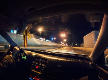
![Randonnée A pied Saragosse - Camino Natural del Ebro de Zaragoza a La Cartuja - Photo](https://media.geolcdn.com/t/350/260/3f2c429e-c4f7-4370-8cd1-fcbe75bcd69e.jpeg&format=jpg&maxdim=2)
![A pied A pied](https://static1.geolcdn.com/sitytour/trail-icons/100.png)
Km
A pied
![](/images/other/stat-length.png)
![](https://static1.geolcdn.com/siteimages/upload/files/1508320355ic_sort_den_pos_24dp.png)
![](https://static1.geolcdn.com/siteimages/upload/files/1508320355ic_sort_den_neg_24dp.png)
![](https://static1.geolcdn.com/siteimages/upload/files/16400158638029165_repeat_loop_refresh_sync_direction_icon.png)
• Randonnée créée par Zaragoza Deporte. Site web: https://zaragozanda.zaragozadeporte.com/Ruta4.asp
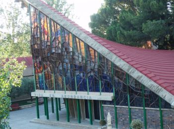
![Randonnée A pied Saragosse - Ruta circular por el Canal y los pinares de Venecia - Photo](https://media.geolcdn.com/t/350/260/09b2353d-bca5-480a-bf9e-6901522de82c.jpeg&format=jpg&maxdim=2)
![A pied A pied](https://static1.geolcdn.com/sitytour/trail-icons/100.png)
Km
A pied
![](/images/other/stat-length.png)
![](https://static1.geolcdn.com/siteimages/upload/files/1508320355ic_sort_den_pos_24dp.png)
![](https://static1.geolcdn.com/siteimages/upload/files/1508320355ic_sort_den_neg_24dp.png)
![](https://static1.geolcdn.com/siteimages/upload/files/16400158638029165_repeat_loop_refresh_sync_direction_icon.png)
• Randonnée créée par Zaragoza Deporte. Site web: https://zaragozanda.zaragozadeporte.com/Ruta6.asp
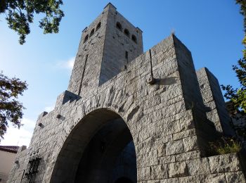
![Randonnée A pied Saragosse - Torrero-Fuente de La Junquera - Photo](https://media.geolcdn.com/t/350/260/860f8256-979b-4f26-bac2-e8d707abb8f6.jpeg&format=jpg&maxdim=2)
![A pied A pied](https://static1.geolcdn.com/sitytour/trail-icons/100.png)
Km
A pied
![](/images/other/stat-length.png)
![](https://static1.geolcdn.com/siteimages/upload/files/1508320355ic_sort_den_pos_24dp.png)
![](https://static1.geolcdn.com/siteimages/upload/files/1508320355ic_sort_den_neg_24dp.png)
![](https://static1.geolcdn.com/siteimages/upload/files/16400158638029165_repeat_loop_refresh_sync_direction_icon.png)
• Randonnée créée par Zaragoza Deporte. Site web: https://zaragozanda.zaragozadeporte.com/Ruta8.asp
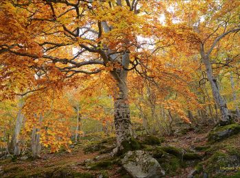
![Randonnée A pied Tarazona - Sendero S-2 Barranco del Apio - Photo](https://media.geolcdn.com/t/350/260/6bd2bcce-b0cb-4a9b-8c20-4f91f33a192e.jpeg&format=jpg&maxdim=2)
![A pied A pied](https://static1.geolcdn.com/sitytour/trail-icons/100.png)
Km
A pied
![](/images/other/stat-length.png)
![](https://static1.geolcdn.com/siteimages/upload/files/1508320355ic_sort_den_pos_24dp.png)
![](https://static1.geolcdn.com/siteimages/upload/files/1508320355ic_sort_den_neg_24dp.png)
![](https://static1.geolcdn.com/siteimages/upload/files/16400158638029165_repeat_loop_refresh_sync_direction_icon.png)
• Randonnée créée par Parque Natural del Moncayo.
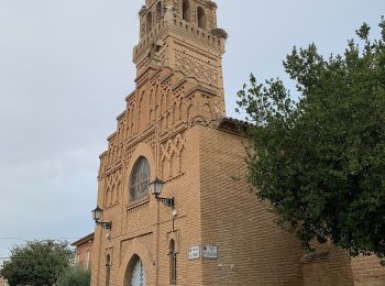
![Randonnée A pied Saragosse - Camino del Monte de Peñaflor - Photo](https://media.geolcdn.com/t/350/260/555b41cd-8677-4d95-a2be-938b80d90245.jpeg&format=jpg&maxdim=2)
![A pied A pied](https://static1.geolcdn.com/sitytour/trail-icons/100.png)
Km
A pied
![](/images/other/stat-length.png)
![](https://static1.geolcdn.com/siteimages/upload/files/1508320355ic_sort_den_pos_24dp.png)
![](https://static1.geolcdn.com/siteimages/upload/files/1508320355ic_sort_den_neg_24dp.png)
![](https://static1.geolcdn.com/siteimages/upload/files/16400158638029165_repeat_loop_refresh_sync_direction_icon.png)
• Randonnée créée par Ayuntamiento de Zaragoza.
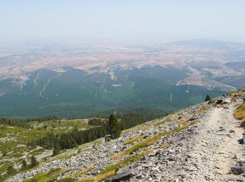
![Randonnée A pied Tarazona - Subida al Moncayo por el pinar - Photo](https://media.geolcdn.com/t/350/260/ff181cc9-6779-4d6f-a6e4-a49b79fa9e10.jpeg&format=jpg&maxdim=2)
![A pied A pied](https://static1.geolcdn.com/sitytour/trail-icons/100.png)
Km
A pied
![](/images/other/stat-length.png)
![](https://static1.geolcdn.com/siteimages/upload/files/1508320355ic_sort_den_pos_24dp.png)
![](https://static1.geolcdn.com/siteimages/upload/files/1508320355ic_sort_den_neg_24dp.png)
![](https://static1.geolcdn.com/siteimages/upload/files/16400158638029165_repeat_loop_refresh_sync_direction_icon.png)
![Randonnée A pied Tarazona - Circular del Moncayo - Photo](https://media.geolcdn.com/t/350/260/21772260-4400-4c90-a138-4b9218ca3f0d.jpeg&format=jpg&maxdim=2)
![A pied A pied](https://static1.geolcdn.com/sitytour/trail-icons/100.png)
Km
A pied
![](/images/other/stat-length.png)
![](https://static1.geolcdn.com/siteimages/upload/files/1508320355ic_sort_den_pos_24dp.png)
![](https://static1.geolcdn.com/siteimages/upload/files/1508320355ic_sort_den_neg_24dp.png)
![](https://static1.geolcdn.com/siteimages/upload/files/16400158638029165_repeat_loop_refresh_sync_direction_icon.png)
![Randonnée A pied Pedrola - 10K Villa de Pedrola 2017 - Photo](https://media.geolcdn.com/t/350/260/ext.jpg?maxdim=2&url=https%3A%2F%2Fstatic1.geolcdn.com%2Fsiteimages%2Fupload%2Ffiles%2F1545311037marcheuse_200dpi.jpg)
![A pied A pied](https://static1.geolcdn.com/sitytour/trail-icons/100.png)
Km
A pied
![](/images/other/stat-length.png)
![](https://static1.geolcdn.com/siteimages/upload/files/1508320355ic_sort_den_pos_24dp.png)
![](https://static1.geolcdn.com/siteimages/upload/files/1508320355ic_sort_den_neg_24dp.png)
![](https://static1.geolcdn.com/siteimages/upload/files/16400158638029165_repeat_loop_refresh_sync_direction_icon.png)
• Site web: http://www.pedrola-corre.com/p/10k.html?spref=fb
![Randonnée A pied Calatayud - SL Z 41: De Huérmeda al mirador de la Cocha - Photo](https://media.geolcdn.com/t/350/260/ext.jpg?maxdim=2&url=https%3A%2F%2Fstatic1.geolcdn.com%2Fsiteimages%2Fupload%2Ffiles%2F1545311037marcheuse_200dpi.jpg)
![A pied A pied](https://static1.geolcdn.com/sitytour/trail-icons/100.png)
Km
A pied
![](/images/other/stat-length.png)
![](https://static1.geolcdn.com/siteimages/upload/files/1508320355ic_sort_den_pos_24dp.png)
![](https://static1.geolcdn.com/siteimages/upload/files/1508320355ic_sort_den_neg_24dp.png)
![](https://static1.geolcdn.com/siteimages/upload/files/16400158638029165_repeat_loop_refresh_sync_direction_icon.png)
• Site web: http://www.caminosnaturales.com
![Randonnée A pied Calatayud - SL Z 8: Ruta de Calatayud - Photo](https://media.geolcdn.com/t/350/260/ext.jpg?maxdim=2&url=https%3A%2F%2Fstatic1.geolcdn.com%2Fsiteimages%2Fupload%2Ffiles%2F1545311037marcheuse_200dpi.jpg)
![A pied A pied](https://static1.geolcdn.com/sitytour/trail-icons/100.png)
Km
A pied
![](/images/other/stat-length.png)
![](https://static1.geolcdn.com/siteimages/upload/files/1508320355ic_sort_den_pos_24dp.png)
![](https://static1.geolcdn.com/siteimages/upload/files/1508320355ic_sort_den_neg_24dp.png)
![](https://static1.geolcdn.com/siteimages/upload/files/16400158638029165_repeat_loop_refresh_sync_direction_icon.png)
• Site web: http://www.caminosnaturales.com
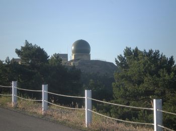
![Randonnée A pied El Frasno - SL Z 36: Subida al pico del Rayo - Photo](https://media.geolcdn.com/t/350/260/805e6b3c-a4fc-457d-becb-23fa1d76a3b0.jpeg&format=jpg&maxdim=2)
![A pied A pied](https://static1.geolcdn.com/sitytour/trail-icons/100.png)
Km
A pied
![](/images/other/stat-length.png)
![](https://static1.geolcdn.com/siteimages/upload/files/1508320355ic_sort_den_pos_24dp.png)
![](https://static1.geolcdn.com/siteimages/upload/files/1508320355ic_sort_den_neg_24dp.png)
![](https://static1.geolcdn.com/siteimages/upload/files/16400158638029165_repeat_loop_refresh_sync_direction_icon.png)
![Randonnée Marche Valpalmas - RIGLOS agaurales de valpalmas (10) - Photo](https://media.geolcdn.com/t/350/260/ext.jpg?maxdim=2&url=https%3A%2F%2Fstatic1.geolcdn.com%2Fsiteimages%2Fupload%2Ffiles%2F1553511878bg_sport_marche.png)
![Marche Marche](https://static1.geolcdn.com/sitytour/trail-icons/101.png)
Km
Marche
![](/images/other/stat-length.png)
![](https://static1.geolcdn.com/siteimages/upload/files/1508320355ic_sort_den_pos_24dp.png)
![](https://static1.geolcdn.com/siteimages/upload/files/1508320355ic_sort_den_neg_24dp.png)
![](https://static1.geolcdn.com/siteimages/upload/files/16400158638029165_repeat_loop_refresh_sync_direction_icon.png)
• Départ rando N 42 08 45.9 W 000 50 05.4 de l'hotel spa au départ de la rando 36.5km compter environ 40 mn Longueur de...
20 randonnées affichées sur 29
Application GPS de randonnée GRATUITE
Activités
Régions proches
- Aguilón
- Alagón
- Alborge
- Alcalá de Moncayo
- Alhama de Aragón
- Aniñón
- Añón de Moncayo
- Ariza
- Artieda
- Atea
- Ateca
- Belchite
- Biel
- Biota
- Borja
- Bujaraloz
- Calatayud
- Caspe
- Castejón de Valdejasa
- Castiliscar
- Cervera de la Cañada
- Daroca
- Ejea de los Caballeros
- El Buste
- El Frasno
- Erla
- Escatrón
- Fabara / Favara
- Fuendetodos
- Fuentes de Ebro
- Gotor
- Grisén
- Jaraba
- Jarque de Moncayo
- Layana
- Lécera
- Los Pintanos
- Luesia
- Luna
- Maella
- Magallón
- María de Huerva
- Mianos
- Monegrillo
- Murillo de Gállego
- Navardún
- Nonaspe / Nonasp
- Nuévalos
- Orés
- Oseja
- Pedrola
- Pina de Ebro
- Plasencia de Jalón
- Purujosa
- Quinto
- Sádaba
- Saragosse
- Sástago
- Sigüés
- Sos del Rey Católico
- Tabuenca
- Talamantes
- Tarazona
- Tauste
- Terrer
- Tierga
- Trasobares
- Uncastillo
- Undués de Lerda
- Urriés
- Valpalmas
- Vera de Moncayo