


3,8 km | 5,9 km-effort
Haría : découvrez les meilleures randonnées : 2 a pied et 11 marche. Tous ces circuits, parcours, itinéraires et activités en plein air sont disponibles dans nos applications SityTrail pour smartphones et tablettes.
Marche


Marche
A pied
A pied
Marche
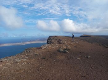
• Le sentier de descente est pentu, très bien tracè, mais il est préférable de prévoir de bonnes chaussures car il est ...

Marche
• aller retour vers une belle plage de sable fin isolée
Marche
• Joli balade entre les terrasses agricoles. Pas de point de vue spectaculaire mais une immersion locale qui mène à la...
Marche
Marche
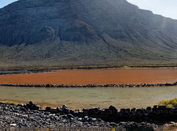
• Yé Les salinas et plage en bas de la falaise. C'est bien de la faire quand il ya du soleil, en bas on peut se baigner...
Marche
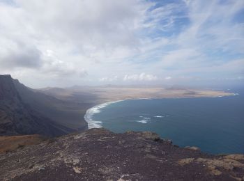
• Caleta de Famara
Marche
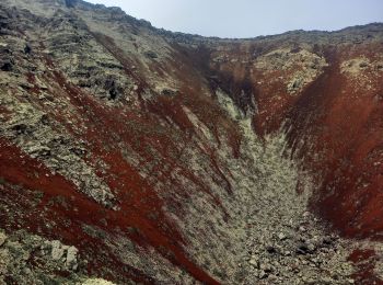
• belle descente
Marche
Marche
13 randonnées affichées sur 13
Application GPS de randonnée GRATUITE
 SityTrail
IGN / Instituts géographiques
SityTrail World
Le monde est à vous