![](/images/other/stat-length.png)
Munster, Heide (arrondissement), A pied : Les meilleures randonnées, itinéraires, parcours, balades et promenades
Munster : découvrez les meilleures randonnées : 4 a pied. Tous ces circuits, parcours, itinéraires et activités en plein air sont disponibles dans nos applications SityTrail pour smartphones et tablettes.
Les meilleurs parcours (4)
![Randonnée A pied Munster - Örtzeweg - Photo](https://media.geolcdn.com/t/350/260/25b42615-0518-4ae3-a43c-5dff790a005a.jpeg&format=jpg&maxdim=2)
![A pied A pied](https://static1.geolcdn.com/sitytour/trail-icons/100.png)
Km
A pied
![](/images/other/stat-length.png)
![](https://static1.geolcdn.com/siteimages/upload/files/1508320355ic_sort_den_pos_24dp.png)
![](https://static1.geolcdn.com/siteimages/upload/files/1508320355ic_sort_den_neg_24dp.png)
![](https://static1.geolcdn.com/siteimages/upload/files/16400158638029165_repeat_loop_refresh_sync_direction_icon.png)
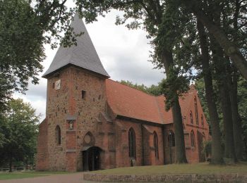
• Randonnée créée par Munster Touristik. Symbole: Drei weiße Wellen auf blauem Grund
![Randonnée A pied Munster - Fischeweg - Photo](https://media.geolcdn.com/t/350/260/a16896c5-938e-411c-bcef-447906b5f820.jpeg&format=jpg&maxdim=2)
![A pied A pied](https://static1.geolcdn.com/sitytour/trail-icons/100.png)
Km
A pied
![](/images/other/stat-length.png)
![](https://static1.geolcdn.com/siteimages/upload/files/1508320355ic_sort_den_pos_24dp.png)
![](https://static1.geolcdn.com/siteimages/upload/files/1508320355ic_sort_den_neg_24dp.png)
![](https://static1.geolcdn.com/siteimages/upload/files/16400158638029165_repeat_loop_refresh_sync_direction_icon.png)
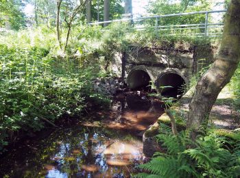
• Randonnée créée par Munster Touristik. Symbole: Weisser Fisch auf grünem Grund
![Randonnée A pied Munster - Kartoffelweg - Photo](https://media.geolcdn.com/t/350/260/f36a72c8-90a0-4b20-af32-a7401c392de2.jpeg&format=jpg&maxdim=2)
![A pied A pied](https://static1.geolcdn.com/sitytour/trail-icons/100.png)
Km
A pied
![](/images/other/stat-length.png)
![](https://static1.geolcdn.com/siteimages/upload/files/1508320355ic_sort_den_pos_24dp.png)
![](https://static1.geolcdn.com/siteimages/upload/files/1508320355ic_sort_den_neg_24dp.png)
![](https://static1.geolcdn.com/siteimages/upload/files/16400158638029165_repeat_loop_refresh_sync_direction_icon.png)
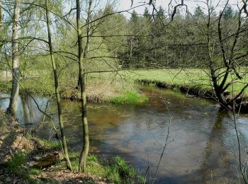
• Randonnée créée par Munster Touristik. Symbole: Braun-Gelbe Kartoffel auf weißem Grund
![Randonnée A pied Munster - Zapfenweg - Photo](https://media.geolcdn.com/t/350/260/387b2ae0-23f5-41ff-abe0-0efdb6d86ee8.jpeg&format=jpg&maxdim=2)
![A pied A pied](https://static1.geolcdn.com/sitytour/trail-icons/100.png)
Km
A pied
![](/images/other/stat-length.png)
![](https://static1.geolcdn.com/siteimages/upload/files/1508320355ic_sort_den_pos_24dp.png)
![](https://static1.geolcdn.com/siteimages/upload/files/1508320355ic_sort_den_neg_24dp.png)
![](https://static1.geolcdn.com/siteimages/upload/files/16400158638029165_repeat_loop_refresh_sync_direction_icon.png)
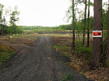
• Randonnée créée par Kulturraum Oberes Örzetal. Symbole: Weisser Zapfen auf braunem Grund
4 randonnées affichées sur 4
Application GPS de randonnée GRATUITE