![](/images/other/stat-length.png)
- Randonnées
- A pied
- Allemagne
- Basse-Saxe
- Helmstedt (arrondissement)
- Königslutter am Elm
Königslutter am Elm, Helmstedt (arrondissement), A pied : Les meilleures randonnées, itinéraires, parcours, balades et promenades
Königslutter am Elm : découvrez les meilleures randonnées : 8 a pied. Tous ces circuits, parcours, itinéraires et activités en plein air sont disponibles dans nos applications SityTrail pour smartphones et tablettes.
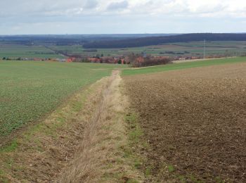
Les meilleurs parcours (8)
![Randonnée A pied Königslutter am Elm - Zielwanderweg Königslutter-Lutterspring-Tetzelstein - Photo](https://media.geolcdn.com/t/350/260/25408fdf-ef2c-4225-870c-d188ac72ab24.jpeg&format=jpg&maxdim=2)
![A pied A pied](https://static1.geolcdn.com/sitytour/trail-icons/100.png)
Km
A pied
![](/images/other/stat-length.png)
![](https://static1.geolcdn.com/siteimages/upload/files/1508320355ic_sort_den_pos_24dp.png)
![](https://static1.geolcdn.com/siteimages/upload/files/1508320355ic_sort_den_neg_24dp.png)
![](https://static1.geolcdn.com/siteimages/upload/files/16400158638029165_repeat_loop_refresh_sync_direction_icon.png)
• Randonnée créée par Naturpark Elm-Lappwald. Symbole: Rechteckumriß auf grünen oder weißem Grund (je nach Version der...
![Randonnée A pied Königslutter am Elm - Zielwanderweg Erkerode-Heinrichsruh - Photo](https://media.geolcdn.com/t/350/260/d149467e-e9a7-4319-beea-c6db868f7f50.jpeg&format=jpg&maxdim=2)
![A pied A pied](https://static1.geolcdn.com/sitytour/trail-icons/100.png)
Km
A pied
![](/images/other/stat-length.png)
![](https://static1.geolcdn.com/siteimages/upload/files/1508320355ic_sort_den_pos_24dp.png)
![](https://static1.geolcdn.com/siteimages/upload/files/1508320355ic_sort_den_neg_24dp.png)
![](https://static1.geolcdn.com/siteimages/upload/files/16400158638029165_repeat_loop_refresh_sync_direction_icon.png)
• Randonnée créée par Naturpark Elm-Lappwald. Symbole: grünes Trapez auf weißem Grund
![Randonnée A pied Königslutter am Elm - Elm Rundwanderweg 22 - Photo](https://media.geolcdn.com/t/350/260/b71e1ce4-1661-4b0e-8118-f9adb4a14c89.jpeg&format=jpg&maxdim=2)
![A pied A pied](https://static1.geolcdn.com/sitytour/trail-icons/100.png)
Km
A pied
![](/images/other/stat-length.png)
![](https://static1.geolcdn.com/siteimages/upload/files/1508320355ic_sort_den_pos_24dp.png)
![](https://static1.geolcdn.com/siteimages/upload/files/1508320355ic_sort_den_neg_24dp.png)
![](https://static1.geolcdn.com/siteimages/upload/files/16400158638029165_repeat_loop_refresh_sync_direction_icon.png)
• Randonnée créée par Naturpark Elm-Lappwald. Symbole: schwarze 22 auf weißem Quadrat
![Randonnée A pied Königslutter am Elm - Elm Rundwanderweg 19 - Photo](https://media.geolcdn.com/t/350/260/c4d0f2d7-a188-4e3f-823b-9265ca8536b2.jpeg&format=jpg&maxdim=2)
![A pied A pied](https://static1.geolcdn.com/sitytour/trail-icons/100.png)
Km
A pied
![](/images/other/stat-length.png)
![](https://static1.geolcdn.com/siteimages/upload/files/1508320355ic_sort_den_pos_24dp.png)
![](https://static1.geolcdn.com/siteimages/upload/files/1508320355ic_sort_den_neg_24dp.png)
![](https://static1.geolcdn.com/siteimages/upload/files/16400158638029165_repeat_loop_refresh_sync_direction_icon.png)
• Randonnée créée par Naturpark Elm-Lappwald. Symbole: schwarze 19 auf weißem Quadrat
![Randonnée A pied Königslutter am Elm - Elm Rundwanderweg 23 - Photo](https://media.geolcdn.com/t/350/260/b71e1ce4-1661-4b0e-8118-f9adb4a14c89.jpeg&format=jpg&maxdim=2)
![A pied A pied](https://static1.geolcdn.com/sitytour/trail-icons/100.png)
Km
A pied
![](/images/other/stat-length.png)
![](https://static1.geolcdn.com/siteimages/upload/files/1508320355ic_sort_den_pos_24dp.png)
![](https://static1.geolcdn.com/siteimages/upload/files/1508320355ic_sort_den_neg_24dp.png)
![](https://static1.geolcdn.com/siteimages/upload/files/16400158638029165_repeat_loop_refresh_sync_direction_icon.png)
• Randonnée créée par Naturpark Elm-Lappwald. Symbole: schwarze 23 auf weißem Quadrat
![Randonnée A pied Königslutter am Elm - Elm Rundwanderweg 24 - Photo](https://media.geolcdn.com/t/350/260/cc8b9745-2509-47a4-a8eb-4924d2f97f8e.jpeg&format=jpg&maxdim=2)
![A pied A pied](https://static1.geolcdn.com/sitytour/trail-icons/100.png)
Km
A pied
![](/images/other/stat-length.png)
![](https://static1.geolcdn.com/siteimages/upload/files/1508320355ic_sort_den_pos_24dp.png)
![](https://static1.geolcdn.com/siteimages/upload/files/1508320355ic_sort_den_neg_24dp.png)
![](https://static1.geolcdn.com/siteimages/upload/files/16400158638029165_repeat_loop_refresh_sync_direction_icon.png)
• Randonnée créée par Naturpark Elm-Lappwald. Symbole: schwarze 24 auf weißem Quadrat
![Randonnée A pied Königslutter am Elm - Dorm Rundwanderweg 4 - Photo](https://media.geolcdn.com/t/350/260/ext.jpg?maxdim=2&url=https%3A%2F%2Fstatic1.geolcdn.com%2Fsiteimages%2Fupload%2Ffiles%2F1545311037marcheuse_200dpi.jpg)
![A pied A pied](https://static1.geolcdn.com/sitytour/trail-icons/100.png)
Km
A pied
![](/images/other/stat-length.png)
![](https://static1.geolcdn.com/siteimages/upload/files/1508320355ic_sort_den_pos_24dp.png)
![](https://static1.geolcdn.com/siteimages/upload/files/1508320355ic_sort_den_neg_24dp.png)
![](https://static1.geolcdn.com/siteimages/upload/files/16400158638029165_repeat_loop_refresh_sync_direction_icon.png)
• Randonnée créée par Naturpark Elm-Lappwald. Symbole: schwarze 4 auf weißem Quadrat
![Randonnée A pied Königslutter am Elm - Elm Rundwanderweg 14 - Photo](https://media.geolcdn.com/t/350/260/ext.jpg?maxdim=2&url=https%3A%2F%2Fstatic1.geolcdn.com%2Fsiteimages%2Fupload%2Ffiles%2F1545311037marcheuse_200dpi.jpg)
![A pied A pied](https://static1.geolcdn.com/sitytour/trail-icons/100.png)
Km
A pied
![](/images/other/stat-length.png)
![](https://static1.geolcdn.com/siteimages/upload/files/1508320355ic_sort_den_pos_24dp.png)
![](https://static1.geolcdn.com/siteimages/upload/files/1508320355ic_sort_den_neg_24dp.png)
![](https://static1.geolcdn.com/siteimages/upload/files/16400158638029165_repeat_loop_refresh_sync_direction_icon.png)
• Randonnée créée par Naturpark Elm-Lappwald. Symbole: schwarze 14 auf weißem Quadrat
8 randonnées affichées sur 8
Application GPS de randonnée GRATUITE