![](/images/other/stat-length.png)
Eldingen, Celle (arrondissement), A pied : Les meilleures randonnées, itinéraires, parcours, balades et promenades
Eldingen : découvrez les meilleures randonnées : 3 a pied. Tous ces circuits, parcours, itinéraires et activités en plein air sont disponibles dans nos applications SityTrail pour smartphones et tablettes.
Les meilleurs parcours (3)
![Randonnée A pied Eldingen - Südheide 'Kühe in Halbtrauer' W21m (mittlere Tour) - Photo](https://media.geolcdn.com/t/350/260/ext.jpg?maxdim=2&url=https%3A%2F%2Fmedia.geolcdn.com%2Ff%2Fe9ddb2d5-ad44-46a9-9d7c-c34b7f25a9d7.jpeg)
![A pied A pied](https://static1.geolcdn.com/sitytour/trail-icons/100.png)
Km
A pied
![](/images/other/stat-length.png)
![](https://static1.geolcdn.com/siteimages/upload/files/1508320355ic_sort_den_pos_24dp.png)
![](https://static1.geolcdn.com/siteimages/upload/files/1508320355ic_sort_den_neg_24dp.png)
![](https://static1.geolcdn.com/siteimages/upload/files/16400158638029165_repeat_loop_refresh_sync_direction_icon.png)
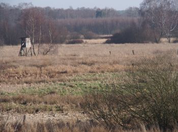
• Sumpfige Moorlandschaft, kristallklares Heideflüsschen und schwarzbunte Kühe - Wandern in der Südheide Site web: htt...
![Randonnée A pied Eldingen - Südheide 'Kühe in Halbtrauer' W21k (kurze Tour) - Photo](https://media.geolcdn.com/t/350/260/ext.jpg?maxdim=2&url=https%3A%2F%2Fmedia.geolcdn.com%2Ff%2Fe9ddb2d5-ad44-46a9-9d7c-c34b7f25a9d7.jpeg)
![A pied A pied](https://static1.geolcdn.com/sitytour/trail-icons/100.png)
Km
A pied
![](/images/other/stat-length.png)
![](https://static1.geolcdn.com/siteimages/upload/files/1508320355ic_sort_den_pos_24dp.png)
![](https://static1.geolcdn.com/siteimages/upload/files/1508320355ic_sort_den_neg_24dp.png)
![](https://static1.geolcdn.com/siteimages/upload/files/16400158638029165_repeat_loop_refresh_sync_direction_icon.png)
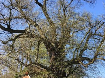
• Die Wanderung führt durch die Feldfluren und kleinere Wälder im Umfeld von Bargfeld und Endeholz im Naturpark Südheid...
![Randonnée A pied Eldingen - Südheide 'Wo Jafelbach und Lachte sich küssen' W22m (mittlere Tour) - Photo](https://media.geolcdn.com/t/350/260/ext.jpg?maxdim=2&url=https%3A%2F%2Fmedia.geolcdn.com%2Ff%2F28312615-a486-4b99-8eca-ae212da678d6.jpeg)
![A pied A pied](https://static1.geolcdn.com/sitytour/trail-icons/100.png)
Km
A pied
![](/images/other/stat-length.png)
![](https://static1.geolcdn.com/siteimages/upload/files/1508320355ic_sort_den_pos_24dp.png)
![](https://static1.geolcdn.com/siteimages/upload/files/1508320355ic_sort_den_neg_24dp.png)
![](https://static1.geolcdn.com/siteimages/upload/files/16400158638029165_repeat_loop_refresh_sync_direction_icon.png)
• Auf der Wanderung des Rundwanderweges W22 "Wo Jafelbach und Lachte sich küssen" erkunden sie die Landschaft südöstlic...
3 randonnées affichées sur 3
Application GPS de randonnée GRATUITE