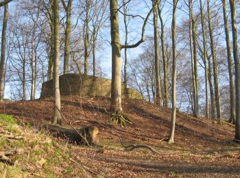
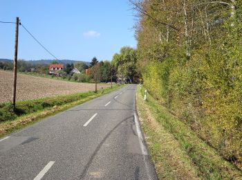
![](/images/other/stat-length.png)
- Randonnées
- A pied
- Allemagne
- Hesse
- Landkreis Hersfeld-Rotenburg
- Rotenburg an der Fulda
Rotenburg an der Fulda, Landkreis Hersfeld-Rotenburg, A pied : Les meilleures randonnées, itinéraires, parcours, balades et promenades
Rotenburg an der Fulda : découvrez les meilleures randonnées : 9 a pied. Tous ces circuits, parcours, itinéraires et activités en plein air sont disponibles dans nos applications SityTrail pour smartphones et tablettes.
Les meilleurs parcours (9)
![Randonnée A pied Rotenburg an der Fulda - Heienbach-Tour - Photo](https://media.geolcdn.com/t/350/260/68477b14-fe23-47de-9435-6f88bc7fbc30.jpeg&format=jpg&maxdim=2)
![A pied A pied](https://static1.geolcdn.com/sitytour/trail-icons/100.png)
Km
A pied
![](/images/other/stat-length.png)
![](https://static1.geolcdn.com/siteimages/upload/files/1508320355ic_sort_den_pos_24dp.png)
![](https://static1.geolcdn.com/siteimages/upload/files/1508320355ic_sort_den_neg_24dp.png)
![](https://static1.geolcdn.com/siteimages/upload/files/16400158638029165_repeat_loop_refresh_sync_direction_icon.png)
• Randonnée créée par Rotenburg. Symbole: blaues W und schwarze 5 auf gelbem Grund
![Randonnée A pied Rotenburg an der Fulda - Rotenburg Wanderweg R3 - Photo](https://media.geolcdn.com/t/350/260/bf2c482b-fc47-4c45-b5dc-933ad3a0d025.jpeg&format=jpg&maxdim=2)
![A pied A pied](https://static1.geolcdn.com/sitytour/trail-icons/100.png)
Km
A pied
![](/images/other/stat-length.png)
![](https://static1.geolcdn.com/siteimages/upload/files/1508320355ic_sort_den_pos_24dp.png)
![](https://static1.geolcdn.com/siteimages/upload/files/1508320355ic_sort_den_neg_24dp.png)
![](https://static1.geolcdn.com/siteimages/upload/files/16400158638029165_repeat_loop_refresh_sync_direction_icon.png)
• Randonnée créée par Rotenburg a.d. Fulda. Symbole: schwarzer Text R3 auf gelbem Grund
![Randonnée A pied Rotenburg an der Fulda - Rotenburg Wanderweg R2 - Photo](https://media.geolcdn.com/t/350/260/ed5ee080-03e4-406d-b675-6e7dafc277ac.jpeg&format=jpg&maxdim=2)
![A pied A pied](https://static1.geolcdn.com/sitytour/trail-icons/100.png)
Km
A pied
![](/images/other/stat-length.png)
![](https://static1.geolcdn.com/siteimages/upload/files/1508320355ic_sort_den_pos_24dp.png)
![](https://static1.geolcdn.com/siteimages/upload/files/1508320355ic_sort_den_neg_24dp.png)
![](https://static1.geolcdn.com/siteimages/upload/files/16400158638029165_repeat_loop_refresh_sync_direction_icon.png)
• Randonnée créée par Rotenburg an der Fulda. Symbole: schwarzer Text R2 auf gelbem Grund
![Randonnée A pied Rotenburg an der Fulda - Rotenburg Wanderweg R1 - Photo](https://media.geolcdn.com/t/350/260/1b095363-56d5-4f85-a348-d07d4ce97920.jpeg&format=jpg&maxdim=2)
![A pied A pied](https://static1.geolcdn.com/sitytour/trail-icons/100.png)
Km
A pied
![](/images/other/stat-length.png)
![](https://static1.geolcdn.com/siteimages/upload/files/1508320355ic_sort_den_pos_24dp.png)
![](https://static1.geolcdn.com/siteimages/upload/files/1508320355ic_sort_den_neg_24dp.png)
![](https://static1.geolcdn.com/siteimages/upload/files/16400158638029165_repeat_loop_refresh_sync_direction_icon.png)
• Randonnée créée par Rotenburg an der Fulda. Symbole: schwarzer Text R1 auf gelbem Grund
![Randonnée A pied Rotenburg an der Fulda - Braach Rundweg B5 - Photo](https://media.geolcdn.com/t/350/260/90a01be5-a2e5-4513-a094-183054857e81.jpeg&format=jpg&maxdim=2)
![A pied A pied](https://static1.geolcdn.com/sitytour/trail-icons/100.png)
Km
A pied
![](/images/other/stat-length.png)
![](https://static1.geolcdn.com/siteimages/upload/files/1508320355ic_sort_den_pos_24dp.png)
![](https://static1.geolcdn.com/siteimages/upload/files/1508320355ic_sort_den_neg_24dp.png)
![](https://static1.geolcdn.com/siteimages/upload/files/16400158638029165_repeat_loop_refresh_sync_direction_icon.png)
• Symbole: schwarzer Text B5 auf gelbem Grund
![Randonnée A pied Rotenburg an der Fulda - Braach Rundweg B1 - Photo](https://media.geolcdn.com/t/350/260/90a01be5-a2e5-4513-a094-183054857e81.jpeg&format=jpg&maxdim=2)
![A pied A pied](https://static1.geolcdn.com/sitytour/trail-icons/100.png)
Km
A pied
![](/images/other/stat-length.png)
![](https://static1.geolcdn.com/siteimages/upload/files/1508320355ic_sort_den_pos_24dp.png)
![](https://static1.geolcdn.com/siteimages/upload/files/1508320355ic_sort_den_neg_24dp.png)
![](https://static1.geolcdn.com/siteimages/upload/files/16400158638029165_repeat_loop_refresh_sync_direction_icon.png)
• Symbole: schwarzer Text B1 auf gelbem Grund
![Randonnée A pied Rotenburg an der Fulda - Rotenburg-Cornberg - Photo](https://media.geolcdn.com/t/350/260/f84ca8f5-c4d9-4125-8f34-bd1fd1873f6d.jpeg&format=jpg&maxdim=2)
![A pied A pied](https://static1.geolcdn.com/sitytour/trail-icons/100.png)
Km
A pied
![](/images/other/stat-length.png)
![](https://static1.geolcdn.com/siteimages/upload/files/1508320355ic_sort_den_pos_24dp.png)
![](https://static1.geolcdn.com/siteimages/upload/files/1508320355ic_sort_den_neg_24dp.png)
![](https://static1.geolcdn.com/siteimages/upload/files/16400158638029165_repeat_loop_refresh_sync_direction_icon.png)
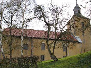
• Randonnée créée par Hessisch-Waldeckischer Gebirgs- und Heimatverein. Symbole: weißes Dach
![Randonnée A pied Rotenburg an der Fulda - Braach Rundweg B4 - Photo](https://media.geolcdn.com/t/350/260/90a01be5-a2e5-4513-a094-183054857e81.jpeg&format=jpg&maxdim=2)
![A pied A pied](https://static1.geolcdn.com/sitytour/trail-icons/100.png)
Km
A pied
![](/images/other/stat-length.png)
![](https://static1.geolcdn.com/siteimages/upload/files/1508320355ic_sort_den_pos_24dp.png)
![](https://static1.geolcdn.com/siteimages/upload/files/1508320355ic_sort_den_neg_24dp.png)
![](https://static1.geolcdn.com/siteimages/upload/files/16400158638029165_repeat_loop_refresh_sync_direction_icon.png)
• Symbole: schwarzer Text B4 auf gelbem Grund
![Randonnée A pied Rotenburg an der Fulda - Braach Rundweg B3 - Photo](https://media.geolcdn.com/t/350/260/90a01be5-a2e5-4513-a094-183054857e81.jpeg&format=jpg&maxdim=2)
![A pied A pied](https://static1.geolcdn.com/sitytour/trail-icons/100.png)
Km
A pied
![](/images/other/stat-length.png)
![](https://static1.geolcdn.com/siteimages/upload/files/1508320355ic_sort_den_pos_24dp.png)
![](https://static1.geolcdn.com/siteimages/upload/files/1508320355ic_sort_den_neg_24dp.png)
![](https://static1.geolcdn.com/siteimages/upload/files/16400158638029165_repeat_loop_refresh_sync_direction_icon.png)
• Symbole: schwarzer Text B3 auf gelbem Grund
9 randonnées affichées sur 9
Application GPS de randonnée GRATUITE