![](/images/other/stat-length.png)
- Randonnées
- A pied
- Allemagne
- Hesse
- Main-Kinzig-Kreis
- Gelnhausen
Gelnhausen, Main-Kinzig-Kreis, A pied : Les meilleures randonnées, itinéraires, parcours, balades et promenades
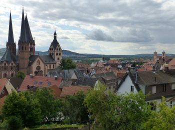
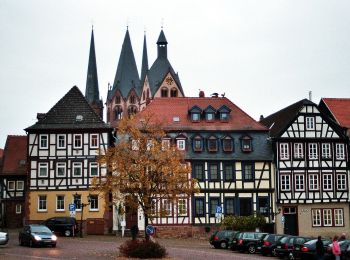
Gelnhausen : découvrez les meilleures randonnées : 12 a pied. Tous ces circuits, parcours, itinéraires et activités en plein air sont disponibles dans nos applications SityTrail pour smartphones et tablettes.
Les meilleurs parcours (12)
![Randonnée A pied Gelnhausen - Kulturweg Gelnhausen 4 - Photo](https://media.geolcdn.com/t/350/260/329f11c1-1597-45ab-8b2f-dd9626f1b266.jpeg&format=jpg&maxdim=2)
![A pied A pied](https://static1.geolcdn.com/sitytour/trail-icons/100.png)
Km
A pied
![](/images/other/stat-length.png)
![](https://static1.geolcdn.com/siteimages/upload/files/1508320355ic_sort_den_pos_24dp.png)
![](https://static1.geolcdn.com/siteimages/upload/files/1508320355ic_sort_den_neg_24dp.png)
![](https://static1.geolcdn.com/siteimages/upload/files/16400158638029165_repeat_loop_refresh_sync_direction_icon.png)
• Randonnée créée par Archäologisches Spessartprojekt. Symbole: Gelbes EU-Schiffchen auf blauem Grund Site web: http...
![Randonnée A pied Gelnhausen - Gelnhäuser Rundweg Nr.1 - Photo](https://media.geolcdn.com/t/350/260/329f11c1-1597-45ab-8b2f-dd9626f1b266.jpeg&format=jpg&maxdim=2)
![A pied A pied](https://static1.geolcdn.com/sitytour/trail-icons/100.png)
Km
A pied
![](/images/other/stat-length.png)
![](https://static1.geolcdn.com/siteimages/upload/files/1508320355ic_sort_den_pos_24dp.png)
![](https://static1.geolcdn.com/siteimages/upload/files/1508320355ic_sort_den_neg_24dp.png)
![](https://static1.geolcdn.com/siteimages/upload/files/16400158638029165_repeat_loop_refresh_sync_direction_icon.png)
• Randonnée créée par Vogelsberger Höhenclub. Symbole: Rote 1 auf weißem Viereck
![Randonnée A pied Gelnhausen - Gelnhäuser Rundweg Nr.3 - Photo](https://media.geolcdn.com/t/350/260/329f11c1-1597-45ab-8b2f-dd9626f1b266.jpeg&format=jpg&maxdim=2)
![A pied A pied](https://static1.geolcdn.com/sitytour/trail-icons/100.png)
Km
A pied
![](/images/other/stat-length.png)
![](https://static1.geolcdn.com/siteimages/upload/files/1508320355ic_sort_den_pos_24dp.png)
![](https://static1.geolcdn.com/siteimages/upload/files/1508320355ic_sort_den_neg_24dp.png)
![](https://static1.geolcdn.com/siteimages/upload/files/16400158638029165_repeat_loop_refresh_sync_direction_icon.png)
• Randonnée créée par Vogelsberger Höhenclub. Symbole: Rote 3 auf weißem Viereck
![Randonnée A pied Gelnhausen - Gelnhäuser Rundweg Nr.6 - Photo](https://media.geolcdn.com/t/350/260/5d3176a8-20e0-4464-bfb4-f36f4ce2c341.jpeg&format=jpg&maxdim=2)
![A pied A pied](https://static1.geolcdn.com/sitytour/trail-icons/100.png)
Km
A pied
![](/images/other/stat-length.png)
![](https://static1.geolcdn.com/siteimages/upload/files/1508320355ic_sort_den_pos_24dp.png)
![](https://static1.geolcdn.com/siteimages/upload/files/1508320355ic_sort_den_neg_24dp.png)
![](https://static1.geolcdn.com/siteimages/upload/files/16400158638029165_repeat_loop_refresh_sync_direction_icon.png)
• Randonnée créée par Vogelsberger Höhenclub. Symbole: Rote 6 auf weißem Viereck
![Randonnée A pied Gelnhausen - Gelnhäuser Rundweg Nr.2 - Photo](https://media.geolcdn.com/t/350/260/5d3176a8-20e0-4464-bfb4-f36f4ce2c341.jpeg&format=jpg&maxdim=2)
![A pied A pied](https://static1.geolcdn.com/sitytour/trail-icons/100.png)
Km
A pied
![](/images/other/stat-length.png)
![](https://static1.geolcdn.com/siteimages/upload/files/1508320355ic_sort_den_pos_24dp.png)
![](https://static1.geolcdn.com/siteimages/upload/files/1508320355ic_sort_den_neg_24dp.png)
![](https://static1.geolcdn.com/siteimages/upload/files/16400158638029165_repeat_loop_refresh_sync_direction_icon.png)
• Randonnée créée par Vogelsberger Höhenclub. Symbole: Rote 2 auf weißem Viereck
![Randonnée A pied Gelnhausen - Gelnhäuser Rundweg Nr.4 - Photo](https://media.geolcdn.com/t/350/260/22dba984-ece3-459d-9cf0-a88020a0ae82.jpeg&format=jpg&maxdim=2)
![A pied A pied](https://static1.geolcdn.com/sitytour/trail-icons/100.png)
Km
A pied
![](/images/other/stat-length.png)
![](https://static1.geolcdn.com/siteimages/upload/files/1508320355ic_sort_den_pos_24dp.png)
![](https://static1.geolcdn.com/siteimages/upload/files/1508320355ic_sort_den_neg_24dp.png)
![](https://static1.geolcdn.com/siteimages/upload/files/16400158638029165_repeat_loop_refresh_sync_direction_icon.png)
• Randonnée créée par Vogelsberger Höhenclub. Symbole: Rote 4 auf weißem Viereck
![Randonnée A pied Gelnhausen - Gelnhäuser Rundweg Nr.5 - Photo](https://media.geolcdn.com/t/350/260/5d3176a8-20e0-4464-bfb4-f36f4ce2c341.jpeg&format=jpg&maxdim=2)
![A pied A pied](https://static1.geolcdn.com/sitytour/trail-icons/100.png)
Km
A pied
![](/images/other/stat-length.png)
![](https://static1.geolcdn.com/siteimages/upload/files/1508320355ic_sort_den_pos_24dp.png)
![](https://static1.geolcdn.com/siteimages/upload/files/1508320355ic_sort_den_neg_24dp.png)
![](https://static1.geolcdn.com/siteimages/upload/files/16400158638029165_repeat_loop_refresh_sync_direction_icon.png)
• Randonnée créée par Vogelsberger Höhenclub. Symbole: Rote 5 auf weißem Viereck
![Randonnée A pied Gelnhausen - Kulturweg Gelnhausen 3 - Photo](https://media.geolcdn.com/t/350/260/ab867ee1-81aa-428d-9afe-9d3c1c7aec0b.jpeg&format=jpg&maxdim=2)
![A pied A pied](https://static1.geolcdn.com/sitytour/trail-icons/100.png)
Km
A pied
![](/images/other/stat-length.png)
![](https://static1.geolcdn.com/siteimages/upload/files/1508320355ic_sort_den_pos_24dp.png)
![](https://static1.geolcdn.com/siteimages/upload/files/1508320355ic_sort_den_neg_24dp.png)
![](https://static1.geolcdn.com/siteimages/upload/files/16400158638029165_repeat_loop_refresh_sync_direction_icon.png)
• Randonnée créée par Archäologisches Spessartprojekt. Symbole: Gelbes EU-Schiffchen auf blauem Grund Site web: http...
![Randonnée A pied Gelnhausen - Gelnhausen - Waechtersbach - Photo](https://media.geolcdn.com/t/350/260/14d71912-5906-45f3-a3d8-a71b5bd73c13.jpeg&format=jpg&maxdim=2)
![A pied A pied](https://static1.geolcdn.com/sitytour/trail-icons/100.png)
Km
A pied
![](/images/other/stat-length.png)
![](https://static1.geolcdn.com/siteimages/upload/files/1508320355ic_sort_den_pos_24dp.png)
![](https://static1.geolcdn.com/siteimages/upload/files/1508320355ic_sort_den_neg_24dp.png)
![](https://static1.geolcdn.com/siteimages/upload/files/16400158638029165_repeat_loop_refresh_sync_direction_icon.png)
• Randonnée créée par Vogelsberger Höhenclub. complete Symbole: white + on black
![Randonnée A pied Gelnhausen - Kulturweg Gelnhausen 2 - Photo](https://media.geolcdn.com/t/350/260/879ab24e-c6b1-4b87-b0e8-3843ab0dfc39.jpeg&format=jpg&maxdim=2)
![A pied A pied](https://static1.geolcdn.com/sitytour/trail-icons/100.png)
Km
A pied
![](/images/other/stat-length.png)
![](https://static1.geolcdn.com/siteimages/upload/files/1508320355ic_sort_den_pos_24dp.png)
![](https://static1.geolcdn.com/siteimages/upload/files/1508320355ic_sort_den_neg_24dp.png)
![](https://static1.geolcdn.com/siteimages/upload/files/16400158638029165_repeat_loop_refresh_sync_direction_icon.png)
• Randonnée créée par Archäologisches Spessartprojekt. Symbole: Gelbes EU-Schiffchen auf blauem Grund
![Randonnée A pied Gelnhausen - Kulturweg Gelnhausen 1 - Photo](https://media.geolcdn.com/t/350/260/6457ff52-5125-4c1e-9371-231996ecb949.jpeg&format=jpg&maxdim=2)
![A pied A pied](https://static1.geolcdn.com/sitytour/trail-icons/100.png)
Km
A pied
![](/images/other/stat-length.png)
![](https://static1.geolcdn.com/siteimages/upload/files/1508320355ic_sort_den_pos_24dp.png)
![](https://static1.geolcdn.com/siteimages/upload/files/1508320355ic_sort_den_neg_24dp.png)
![](https://static1.geolcdn.com/siteimages/upload/files/16400158638029165_repeat_loop_refresh_sync_direction_icon.png)
• Randonnée créée par Archäologisches Spessartprojekt. Symbole: Gelbes EU-Schiffchen auf blauem Grund Site web: http...
![Randonnée A pied Gelnhausen - Natur-Erlebnispfad - Photo](https://media.geolcdn.com/t/350/260/3e623794-157c-40b8-a2d8-4cb5e8847430.jpeg&format=jpg&maxdim=2)
![A pied A pied](https://static1.geolcdn.com/sitytour/trail-icons/100.png)
Km
A pied
![](/images/other/stat-length.png)
![](https://static1.geolcdn.com/siteimages/upload/files/1508320355ic_sort_den_pos_24dp.png)
![](https://static1.geolcdn.com/siteimages/upload/files/1508320355ic_sort_den_neg_24dp.png)
![](https://static1.geolcdn.com/siteimages/upload/files/16400158638029165_repeat_loop_refresh_sync_direction_icon.png)
• Randonnée créée par Natur - Vogelschutzgruppe Meerholz - Hailer.
12 randonnées affichées sur 12
Application GPS de randonnée GRATUITE