![](/images/other/stat-length.png)
- Randonnées
- A pied
- Allemagne
- Hesse
- Odenwaldkreis
- Michelstadt
Michelstadt, Odenwaldkreis, A pied : Les meilleures randonnées, itinéraires, parcours, balades et promenades
Michelstadt : découvrez les meilleures randonnées : 34 a pied. Tous ces circuits, parcours, itinéraires et activités en plein air sont disponibles dans nos applications SityTrail pour smartphones et tablettes.
Les meilleurs parcours (34)
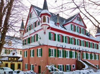
![Randonnée A pied Michelstadt - Rundwanderweg Gönz 3 : Eulbach-Weg - Photo](https://media.geolcdn.com/t/350/260/4da989ce-bffa-49e4-9d45-b4741da26325.jpeg&format=jpg&maxdim=2)
![A pied A pied](https://static1.geolcdn.com/sitytour/trail-icons/100.png)
Km
A pied
![](/images/other/stat-length.png)
![](https://static1.geolcdn.com/siteimages/upload/files/1508320355ic_sort_den_pos_24dp.png)
![](https://static1.geolcdn.com/siteimages/upload/files/1508320355ic_sort_den_neg_24dp.png)
![](https://static1.geolcdn.com/siteimages/upload/files/16400158638029165_repeat_loop_refresh_sync_direction_icon.png)
• Randonnée créée par Geo-Naturpark Bergstraße-Odenwald.
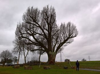
![Randonnée A pied Michelstadt - Rundwanderweg Weiten-Gesäß 4 : Hüttenweg - Photo](https://media.geolcdn.com/t/350/260/4f9bec72-1b57-431e-b541-8eb17aeeed4b.jpeg&format=jpg&maxdim=2)
![A pied A pied](https://static1.geolcdn.com/sitytour/trail-icons/100.png)
Km
A pied
![](/images/other/stat-length.png)
![](https://static1.geolcdn.com/siteimages/upload/files/1508320355ic_sort_den_pos_24dp.png)
![](https://static1.geolcdn.com/siteimages/upload/files/1508320355ic_sort_den_neg_24dp.png)
![](https://static1.geolcdn.com/siteimages/upload/files/16400158638029165_repeat_loop_refresh_sync_direction_icon.png)
• Randonnée créée par Geo-Naturpark Bergstraße-Odenwald.
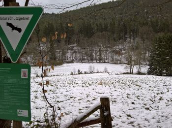
![Randonnée A pied Michelstadt - Rundwanderweg Michelstadt Geierstal 1: Ohrenbach-Weg - Photo](https://media.geolcdn.com/t/350/260/caa2f8ba-c6bd-4cba-87a0-106e58187655.jpeg&format=jpg&maxdim=2)
![A pied A pied](https://static1.geolcdn.com/sitytour/trail-icons/100.png)
Km
A pied
![](/images/other/stat-length.png)
![](https://static1.geolcdn.com/siteimages/upload/files/1508320355ic_sort_den_pos_24dp.png)
![](https://static1.geolcdn.com/siteimages/upload/files/1508320355ic_sort_den_neg_24dp.png)
![](https://static1.geolcdn.com/siteimages/upload/files/16400158638029165_repeat_loop_refresh_sync_direction_icon.png)
• Randonnée créée par Geo-Naturpark Bergstraße-Odenwald.
![Randonnée A pied Michelstadt - Rundwanderweg Vielbrunn 2 : Brunnenwanderweg - Photo](https://media.geolcdn.com/t/350/260/4f9bec72-1b57-431e-b541-8eb17aeeed4b.jpeg&format=jpg&maxdim=2)
![A pied A pied](https://static1.geolcdn.com/sitytour/trail-icons/100.png)
Km
A pied
![](/images/other/stat-length.png)
![](https://static1.geolcdn.com/siteimages/upload/files/1508320355ic_sort_den_pos_24dp.png)
![](https://static1.geolcdn.com/siteimages/upload/files/1508320355ic_sort_den_neg_24dp.png)
![](https://static1.geolcdn.com/siteimages/upload/files/16400158638029165_repeat_loop_refresh_sync_direction_icon.png)
• Randonnée créée par Geo-Naturpark Bergstraße-Odenwald.
![Randonnée A pied Michelstadt - Rundwanderweg Michelstadt Waldhorn 3: Silberbrünnchenweg - Photo](https://media.geolcdn.com/t/350/260/73d2951f-5d44-4953-a463-930469c7b118.jpeg&format=jpg&maxdim=2)
![A pied A pied](https://static1.geolcdn.com/sitytour/trail-icons/100.png)
Km
A pied
![](/images/other/stat-length.png)
![](https://static1.geolcdn.com/siteimages/upload/files/1508320355ic_sort_den_pos_24dp.png)
![](https://static1.geolcdn.com/siteimages/upload/files/1508320355ic_sort_den_neg_24dp.png)
![](https://static1.geolcdn.com/siteimages/upload/files/16400158638029165_repeat_loop_refresh_sync_direction_icon.png)
• Randonnée créée par Geo-Naturpark Bergstraße-Odenwald. Symbole: Gelbe 3 im gelben Kreis
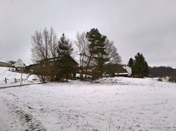
![Randonnée A pied Michelstadt - Rundwanderweg Michelstadt Bremhof 4: Langstein-Weg - Photo](https://media.geolcdn.com/t/350/260/10c7cdf4-d988-4ef3-9a73-feb5688ee815.jpeg&format=jpg&maxdim=2)
![A pied A pied](https://static1.geolcdn.com/sitytour/trail-icons/100.png)
Km
A pied
![](/images/other/stat-length.png)
![](https://static1.geolcdn.com/siteimages/upload/files/1508320355ic_sort_den_pos_24dp.png)
![](https://static1.geolcdn.com/siteimages/upload/files/1508320355ic_sort_den_neg_24dp.png)
![](https://static1.geolcdn.com/siteimages/upload/files/16400158638029165_repeat_loop_refresh_sync_direction_icon.png)
• Randonnée créée par Geo-Naturpark Bergstraße-Odenwald.
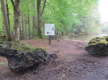
![Randonnée A pied Michelstadt - Rundwanderweg Michelstadt Einhard Quelle 2: Kühberg-Weg - Photo](https://media.geolcdn.com/t/350/260/6f017b49-450c-4de9-bda2-e7429ad654f7.jpeg&format=jpg&maxdim=2)
![A pied A pied](https://static1.geolcdn.com/sitytour/trail-icons/100.png)
Km
A pied
![](/images/other/stat-length.png)
![](https://static1.geolcdn.com/siteimages/upload/files/1508320355ic_sort_den_pos_24dp.png)
![](https://static1.geolcdn.com/siteimages/upload/files/1508320355ic_sort_den_neg_24dp.png)
![](https://static1.geolcdn.com/siteimages/upload/files/16400158638029165_repeat_loop_refresh_sync_direction_icon.png)
• Randonnée créée par Geo-Naturpark Bergstraße-Odenwald. Symbole: Gelbe 2 in gelbem Kreis
![Randonnée A pied Michelstadt - Rundwanderweg Michelstadt Geierstal 2: Geißberg-Weg - Photo](https://media.geolcdn.com/t/350/260/caa2f8ba-c6bd-4cba-87a0-106e58187655.jpeg&format=jpg&maxdim=2)
![A pied A pied](https://static1.geolcdn.com/sitytour/trail-icons/100.png)
Km
A pied
![](/images/other/stat-length.png)
![](https://static1.geolcdn.com/siteimages/upload/files/1508320355ic_sort_den_pos_24dp.png)
![](https://static1.geolcdn.com/siteimages/upload/files/1508320355ic_sort_den_neg_24dp.png)
![](https://static1.geolcdn.com/siteimages/upload/files/16400158638029165_repeat_loop_refresh_sync_direction_icon.png)
• Randonnée créée par Geo-Naturpark Bergstraße-Odenwald.
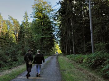
![Randonnée A pied Michelstadt - Rundwanderweg Römerbad 6 - Photo](https://media.geolcdn.com/t/350/260/72d68b23-4648-40b6-b897-db87076bde8d.jpeg&format=jpg&maxdim=2)
![A pied A pied](https://static1.geolcdn.com/sitytour/trail-icons/100.png)
Km
A pied
![](/images/other/stat-length.png)
![](https://static1.geolcdn.com/siteimages/upload/files/1508320355ic_sort_den_pos_24dp.png)
![](https://static1.geolcdn.com/siteimages/upload/files/1508320355ic_sort_den_neg_24dp.png)
![](https://static1.geolcdn.com/siteimages/upload/files/16400158638029165_repeat_loop_refresh_sync_direction_icon.png)
• Randonnée créée par Geo-Naturpark Bergstraße-Odenwald. Symbole: Gelbe 6 in einem gelben Kreis
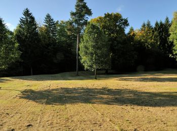
![Randonnée A pied Michelstadt - Rundwanderweg Römerbad 5 - Photo](https://media.geolcdn.com/t/350/260/f8db90ae-aab1-4b1c-a718-7dcc802c5fcb.jpeg&format=jpg&maxdim=2)
![A pied A pied](https://static1.geolcdn.com/sitytour/trail-icons/100.png)
Km
A pied
![](/images/other/stat-length.png)
![](https://static1.geolcdn.com/siteimages/upload/files/1508320355ic_sort_den_pos_24dp.png)
![](https://static1.geolcdn.com/siteimages/upload/files/1508320355ic_sort_den_neg_24dp.png)
![](https://static1.geolcdn.com/siteimages/upload/files/16400158638029165_repeat_loop_refresh_sync_direction_icon.png)
• Randonnée créée par Geo-Naturpark Bergstraße-Odenwald. Symbole: Gelbe 5 in einem gelben Kreis
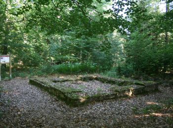
![Randonnée A pied Michelstadt - Rundwanderweg Würzberg 4 : Hubenweg Würzberg - Photo](https://media.geolcdn.com/t/350/260/1e7095c2-8906-4fd1-a117-28f1f3358a8d.jpeg&format=jpg&maxdim=2)
![A pied A pied](https://static1.geolcdn.com/sitytour/trail-icons/100.png)
Km
A pied
![](/images/other/stat-length.png)
![](https://static1.geolcdn.com/siteimages/upload/files/1508320355ic_sort_den_pos_24dp.png)
![](https://static1.geolcdn.com/siteimages/upload/files/1508320355ic_sort_den_neg_24dp.png)
![](https://static1.geolcdn.com/siteimages/upload/files/16400158638029165_repeat_loop_refresh_sync_direction_icon.png)
• Randonnée créée par Geo-Naturpark Bergstraße-Odenwald. Symbole: Grüne 4 in einem oben offenen Kreis, darüber grünes Wü
![Randonnée A pied Michelstadt - Rundwanderweg Würzberg 3 - Photo](https://media.geolcdn.com/t/350/260/0312c201-f071-44fc-9265-ddc6629c1fb2.jpeg&format=jpg&maxdim=2)
![A pied A pied](https://static1.geolcdn.com/sitytour/trail-icons/100.png)
Km
A pied
![](/images/other/stat-length.png)
![](https://static1.geolcdn.com/siteimages/upload/files/1508320355ic_sort_den_pos_24dp.png)
![](https://static1.geolcdn.com/siteimages/upload/files/1508320355ic_sort_den_neg_24dp.png)
![](https://static1.geolcdn.com/siteimages/upload/files/16400158638029165_repeat_loop_refresh_sync_direction_icon.png)
• Randonnée créée par Geo-Naturpark Bergstraße-Odenwald. Symbole: Weiße 3 in einem oben offenen Kreis, darüber weißes Wü
![Randonnée A pied Michelstadt - Rundwanderweg Würzberg 1 - Photo](https://media.geolcdn.com/t/350/260/0312c201-f071-44fc-9265-ddc6629c1fb2.jpeg&format=jpg&maxdim=2)
![A pied A pied](https://static1.geolcdn.com/sitytour/trail-icons/100.png)
Km
A pied
![](/images/other/stat-length.png)
![](https://static1.geolcdn.com/siteimages/upload/files/1508320355ic_sort_den_pos_24dp.png)
![](https://static1.geolcdn.com/siteimages/upload/files/1508320355ic_sort_den_neg_24dp.png)
![](https://static1.geolcdn.com/siteimages/upload/files/16400158638029165_repeat_loop_refresh_sync_direction_icon.png)
• Randonnée créée par Geo-Naturpark Bergstraße-Odenwald. Symbole: Weiße 1 in einem oben offenen Kreis, darüber weißes Wü
![Randonnée A pied Michelstadt - Rundwanderweg Vielbrunn 3 : Walberntal-Weg - Photo](https://media.geolcdn.com/t/350/260/caa2f8ba-c6bd-4cba-87a0-106e58187655.jpeg&format=jpg&maxdim=2)
![A pied A pied](https://static1.geolcdn.com/sitytour/trail-icons/100.png)
Km
A pied
![](/images/other/stat-length.png)
![](https://static1.geolcdn.com/siteimages/upload/files/1508320355ic_sort_den_pos_24dp.png)
![](https://static1.geolcdn.com/siteimages/upload/files/1508320355ic_sort_den_neg_24dp.png)
![](https://static1.geolcdn.com/siteimages/upload/files/16400158638029165_repeat_loop_refresh_sync_direction_icon.png)
• Randonnée créée par Geo-Naturpark Bergstraße-Odenwald. Symbole: weiße 3 im oben offenen Kreis, darin ein 'Vi'
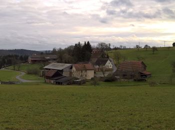
![Randonnée A pied Michelstadt - Rundwanderweg Vielbrunn 5 : Sansenhof-Weg - Photo](https://media.geolcdn.com/t/350/260/83a7354b-6688-4b1d-92ba-1b839a33edba.jpeg&format=jpg&maxdim=2)
![A pied A pied](https://static1.geolcdn.com/sitytour/trail-icons/100.png)
Km
A pied
![](/images/other/stat-length.png)
![](https://static1.geolcdn.com/siteimages/upload/files/1508320355ic_sort_den_pos_24dp.png)
![](https://static1.geolcdn.com/siteimages/upload/files/1508320355ic_sort_den_neg_24dp.png)
![](https://static1.geolcdn.com/siteimages/upload/files/16400158638029165_repeat_loop_refresh_sync_direction_icon.png)
• Randonnée créée par Geo-Naturpark Bergstraße-Odenwald. Symbole: weiße 5 im oben offenen Kreis, darin ein 'Vi'
![Randonnée A pied Michelstadt - Rundwanderweg Vielbrunn 1 : Bremhof-Weg - Photo](https://media.geolcdn.com/t/350/260/caa2f8ba-c6bd-4cba-87a0-106e58187655.jpeg&format=jpg&maxdim=2)
![A pied A pied](https://static1.geolcdn.com/sitytour/trail-icons/100.png)
Km
A pied
![](/images/other/stat-length.png)
![](https://static1.geolcdn.com/siteimages/upload/files/1508320355ic_sort_den_pos_24dp.png)
![](https://static1.geolcdn.com/siteimages/upload/files/1508320355ic_sort_den_neg_24dp.png)
![](https://static1.geolcdn.com/siteimages/upload/files/16400158638029165_repeat_loop_refresh_sync_direction_icon.png)
• Randonnée créée par Geo-Naturpark Bergstraße-Odenwald. Symbole: weiße 1 im oben offenen Kreis, darin ein 'Vi'
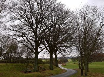
![Randonnée A pied Michelstadt - Rundwanderweg Brombachtal 5 - Photo](https://media.geolcdn.com/t/350/260/b22a1b6b-db57-4bd5-b2b6-b9d0d9584599.jpeg&format=jpg&maxdim=2)
![A pied A pied](https://static1.geolcdn.com/sitytour/trail-icons/100.png)
Km
A pied
![](/images/other/stat-length.png)
![](https://static1.geolcdn.com/siteimages/upload/files/1508320355ic_sort_den_pos_24dp.png)
![](https://static1.geolcdn.com/siteimages/upload/files/1508320355ic_sort_den_neg_24dp.png)
![](https://static1.geolcdn.com/siteimages/upload/files/16400158638029165_repeat_loop_refresh_sync_direction_icon.png)
• Randonnée créée par Geo-Naturpark Bergstraße-Odenwald. Symbole: white 5 in a white circle with B in a break at the t...
![Randonnée A pied Michelstadt - Basilika-Rundweg - Photo](https://media.geolcdn.com/t/350/260/08a807c3-4d7b-45bb-89da-638baa855bbb.jpeg&format=jpg&maxdim=2)
![A pied A pied](https://static1.geolcdn.com/sitytour/trail-icons/100.png)
Km
A pied
![](/images/other/stat-length.png)
![](https://static1.geolcdn.com/siteimages/upload/files/1508320355ic_sort_den_pos_24dp.png)
![](https://static1.geolcdn.com/siteimages/upload/files/1508320355ic_sort_den_neg_24dp.png)
![](https://static1.geolcdn.com/siteimages/upload/files/16400158638029165_repeat_loop_refresh_sync_direction_icon.png)
• Randonnée créée par Odenwaldklub. Symbole: Weiße 4 in weißem Kreis, S oberhalb.
![Randonnée A pied Michelstadt - Geo-Lehrpfad Michelstadt : Kulturhistorischer Wanderweg Steinbach - Photo](https://media.geolcdn.com/t/350/260/08a807c3-4d7b-45bb-89da-638baa855bbb.jpeg&format=jpg&maxdim=2)
![A pied A pied](https://static1.geolcdn.com/sitytour/trail-icons/100.png)
Km
A pied
![](/images/other/stat-length.png)
![](https://static1.geolcdn.com/siteimages/upload/files/1508320355ic_sort_den_pos_24dp.png)
![](https://static1.geolcdn.com/siteimages/upload/files/1508320355ic_sort_den_neg_24dp.png)
![](https://static1.geolcdn.com/siteimages/upload/files/16400158638029165_repeat_loop_refresh_sync_direction_icon.png)
• Randonnée créée par Geo-Naturpark Bergstraße-Odenwald. Symbole: Gelbes L in gelbem Kreis Site web: http://www.geo-...
![Randonnée A pied Michelstadt - Mossautaler Drachenweg 4 : Saphira - Photo](https://media.geolcdn.com/t/350/260/a876ddd2-9173-4230-a975-a6e1c802a0c9.jpeg&format=jpg&maxdim=2)
![A pied A pied](https://static1.geolcdn.com/sitytour/trail-icons/100.png)
Km
A pied
![](/images/other/stat-length.png)
![](https://static1.geolcdn.com/siteimages/upload/files/1508320355ic_sort_den_pos_24dp.png)
![](https://static1.geolcdn.com/siteimages/upload/files/1508320355ic_sort_den_neg_24dp.png)
![](https://static1.geolcdn.com/siteimages/upload/files/16400158638029165_repeat_loop_refresh_sync_direction_icon.png)
• Randonnée créée par Geo-Naturpark Bergstraße-Odenwald. Symbole: Grüne 4 im oben offenen Kreis, in der Öffnung ein MD
20 randonnées affichées sur 34
Application GPS de randonnée GRATUITE