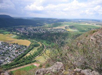
![](/images/other/stat-length.png)
- Randonnées
- A pied
- Allemagne
- Rhénanie-Palatinat
- Landkreis Bad Kreuznach
- Bad Kreuznach
Bad Kreuznach, Landkreis Bad Kreuznach, A pied : Les meilleures randonnées, itinéraires, parcours, balades et promenades
Bad Kreuznach : découvrez les meilleures randonnées : 11 a pied. Tous ces circuits, parcours, itinéraires et activités en plein air sont disponibles dans nos applications SityTrail pour smartphones et tablettes.
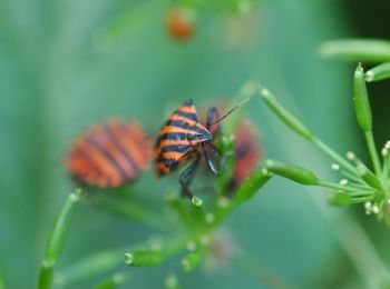
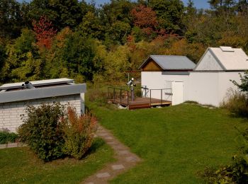
Les meilleurs parcours (11)
![Randonnée A pied Bad Kreuznach - Tour Natur - Photo](https://media.geolcdn.com/t/350/260/0bd70bf5-e581-42bb-811f-f899da135d18.jpeg&format=jpg&maxdim=2)
![A pied A pied](https://static1.geolcdn.com/sitytour/trail-icons/100.png)
Km
A pied
![](/images/other/stat-length.png)
![](https://static1.geolcdn.com/siteimages/upload/files/1508320355ic_sort_den_pos_24dp.png)
![](https://static1.geolcdn.com/siteimages/upload/files/1508320355ic_sort_den_neg_24dp.png)
![](https://static1.geolcdn.com/siteimages/upload/files/16400158638029165_repeat_loop_refresh_sync_direction_icon.png)
• Symbole: Grünes Ahornblatt auf weißem Grund
![Randonnée A pied Bad Kreuznach - VITALtour Ebernburg - Photo](https://media.geolcdn.com/t/350/260/11454e8e-f7ad-45a5-b1fd-c3959b4ed60d.jpeg&format=jpg&maxdim=2)
![A pied A pied](https://static1.geolcdn.com/sitytour/trail-icons/100.png)
Km
A pied
![](/images/other/stat-length.png)
![](https://static1.geolcdn.com/siteimages/upload/files/1508320355ic_sort_den_pos_24dp.png)
![](https://static1.geolcdn.com/siteimages/upload/files/1508320355ic_sort_den_neg_24dp.png)
![](https://static1.geolcdn.com/siteimages/upload/files/16400158638029165_repeat_loop_refresh_sync_direction_icon.png)
• Randonnée créée par Stadt Bad Kreuznach.
![Randonnée A pied Bad Kreuznach - CLASSICtour Ebernburg - Photo](https://media.geolcdn.com/t/350/260/367c4f69-37b0-4930-a976-e0fba27c0ac4.jpeg&format=jpg&maxdim=2)
![A pied A pied](https://static1.geolcdn.com/sitytour/trail-icons/100.png)
Km
A pied
![](/images/other/stat-length.png)
![](https://static1.geolcdn.com/siteimages/upload/files/1508320355ic_sort_den_pos_24dp.png)
![](https://static1.geolcdn.com/siteimages/upload/files/1508320355ic_sort_den_neg_24dp.png)
![](https://static1.geolcdn.com/siteimages/upload/files/16400158638029165_repeat_loop_refresh_sync_direction_icon.png)
• Randonnée créée par Stadt Bad Kreuznach.
![Randonnée A pied Bad Kreuznach - INTROtour Ebernburg - Photo](https://media.geolcdn.com/t/350/260/9cdfcaed-0f29-406a-a8d3-be07df56a775.jpeg&format=jpg&maxdim=2)
![A pied A pied](https://static1.geolcdn.com/sitytour/trail-icons/100.png)
Km
A pied
![](/images/other/stat-length.png)
![](https://static1.geolcdn.com/siteimages/upload/files/1508320355ic_sort_den_pos_24dp.png)
![](https://static1.geolcdn.com/siteimages/upload/files/1508320355ic_sort_den_neg_24dp.png)
![](https://static1.geolcdn.com/siteimages/upload/files/16400158638029165_repeat_loop_refresh_sync_direction_icon.png)
• Randonnée créée par Stadt Bad Kreuznach.
![Randonnée A pied Bad Kreuznach - Bäderhöhenweg 5km - Photo](https://media.geolcdn.com/t/350/260/9ee6532b-8b87-4b5a-bf29-6ac4fa517dd6.jpeg&format=jpg&maxdim=2)
![A pied A pied](https://static1.geolcdn.com/sitytour/trail-icons/100.png)
Km
A pied
![](/images/other/stat-length.png)
![](https://static1.geolcdn.com/siteimages/upload/files/1508320355ic_sort_den_pos_24dp.png)
![](https://static1.geolcdn.com/siteimages/upload/files/1508320355ic_sort_den_neg_24dp.png)
![](https://static1.geolcdn.com/siteimages/upload/files/16400158638029165_repeat_loop_refresh_sync_direction_icon.png)
• Randonnée créée par Wanderfreunde Naheland. Symbole: quadratisches weißes Schild mit rotem Rand;2 rote gleichgericht...
![Randonnée A pied Bad Kreuznach - VITALtour Rotenfels - Photo](https://media.geolcdn.com/t/350/260/a3e43b83-cfd7-4092-b126-d0afe63d2a12.jpeg&format=jpg&maxdim=2)
![A pied A pied](https://static1.geolcdn.com/sitytour/trail-icons/100.png)
Km
A pied
![](/images/other/stat-length.png)
![](https://static1.geolcdn.com/siteimages/upload/files/1508320355ic_sort_den_pos_24dp.png)
![](https://static1.geolcdn.com/siteimages/upload/files/1508320355ic_sort_den_neg_24dp.png)
![](https://static1.geolcdn.com/siteimages/upload/files/16400158638029165_repeat_loop_refresh_sync_direction_icon.png)
• Randonnée créée par Stadt Bad Kreuznach.
![Randonnée A pied Bad Kreuznach - CLASSICtour Rotenfels - Photo](https://media.geolcdn.com/t/350/260/cee8d753-620d-47e8-90c1-d8e178f1cc59.jpeg&format=jpg&maxdim=2)
![A pied A pied](https://static1.geolcdn.com/sitytour/trail-icons/100.png)
Km
A pied
![](/images/other/stat-length.png)
![](https://static1.geolcdn.com/siteimages/upload/files/1508320355ic_sort_den_pos_24dp.png)
![](https://static1.geolcdn.com/siteimages/upload/files/1508320355ic_sort_den_neg_24dp.png)
![](https://static1.geolcdn.com/siteimages/upload/files/16400158638029165_repeat_loop_refresh_sync_direction_icon.png)
• Randonnée créée par Stadt Bad Kreuznach.
![Randonnée A pied Bad Kreuznach - INTROtour Rotenfels - Photo](https://media.geolcdn.com/t/350/260/d397efa7-486d-47ff-aab7-88c64a0ac604.jpeg&format=jpg&maxdim=2)
![A pied A pied](https://static1.geolcdn.com/sitytour/trail-icons/100.png)
Km
A pied
![](/images/other/stat-length.png)
![](https://static1.geolcdn.com/siteimages/upload/files/1508320355ic_sort_den_pos_24dp.png)
![](https://static1.geolcdn.com/siteimages/upload/files/1508320355ic_sort_den_neg_24dp.png)
![](https://static1.geolcdn.com/siteimages/upload/files/16400158638029165_repeat_loop_refresh_sync_direction_icon.png)
• Randonnée créée par Stadt Bad Kreuznach.
![Randonnée A pied Bad Kreuznach - CLASSICtour Rheingrafenstein - Photo](https://media.geolcdn.com/t/350/260/690c3691-3353-4205-bd12-5609d191005f.jpeg&format=jpg&maxdim=2)
![A pied A pied](https://static1.geolcdn.com/sitytour/trail-icons/100.png)
Km
A pied
![](/images/other/stat-length.png)
![](https://static1.geolcdn.com/siteimages/upload/files/1508320355ic_sort_den_pos_24dp.png)
![](https://static1.geolcdn.com/siteimages/upload/files/1508320355ic_sort_den_neg_24dp.png)
![](https://static1.geolcdn.com/siteimages/upload/files/16400158638029165_repeat_loop_refresh_sync_direction_icon.png)
• Randonnée créée par Stadt Bad Kreuznach.
![Randonnée A pied Bad Kreuznach - INTROtour Rheingrafenstein - Photo](https://media.geolcdn.com/t/350/260/690c3691-3353-4205-bd12-5609d191005f.jpeg&format=jpg&maxdim=2)
![A pied A pied](https://static1.geolcdn.com/sitytour/trail-icons/100.png)
Km
A pied
![](/images/other/stat-length.png)
![](https://static1.geolcdn.com/siteimages/upload/files/1508320355ic_sort_den_pos_24dp.png)
![](https://static1.geolcdn.com/siteimages/upload/files/1508320355ic_sort_den_neg_24dp.png)
![](https://static1.geolcdn.com/siteimages/upload/files/16400158638029165_repeat_loop_refresh_sync_direction_icon.png)
• Randonnée créée par Stadt Bad Kreuznach.
![Randonnée A pied Bad Kreuznach - Bäderhöhenweg 21km - Photo](https://media.geolcdn.com/t/350/260/9ee6532b-8b87-4b5a-bf29-6ac4fa517dd6.jpeg&format=jpg&maxdim=2)
![A pied A pied](https://static1.geolcdn.com/sitytour/trail-icons/100.png)
Km
A pied
![](/images/other/stat-length.png)
![](https://static1.geolcdn.com/siteimages/upload/files/1508320355ic_sort_den_pos_24dp.png)
![](https://static1.geolcdn.com/siteimages/upload/files/1508320355ic_sort_den_neg_24dp.png)
![](https://static1.geolcdn.com/siteimages/upload/files/16400158638029165_repeat_loop_refresh_sync_direction_icon.png)
• Randonnée créée par Wanderfreunde Naheland. Symbole: quadratisches weißes Schild mit rotem Rand;2 rote gleichgericht...
11 randonnées affichées sur 11
Application GPS de randonnée GRATUITE