![](/images/other/stat-length.png)
- Randonnées
- A pied
- Allemagne
- Rhénanie-du-Nord-Westphalie
- Rhein-Sieg-Kreis
- Hennef (Sieg)
Hennef (Sieg), Rhein-Sieg-Kreis, A pied : Les meilleures randonnées, itinéraires, parcours, balades et promenades
Hennef (Sieg) : découvrez les meilleures randonnées : 15 a pied. Tous ces circuits, parcours, itinéraires et activités en plein air sont disponibles dans nos applications SityTrail pour smartphones et tablettes.
Les meilleurs parcours (15)
![Randonnée A pied Hennef (Sieg) - Kulturlandweg Erlebnisweg Sieg Nr. 4 - Photo](https://media.geolcdn.com/t/350/260/c831b782-23fd-479d-ac83-538acd5c2339.jpeg&format=jpg&maxdim=2)
![A pied A pied](https://static1.geolcdn.com/sitytour/trail-icons/100.png)
Km
A pied
![](/images/other/stat-length.png)
![](https://static1.geolcdn.com/siteimages/upload/files/1508320355ic_sort_den_pos_24dp.png)
![](https://static1.geolcdn.com/siteimages/upload/files/1508320355ic_sort_den_neg_24dp.png)
![](https://static1.geolcdn.com/siteimages/upload/files/16400158638029165_repeat_loop_refresh_sync_direction_icon.png)
• Randonnée créée par Naturregion Sieg. Symbole: weißes S auf rotem Grund Site web: https://www.naturregion-sieg.de/
![Randonnée A pied Hennef (Sieg) - Bergischer Weg Zuweg Hennef - Photo](https://media.geolcdn.com/t/350/260/c831b782-23fd-479d-ac83-538acd5c2339.jpeg&format=jpg&maxdim=2)
![A pied A pied](https://static1.geolcdn.com/sitytour/trail-icons/100.png)
Km
A pied
![](/images/other/stat-length.png)
![](https://static1.geolcdn.com/siteimages/upload/files/1508320355ic_sort_den_pos_24dp.png)
![](https://static1.geolcdn.com/siteimages/upload/files/1508320355ic_sort_den_neg_24dp.png)
![](https://static1.geolcdn.com/siteimages/upload/files/16400158638029165_repeat_loop_refresh_sync_direction_icon.png)
• Randonnée créée par Das Bergische gGmbH. Symbole: Schwarze Schlange auf orangem Grund mit Text “Bergischer Weg”
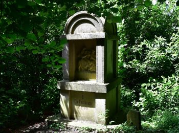
![Randonnée A pied Hennef (Sieg) - Marienweg (Erlebniswege Sieg Nr. 5) - Photo](https://media.geolcdn.com/t/350/260/dd86edba-d6cd-427c-93fd-ebbb2b18bb35.jpeg&format=jpg&maxdim=2)
![A pied A pied](https://static1.geolcdn.com/sitytour/trail-icons/100.png)
Km
A pied
![](/images/other/stat-length.png)
![](https://static1.geolcdn.com/siteimages/upload/files/1508320355ic_sort_den_pos_24dp.png)
![](https://static1.geolcdn.com/siteimages/upload/files/1508320355ic_sort_den_neg_24dp.png)
![](https://static1.geolcdn.com/siteimages/upload/files/16400158638029165_repeat_loop_refresh_sync_direction_icon.png)
• Randonnée créée par Naturregion Sieg. Symbole: weißes S auf rotem Grund Site web: https://www.naturregion-sieg.de/
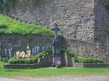
![Randonnée A pied Hennef (Sieg) - Burgweg (Erlebnisweg Sieg Nr. 7) - Photo](https://media.geolcdn.com/t/350/260/7b82b055-4d0e-4330-a940-b2db4efe00b0.jpeg&format=jpg&maxdim=2)
![A pied A pied](https://static1.geolcdn.com/sitytour/trail-icons/100.png)
Km
A pied
![](/images/other/stat-length.png)
![](https://static1.geolcdn.com/siteimages/upload/files/1508320355ic_sort_den_pos_24dp.png)
![](https://static1.geolcdn.com/siteimages/upload/files/1508320355ic_sort_den_neg_24dp.png)
![](https://static1.geolcdn.com/siteimages/upload/files/16400158638029165_repeat_loop_refresh_sync_direction_icon.png)
• Randonnée créée par Naturregion Sieg. Symbole: weißes S auf rotem Grund Site web: https://www.naturregion-sieg.de/
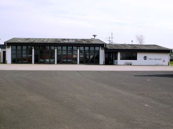
![Randonnée A pied Hennef (Sieg) - Holzweg (Erlebnisweg Sieg Nr. 6) - Photo](https://media.geolcdn.com/t/350/260/608fe390-35e3-4604-830e-fee18fd50066.jpeg&format=jpg&maxdim=2)
![A pied A pied](https://static1.geolcdn.com/sitytour/trail-icons/100.png)
Km
A pied
![](/images/other/stat-length.png)
![](https://static1.geolcdn.com/siteimages/upload/files/1508320355ic_sort_den_pos_24dp.png)
![](https://static1.geolcdn.com/siteimages/upload/files/1508320355ic_sort_den_neg_24dp.png)
![](https://static1.geolcdn.com/siteimages/upload/files/16400158638029165_repeat_loop_refresh_sync_direction_icon.png)
• Randonnée créée par Naturregion Sieg. Symbole: weißes S auf rotem Grund Site web: https://www.naturregion-sieg.de/
![Randonnée A pied Hennef (Sieg) - Verbindungsweg 9 Hennef-Bröl - Photo](https://media.geolcdn.com/t/350/260/c831b782-23fd-479d-ac83-538acd5c2339.jpeg&format=jpg&maxdim=2)
![A pied A pied](https://static1.geolcdn.com/sitytour/trail-icons/100.png)
Km
A pied
![](/images/other/stat-length.png)
![](https://static1.geolcdn.com/siteimages/upload/files/1508320355ic_sort_den_pos_24dp.png)
![](https://static1.geolcdn.com/siteimages/upload/files/1508320355ic_sort_den_neg_24dp.png)
![](https://static1.geolcdn.com/siteimages/upload/files/16400158638029165_repeat_loop_refresh_sync_direction_icon.png)
• Randonnée créée par SGV. Symbole: weißes <9 auf schwarzem Grund
![Randonnée A pied Hennef (Sieg) - Natursteig Sieg Zugang Hennef - Photo](https://media.geolcdn.com/t/350/260/c831b782-23fd-479d-ac83-538acd5c2339.jpeg&format=jpg&maxdim=2)
![A pied A pied](https://static1.geolcdn.com/sitytour/trail-icons/100.png)
Km
A pied
![](/images/other/stat-length.png)
![](https://static1.geolcdn.com/siteimages/upload/files/1508320355ic_sort_den_pos_24dp.png)
![](https://static1.geolcdn.com/siteimages/upload/files/1508320355ic_sort_den_neg_24dp.png)
![](https://static1.geolcdn.com/siteimages/upload/files/16400158638029165_repeat_loop_refresh_sync_direction_icon.png)
• Randonnée créée par Naturregion Sieg. Symbole: weißes S auf gelbem Grund Site web: https://www.naturregion-sieg.de/
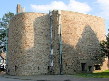
![Randonnée A pied Hennef (Sieg) - Dreitälerweg (Erlebnisweg Sieg Nr. 8) - Photo](https://media.geolcdn.com/t/350/260/5e05f7c0-0d6b-40d2-980b-af8d91c754c1.jpeg&format=jpg&maxdim=2)
![A pied A pied](https://static1.geolcdn.com/sitytour/trail-icons/100.png)
Km
A pied
![](/images/other/stat-length.png)
![](https://static1.geolcdn.com/siteimages/upload/files/1508320355ic_sort_den_pos_24dp.png)
![](https://static1.geolcdn.com/siteimages/upload/files/1508320355ic_sort_den_neg_24dp.png)
![](https://static1.geolcdn.com/siteimages/upload/files/16400158638029165_repeat_loop_refresh_sync_direction_icon.png)
• Randonnée créée par Naturregion Sieg. Symbole: weißes S auf rotem Grund Site web: https://www.naturregion-sieg.de/
![Randonnée A pied Hennef (Sieg) - Süchterscheid Rundweg A2 - Photo](https://media.geolcdn.com/t/350/260/5e05f7c0-0d6b-40d2-980b-af8d91c754c1.jpeg&format=jpg&maxdim=2)
![A pied A pied](https://static1.geolcdn.com/sitytour/trail-icons/100.png)
Km
A pied
![](/images/other/stat-length.png)
![](https://static1.geolcdn.com/siteimages/upload/files/1508320355ic_sort_den_pos_24dp.png)
![](https://static1.geolcdn.com/siteimages/upload/files/1508320355ic_sort_den_neg_24dp.png)
![](https://static1.geolcdn.com/siteimages/upload/files/16400158638029165_repeat_loop_refresh_sync_direction_icon.png)
• Randonnée créée par Sauerländischer Gebirgsverein. Symbole: de.sgv.a.2
![Randonnée A pied Hennef (Sieg) - Naturparkweg 1 - Photo](https://media.geolcdn.com/t/350/260/c831b782-23fd-479d-ac83-538acd5c2339.jpeg&format=jpg&maxdim=2)
![A pied A pied](https://static1.geolcdn.com/sitytour/trail-icons/100.png)
Km
A pied
![](/images/other/stat-length.png)
![](https://static1.geolcdn.com/siteimages/upload/files/1508320355ic_sort_den_pos_24dp.png)
![](https://static1.geolcdn.com/siteimages/upload/files/1508320355ic_sort_den_neg_24dp.png)
![](https://static1.geolcdn.com/siteimages/upload/files/16400158638029165_repeat_loop_refresh_sync_direction_icon.png)
![Randonnée A pied Hennef (Sieg) - Bödingen Rundweg A4 - Photo](https://media.geolcdn.com/t/350/260/855b5757-46bd-478a-aec5-4b7ad6df8030.jpeg&format=jpg&maxdim=2)
![A pied A pied](https://static1.geolcdn.com/sitytour/trail-icons/100.png)
Km
A pied
![](/images/other/stat-length.png)
![](https://static1.geolcdn.com/siteimages/upload/files/1508320355ic_sort_den_pos_24dp.png)
![](https://static1.geolcdn.com/siteimages/upload/files/1508320355ic_sort_den_neg_24dp.png)
![](https://static1.geolcdn.com/siteimages/upload/files/16400158638029165_repeat_loop_refresh_sync_direction_icon.png)
![Randonnée A pied Hennef (Sieg) - Bödingen Rundweg A1 - Photo](https://media.geolcdn.com/t/350/260/7c96d56c-34f9-4fd5-9027-4aae74c8fef1.jpeg&format=jpg&maxdim=2)
![A pied A pied](https://static1.geolcdn.com/sitytour/trail-icons/100.png)
Km
A pied
![](/images/other/stat-length.png)
![](https://static1.geolcdn.com/siteimages/upload/files/1508320355ic_sort_den_pos_24dp.png)
![](https://static1.geolcdn.com/siteimages/upload/files/1508320355ic_sort_den_neg_24dp.png)
![](https://static1.geolcdn.com/siteimages/upload/files/16400158638029165_repeat_loop_refresh_sync_direction_icon.png)
![Randonnée A pied Hennef (Sieg) - Bödingen Rundweg A3 - Photo](https://media.geolcdn.com/t/350/260/855b5757-46bd-478a-aec5-4b7ad6df8030.jpeg&format=jpg&maxdim=2)
![A pied A pied](https://static1.geolcdn.com/sitytour/trail-icons/100.png)
Km
A pied
![](/images/other/stat-length.png)
![](https://static1.geolcdn.com/siteimages/upload/files/1508320355ic_sort_den_pos_24dp.png)
![](https://static1.geolcdn.com/siteimages/upload/files/1508320355ic_sort_den_neg_24dp.png)
![](https://static1.geolcdn.com/siteimages/upload/files/16400158638029165_repeat_loop_refresh_sync_direction_icon.png)
![Randonnée A pied Hennef (Sieg) - Naturparkweg 4 - Photo](https://media.geolcdn.com/t/350/260/5e05f7c0-0d6b-40d2-980b-af8d91c754c1.jpeg&format=jpg&maxdim=2)
![A pied A pied](https://static1.geolcdn.com/sitytour/trail-icons/100.png)
Km
A pied
![](/images/other/stat-length.png)
![](https://static1.geolcdn.com/siteimages/upload/files/1508320355ic_sort_den_pos_24dp.png)
![](https://static1.geolcdn.com/siteimages/upload/files/1508320355ic_sort_den_neg_24dp.png)
![](https://static1.geolcdn.com/siteimages/upload/files/16400158638029165_repeat_loop_refresh_sync_direction_icon.png)
![Randonnée A pied Hennef (Sieg) - Uckerath Rundweg A1 - Photo](https://media.geolcdn.com/t/350/260/475ecaf0-d4e4-4b52-9567-44dc4769e42f.jpeg&format=jpg&maxdim=2)
![A pied A pied](https://static1.geolcdn.com/sitytour/trail-icons/100.png)
Km
A pied
![](/images/other/stat-length.png)
![](https://static1.geolcdn.com/siteimages/upload/files/1508320355ic_sort_den_pos_24dp.png)
![](https://static1.geolcdn.com/siteimages/upload/files/1508320355ic_sort_den_neg_24dp.png)
![](https://static1.geolcdn.com/siteimages/upload/files/16400158638029165_repeat_loop_refresh_sync_direction_icon.png)
15 randonnées affichées sur 15
Application GPS de randonnée GRATUITE