![](/images/other/stat-length.png)
- Randonnées
- A pied
- Allemagne
- Rhénanie-du-Nord-Westphalie
- Kreis Heinsberg
Kreis Heinsberg, Rhénanie-du-Nord-Westphalie, A pied : Les meilleures randonnées, itinéraires, parcours, balades et promenades
Kreis Heinsberg : découvrez les meilleures randonnées : 48 a pied, 16 marche et 1 marche nordique. Tous ces circuits, parcours, itinéraires et activités en plein air sont disponibles dans nos applications SityTrail pour smartphones et tablettes.
Les meilleurs parcours (65)
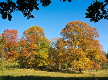
![Randonnée A pied Wegberg - Forst Meinweg - Photo](https://media.geolcdn.com/t/350/260/5acd597a-e981-42e3-b3b2-e9aaba32fd46.jpeg&format=jpg&maxdim=2)
![A pied A pied](https://static1.geolcdn.com/sitytour/trail-icons/100.png)
Km
A pied
![](/images/other/stat-length.png)
![](https://static1.geolcdn.com/siteimages/upload/files/1508320355ic_sort_den_pos_24dp.png)
![](https://static1.geolcdn.com/siteimages/upload/files/1508320355ic_sort_den_neg_24dp.png)
![](https://static1.geolcdn.com/siteimages/upload/files/16400158638029165_repeat_loop_refresh_sync_direction_icon.png)
• Randonnée créée par VN Niederrhein e.V.. Symbole: Schild VN Niederrhein e.V. wandern im Forst Meinweg
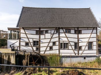
![Randonnée A pied Wegberg - Wegberger MühlenTour - Photo](https://media.geolcdn.com/t/350/260/c01bda15-9d94-4dbe-bc83-12a749039ca0.jpeg&format=jpg&maxdim=2)
![A pied A pied](https://static1.geolcdn.com/sitytour/trail-icons/100.png)
Km
A pied
![](/images/other/stat-length.png)
![](https://static1.geolcdn.com/siteimages/upload/files/1508320355ic_sort_den_pos_24dp.png)
![](https://static1.geolcdn.com/siteimages/upload/files/1508320355ic_sort_den_neg_24dp.png)
![](https://static1.geolcdn.com/siteimages/upload/files/16400158638029165_repeat_loop_refresh_sync_direction_icon.png)
• Randonnée créée par Stadt Wegberg.
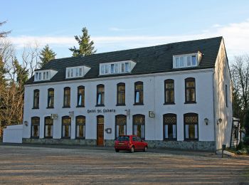
![Randonnée A pied Wegberg - Traumweg Dalheimer Schweiz - Photo](https://media.geolcdn.com/t/350/260/f9cc4bf4-a11f-4d55-8d46-022843fa006a.jpeg&format=jpg&maxdim=2)
![A pied A pied](https://static1.geolcdn.com/sitytour/trail-icons/100.png)
Km
A pied
![](/images/other/stat-length.png)
![](https://static1.geolcdn.com/siteimages/upload/files/1508320355ic_sort_den_pos_24dp.png)
![](https://static1.geolcdn.com/siteimages/upload/files/1508320355ic_sort_den_neg_24dp.png)
![](https://static1.geolcdn.com/siteimages/upload/files/16400158638029165_repeat_loop_refresh_sync_direction_icon.png)
• Randonnée créée par Stadt Wegberg. Symbole: Mühlenstadt Wegberg Logo, Bild und schwarzer Wanderwegname auf grünem Gr...
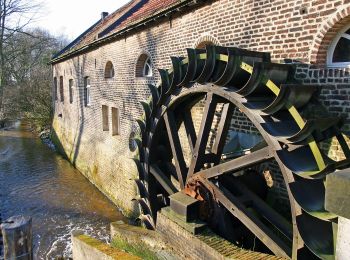
![Randonnée A pied Wassenberg - Rundweg](https://media.geolcdn.com/t/350/260/b5dc41ff-ee6c-4e28-80ca-7ecb94833885.jpeg&format=jpg&maxdim=2)
![A pied A pied](https://static1.geolcdn.com/sitytour/trail-icons/100.png)
Km
A pied
![](/images/other/stat-length.png)
![](https://static1.geolcdn.com/siteimages/upload/files/1508320355ic_sort_den_pos_24dp.png)
![](https://static1.geolcdn.com/siteimages/upload/files/1508320355ic_sort_den_neg_24dp.png)
![](https://static1.geolcdn.com/siteimages/upload/files/16400158638029165_repeat_loop_refresh_sync_direction_icon.png)
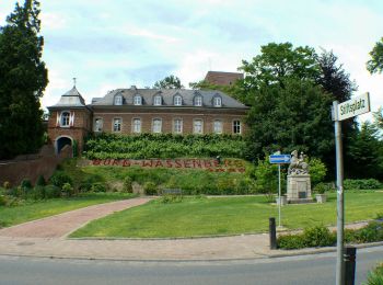
• Randonnée créée par Naturpark Schwalm-Nette. Symbole: Weißer Text "A7" auf schwarzem Grund
![Randonnée A pied Wassenberg - Rundweg](https://media.geolcdn.com/t/350/260/e404a89f-9785-4c26-8ce6-7b5e16704d0b.jpeg&format=jpg&maxdim=2)
![A pied A pied](https://static1.geolcdn.com/sitytour/trail-icons/100.png)
Km
A pied
![](/images/other/stat-length.png)
![](https://static1.geolcdn.com/siteimages/upload/files/1508320355ic_sort_den_pos_24dp.png)
![](https://static1.geolcdn.com/siteimages/upload/files/1508320355ic_sort_den_neg_24dp.png)
![](https://static1.geolcdn.com/siteimages/upload/files/16400158638029165_repeat_loop_refresh_sync_direction_icon.png)
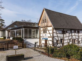
• Randonnée créée par Naturpark Schwalm-Nette. Symbole: Weißer Text "A2" auf schwarzem Grund
![Randonnée A pied Wegberg - Rundweg A4 Tüschenbroicher Mühle - Photo](https://media.geolcdn.com/t/350/260/ec045ffb-32f5-42ae-beae-3e043c4a39db.jpeg&format=jpg&maxdim=2)
![A pied A pied](https://static1.geolcdn.com/sitytour/trail-icons/100.png)
Km
A pied
![](/images/other/stat-length.png)
![](https://static1.geolcdn.com/siteimages/upload/files/1508320355ic_sort_den_pos_24dp.png)
![](https://static1.geolcdn.com/siteimages/upload/files/1508320355ic_sort_den_neg_24dp.png)
![](https://static1.geolcdn.com/siteimages/upload/files/16400158638029165_repeat_loop_refresh_sync_direction_icon.png)
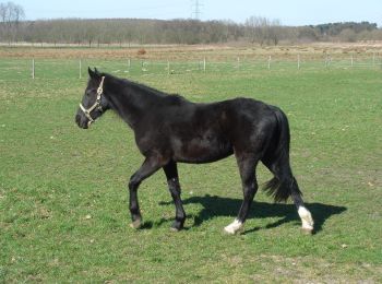
• Randonnée créée par Naturpark Schwalm-Nette. Symbole: Weißer Text "A4" auf schwarzem Grund
![Randonnée A pied Wegberg - Rundweg A4 Dalheimer Mühle - Photo](https://media.geolcdn.com/t/350/260/5acd597a-e981-42e3-b3b2-e9aaba32fd46.jpeg&format=jpg&maxdim=2)
![A pied A pied](https://static1.geolcdn.com/sitytour/trail-icons/100.png)
Km
A pied
![](/images/other/stat-length.png)
![](https://static1.geolcdn.com/siteimages/upload/files/1508320355ic_sort_den_pos_24dp.png)
![](https://static1.geolcdn.com/siteimages/upload/files/1508320355ic_sort_den_neg_24dp.png)
![](https://static1.geolcdn.com/siteimages/upload/files/16400158638029165_repeat_loop_refresh_sync_direction_icon.png)
• Randonnée créée par Naturpark Schwalm-Nette. Symbole: Weißer Text A4 auf schwarzem Grund
![Randonnée A pied Gangelt - NordicWalking7 - Photo](https://media.geolcdn.com/t/350/260/ee24fe33-e676-4d4e-8211-77f2cd86e479.jpeg&format=jpg&maxdim=2)
![A pied A pied](https://static1.geolcdn.com/sitytour/trail-icons/100.png)
Km
A pied
![](/images/other/stat-length.png)
![](https://static1.geolcdn.com/siteimages/upload/files/1508320355ic_sort_den_pos_24dp.png)
![](https://static1.geolcdn.com/siteimages/upload/files/1508320355ic_sort_den_neg_24dp.png)
![](https://static1.geolcdn.com/siteimages/upload/files/16400158638029165_repeat_loop_refresh_sync_direction_icon.png)
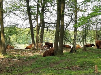
• Randonnée créée par Gemeente Onderbanken. Symbole: Hintergrund:schwarz quadratisch; Vordergrund:weiss-7
![Randonnée A pied Gangelt - NordicWalking6 - Photo](https://media.geolcdn.com/t/350/260/1b40752f-d6b9-426d-aca4-1343e28fb161.jpeg&format=jpg&maxdim=2)
![A pied A pied](https://static1.geolcdn.com/sitytour/trail-icons/100.png)
Km
A pied
![](/images/other/stat-length.png)
![](https://static1.geolcdn.com/siteimages/upload/files/1508320355ic_sort_den_pos_24dp.png)
![](https://static1.geolcdn.com/siteimages/upload/files/1508320355ic_sort_den_neg_24dp.png)
![](https://static1.geolcdn.com/siteimages/upload/files/16400158638029165_repeat_loop_refresh_sync_direction_icon.png)
• Randonnée créée par Gemeente Onderbanken. Symbole: Hintergrund:rot quadratisch; Vordergrund:weiss-6
![Randonnée A pied Gangelt - NordicWalking5 - Photo](https://media.geolcdn.com/t/350/260/ee24fe33-e676-4d4e-8211-77f2cd86e479.jpeg&format=jpg&maxdim=2)
![A pied A pied](https://static1.geolcdn.com/sitytour/trail-icons/100.png)
Km
A pied
![](/images/other/stat-length.png)
![](https://static1.geolcdn.com/siteimages/upload/files/1508320355ic_sort_den_pos_24dp.png)
![](https://static1.geolcdn.com/siteimages/upload/files/1508320355ic_sort_den_neg_24dp.png)
![](https://static1.geolcdn.com/siteimages/upload/files/16400158638029165_repeat_loop_refresh_sync_direction_icon.png)
• Randonnée créée par Gemeente Onderbanken. Symbole: Hintergrund:rot quadratisch; Vordergrund:weiss-5
![Randonnée A pied Gangelt - NordicWalking3 - Photo](https://media.geolcdn.com/t/350/260/ee24fe33-e676-4d4e-8211-77f2cd86e479.jpeg&format=jpg&maxdim=2)
![A pied A pied](https://static1.geolcdn.com/sitytour/trail-icons/100.png)
Km
A pied
![](/images/other/stat-length.png)
![](https://static1.geolcdn.com/siteimages/upload/files/1508320355ic_sort_den_pos_24dp.png)
![](https://static1.geolcdn.com/siteimages/upload/files/1508320355ic_sort_den_neg_24dp.png)
![](https://static1.geolcdn.com/siteimages/upload/files/16400158638029165_repeat_loop_refresh_sync_direction_icon.png)
• Randonnée créée par Gemeinde Gangelt. Symbole: Hintergrund:schwarz quadratisch; Vordergrund:weiss-3
![Randonnée A pied Gangelt - NordicWalking2 - Photo](https://media.geolcdn.com/t/350/260/1b40752f-d6b9-426d-aca4-1343e28fb161.jpeg&format=jpg&maxdim=2)
![A pied A pied](https://static1.geolcdn.com/sitytour/trail-icons/100.png)
Km
A pied
![](/images/other/stat-length.png)
![](https://static1.geolcdn.com/siteimages/upload/files/1508320355ic_sort_den_pos_24dp.png)
![](https://static1.geolcdn.com/siteimages/upload/files/1508320355ic_sort_den_neg_24dp.png)
![](https://static1.geolcdn.com/siteimages/upload/files/16400158638029165_repeat_loop_refresh_sync_direction_icon.png)
• Randonnée créée par Gemeinde Gangelt. Symbole: Hintergrund:rot quadratisch; Vordergrund:weiss-2
![Randonnée A pied Gangelt - NordicWalking4 - Photo](https://media.geolcdn.com/t/350/260/ee24fe33-e676-4d4e-8211-77f2cd86e479.jpeg&format=jpg&maxdim=2)
![A pied A pied](https://static1.geolcdn.com/sitytour/trail-icons/100.png)
Km
A pied
![](/images/other/stat-length.png)
![](https://static1.geolcdn.com/siteimages/upload/files/1508320355ic_sort_den_pos_24dp.png)
![](https://static1.geolcdn.com/siteimages/upload/files/1508320355ic_sort_den_neg_24dp.png)
![](https://static1.geolcdn.com/siteimages/upload/files/16400158638029165_repeat_loop_refresh_sync_direction_icon.png)
• Randonnée créée par Gemeinde Gangelt. Symbole: Hintergrund:blau quadratisch; Vordergrund:weiss-4
![Randonnée A pied Gangelt - NordicWalking1 - Photo](https://media.geolcdn.com/t/350/260/ee24fe33-e676-4d4e-8211-77f2cd86e479.jpeg&format=jpg&maxdim=2)
![A pied A pied](https://static1.geolcdn.com/sitytour/trail-icons/100.png)
Km
A pied
![](/images/other/stat-length.png)
![](https://static1.geolcdn.com/siteimages/upload/files/1508320355ic_sort_den_pos_24dp.png)
![](https://static1.geolcdn.com/siteimages/upload/files/1508320355ic_sort_den_neg_24dp.png)
![](https://static1.geolcdn.com/siteimages/upload/files/16400158638029165_repeat_loop_refresh_sync_direction_icon.png)
• Randonnée créée par Gemeinde Gangelt. Symbole: Hintergrund:rot quadratisch; Vordergrund:weiss-1
![Randonnée A pied Gangelt - A2 - Photo](https://media.geolcdn.com/t/350/260/c92f030f-7fdc-4476-af50-594191c25145.jpeg&format=jpg&maxdim=2)
![A pied A pied](https://static1.geolcdn.com/sitytour/trail-icons/100.png)
Km
A pied
![](/images/other/stat-length.png)
![](https://static1.geolcdn.com/siteimages/upload/files/1508320355ic_sort_den_pos_24dp.png)
![](https://static1.geolcdn.com/siteimages/upload/files/1508320355ic_sort_den_neg_24dp.png)
![](https://static1.geolcdn.com/siteimages/upload/files/16400158638029165_repeat_loop_refresh_sync_direction_icon.png)
• Symbole: Hintergrund:schwarz quadratisch ; Vordergrund:weiss-A2
![Randonnée A pied Gangelt - A3 - Photo](https://media.geolcdn.com/t/350/260/1b40752f-d6b9-426d-aca4-1343e28fb161.jpeg&format=jpg&maxdim=2)
![A pied A pied](https://static1.geolcdn.com/sitytour/trail-icons/100.png)
Km
A pied
![](/images/other/stat-length.png)
![](https://static1.geolcdn.com/siteimages/upload/files/1508320355ic_sort_den_pos_24dp.png)
![](https://static1.geolcdn.com/siteimages/upload/files/1508320355ic_sort_den_neg_24dp.png)
![](https://static1.geolcdn.com/siteimages/upload/files/16400158638029165_repeat_loop_refresh_sync_direction_icon.png)
• Symbole: Hintergrund:schwarz quadratisch;Vordergrund:weiss-A3
![Randonnée A pied Gangelt - A7 - Photo](https://media.geolcdn.com/t/350/260/c92f030f-7fdc-4476-af50-594191c25145.jpeg&format=jpg&maxdim=2)
![A pied A pied](https://static1.geolcdn.com/sitytour/trail-icons/100.png)
Km
A pied
![](/images/other/stat-length.png)
![](https://static1.geolcdn.com/siteimages/upload/files/1508320355ic_sort_den_pos_24dp.png)
![](https://static1.geolcdn.com/siteimages/upload/files/1508320355ic_sort_den_neg_24dp.png)
![](https://static1.geolcdn.com/siteimages/upload/files/16400158638029165_repeat_loop_refresh_sync_direction_icon.png)
• Symbole: Hintergrund:schwarz quadratisch;Vordergrund:weiss-A7
![Randonnée A pied Gangelt - Gangelt - Schierwaldenrath - Photo](https://media.geolcdn.com/t/350/260/c92f030f-7fdc-4476-af50-594191c25145.jpeg&format=jpg&maxdim=2)
![A pied A pied](https://static1.geolcdn.com/sitytour/trail-icons/100.png)
Km
A pied
![](/images/other/stat-length.png)
![](https://static1.geolcdn.com/siteimages/upload/files/1508320355ic_sort_den_pos_24dp.png)
![](https://static1.geolcdn.com/siteimages/upload/files/1508320355ic_sort_den_neg_24dp.png)
![](https://static1.geolcdn.com/siteimages/upload/files/16400158638029165_repeat_loop_refresh_sync_direction_icon.png)
• Symbole: Hintergrund:schwarz quadratisch;Vordergrund:weiss-A6
![Randonnée A pied Gangelt - Gangelt - Schierwaldenrath/Bhf - Photo](https://media.geolcdn.com/t/350/260/615ea5c0-4026-469e-8d4a-093ac7a14af6.jpeg&format=jpg&maxdim=2)
![A pied A pied](https://static1.geolcdn.com/sitytour/trail-icons/100.png)
Km
A pied
![](/images/other/stat-length.png)
![](https://static1.geolcdn.com/siteimages/upload/files/1508320355ic_sort_den_pos_24dp.png)
![](https://static1.geolcdn.com/siteimages/upload/files/1508320355ic_sort_den_neg_24dp.png)
![](https://static1.geolcdn.com/siteimages/upload/files/16400158638029165_repeat_loop_refresh_sync_direction_icon.png)
• Symbole: Hintergrund:schwarz quadratisch;Vordergrund:weiss-A5
![Randonnée A pied Gangelt - Niederbusch A4 - Photo](https://media.geolcdn.com/t/350/260/7821e26f-23a5-4e5b-bcad-0dd13e858cbd.jpeg&format=jpg&maxdim=2)
![A pied A pied](https://static1.geolcdn.com/sitytour/trail-icons/100.png)
Km
A pied
![](/images/other/stat-length.png)
![](https://static1.geolcdn.com/siteimages/upload/files/1508320355ic_sort_den_pos_24dp.png)
![](https://static1.geolcdn.com/siteimages/upload/files/1508320355ic_sort_den_neg_24dp.png)
![](https://static1.geolcdn.com/siteimages/upload/files/16400158638029165_repeat_loop_refresh_sync_direction_icon.png)
• Symbole: Hintergrund:schwarz quadratisch;Vordergrund:weiss-A4
20 randonnées affichées sur 65
Application GPS de randonnée GRATUITE