![](/images/other/stat-length.png)
- Randonnées
- A pied
- Allemagne
- Rhénanie-du-Nord-Westphalie
- Mülheim an der Ruhr
- Inconnu
- Rechtsruhr-Süd
Rechtsruhr-Süd, Inconnu, A pied : Les meilleures randonnées, itinéraires, parcours, balades et promenades
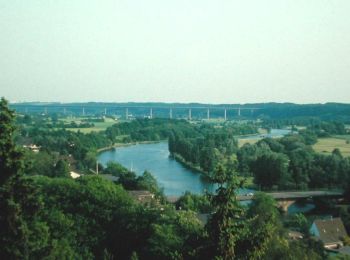
Rechtsruhr-Süd : découvrez les meilleures randonnées : 8 a pied. Tous ces circuits, parcours, itinéraires et activités en plein air sont disponibles dans nos applications SityTrail pour smartphones et tablettes.
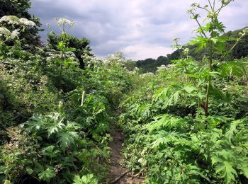
Les meilleurs parcours (8)
![Randonnée A pied Inconnu - Naturfreundeweg Ruhrtalhaus - Kettwig - Tönisheide - Photo](https://media.geolcdn.com/t/350/260/882e315b-2a5a-42a9-8c87-cfa647c78e94.jpeg&format=jpg&maxdim=2)
![A pied A pied](https://static1.geolcdn.com/sitytour/trail-icons/100.png)
Km
A pied
![](/images/other/stat-length.png)
![](https://static1.geolcdn.com/siteimages/upload/files/1508320355ic_sort_den_pos_24dp.png)
![](https://static1.geolcdn.com/siteimages/upload/files/1508320355ic_sort_den_neg_24dp.png)
![](https://static1.geolcdn.com/siteimages/upload/files/16400158638029165_repeat_loop_refresh_sync_direction_icon.png)
• Randonnée créée par Die Naturfreunde. Symbole: weißer Buchstabe "N" auf schwarzem Grund
![Randonnée A pied Inconnu - Naturfreundehaus Rundweg (N) - Photo](https://media.geolcdn.com/t/350/260/d84dd9e0-e1f2-4e37-a21e-c61351a25df9.jpeg&format=jpg&maxdim=2)
![A pied A pied](https://static1.geolcdn.com/sitytour/trail-icons/100.png)
Km
A pied
![](/images/other/stat-length.png)
![](https://static1.geolcdn.com/siteimages/upload/files/1508320355ic_sort_den_pos_24dp.png)
![](https://static1.geolcdn.com/siteimages/upload/files/1508320355ic_sort_den_neg_24dp.png)
![](https://static1.geolcdn.com/siteimages/upload/files/16400158638029165_repeat_loop_refresh_sync_direction_icon.png)
• Randonnée créée par Die Naturfreunde. Symbole: weißer Buchstabe "N" im Kreis auf schwarzem Grund
![Randonnée A pied Inconnu - Mülheimer Bodenschätze - Bodenroute](https://media.geolcdn.com/t/350/260/a81c84a0-b3bf-4986-b550-08b765edafa5.jpeg&format=jpg&maxdim=2)
![A pied A pied](https://static1.geolcdn.com/sitytour/trail-icons/100.png)
Km
A pied
![](/images/other/stat-length.png)
![](https://static1.geolcdn.com/siteimages/upload/files/1508320355ic_sort_den_pos_24dp.png)
![](https://static1.geolcdn.com/siteimages/upload/files/1508320355ic_sort_den_neg_24dp.png)
![](https://static1.geolcdn.com/siteimages/upload/files/16400158638029165_repeat_loop_refresh_sync_direction_icon.png)
• Randonnée créée par Biologische Station Westliches Ruhrgebiet. Site web: https://www.muelheim-ruhr.de/cms/bodenrou...
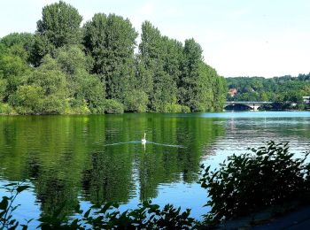
![Randonnée A pied Inconnu - Z Kaiserplatz - Menden - Photo](https://media.geolcdn.com/t/350/260/2b5ef27d-b989-487d-bdfa-c14ae6ca843e.jpeg&format=jpg&maxdim=2)
![A pied A pied](https://static1.geolcdn.com/sitytour/trail-icons/100.png)
Km
A pied
![](/images/other/stat-length.png)
![](https://static1.geolcdn.com/siteimages/upload/files/1508320355ic_sort_den_pos_24dp.png)
![](https://static1.geolcdn.com/siteimages/upload/files/1508320355ic_sort_den_neg_24dp.png)
![](https://static1.geolcdn.com/siteimages/upload/files/16400158638029165_repeat_loop_refresh_sync_direction_icon.png)
• Randonnée créée par Sauerländischer Gebirgsverein. Symbole: weißes Z auf schwarzem Grund
![Randonnée A pied Inconnu - Naturfreundeweg Duisburg - Ruhrtalhaus - Photo](https://media.geolcdn.com/t/350/260/4167ad8b-25bb-43a4-896e-b89b03f3dbac.jpeg&format=jpg&maxdim=2)
![A pied A pied](https://static1.geolcdn.com/sitytour/trail-icons/100.png)
Km
A pied
![](/images/other/stat-length.png)
![](https://static1.geolcdn.com/siteimages/upload/files/1508320355ic_sort_den_pos_24dp.png)
![](https://static1.geolcdn.com/siteimages/upload/files/1508320355ic_sort_den_neg_24dp.png)
![](https://static1.geolcdn.com/siteimages/upload/files/16400158638029165_repeat_loop_refresh_sync_direction_icon.png)
• Symbole: weisses "N" auf schwarzem Grund
![Randonnée A pied Inconnu - Mülheim Wasserbf Rundweg A8 - Photo](https://media.geolcdn.com/t/350/260/5f969226-6b26-4fc2-beaa-4d3891f0c421.jpeg&format=jpg&maxdim=2)
![A pied A pied](https://static1.geolcdn.com/sitytour/trail-icons/100.png)
Km
A pied
![](/images/other/stat-length.png)
![](https://static1.geolcdn.com/siteimages/upload/files/1508320355ic_sort_den_pos_24dp.png)
![](https://static1.geolcdn.com/siteimages/upload/files/1508320355ic_sort_den_neg_24dp.png)
![](https://static1.geolcdn.com/siteimages/upload/files/16400158638029165_repeat_loop_refresh_sync_direction_icon.png)
![Randonnée A pied Inconnu - T Rumbachtal - Menden - Photo](https://media.geolcdn.com/t/350/260/ext.jpg?maxdim=2&url=https%3A%2F%2Fstatic1.geolcdn.com%2Fsiteimages%2Fupload%2Ffiles%2F1545311037marcheuse_200dpi.jpg)
![A pied A pied](https://static1.geolcdn.com/sitytour/trail-icons/100.png)
Km
A pied
![](/images/other/stat-length.png)
![](https://static1.geolcdn.com/siteimages/upload/files/1508320355ic_sort_den_pos_24dp.png)
![](https://static1.geolcdn.com/siteimages/upload/files/1508320355ic_sort_den_neg_24dp.png)
![](https://static1.geolcdn.com/siteimages/upload/files/16400158638029165_repeat_loop_refresh_sync_direction_icon.png)
• Randonnée créée par Sauerländischer Gebirgsverein. Symbole: weißes T auf dem Kopf auf schwarzem Grund
![Randonnée A pied Inconnu - (M) Rund um Mülheim - Photo](https://media.geolcdn.com/t/350/260/ext.jpg?maxdim=2&url=https%3A%2F%2Fstatic1.geolcdn.com%2Fsiteimages%2Fupload%2Ffiles%2F1545311037marcheuse_200dpi.jpg)
![A pied A pied](https://static1.geolcdn.com/sitytour/trail-icons/100.png)
Km
A pied
![](/images/other/stat-length.png)
![](https://static1.geolcdn.com/siteimages/upload/files/1508320355ic_sort_den_pos_24dp.png)
![](https://static1.geolcdn.com/siteimages/upload/files/1508320355ic_sort_den_neg_24dp.png)
![](https://static1.geolcdn.com/siteimages/upload/files/16400158638029165_repeat_loop_refresh_sync_direction_icon.png)
• Randonnée créée par Sauerländischer Gebirgsverein. Symbole: M (weisses M in weissem Kreis auf schwarzem Grund)
8 randonnées affichées sur 8
Application GPS de randonnée GRATUITE