![](/images/other/stat-length.png)
- Randonnées
- A pied
- Allemagne
- Rhénanie-du-Nord-Westphalie
- Kreis Recklinghausen
Kreis Recklinghausen, Rhénanie-du-Nord-Westphalie, A pied : Les meilleures randonnées, itinéraires, parcours, balades et promenades
Kreis Recklinghausen : découvrez les meilleures randonnées : 81 a pied. Tous ces circuits, parcours, itinéraires et activités en plein air sont disponibles dans nos applications SityTrail pour smartphones et tablettes.
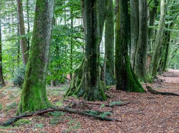
Les meilleurs parcours (81)
![Randonnée A pied Haltern am See - Hohe Mark Steig (Wesel - Olfen) - Photo](https://media.geolcdn.com/t/350/260/96bced55-a304-445f-b01b-9c72bcf815f2.jpeg&format=jpg&maxdim=2)
![A pied A pied](https://static1.geolcdn.com/sitytour/trail-icons/100.png)
Km
A pied
![](/images/other/stat-length.png)
![](https://static1.geolcdn.com/siteimages/upload/files/1508320355ic_sort_den_pos_24dp.png)
![](https://static1.geolcdn.com/siteimages/upload/files/1508320355ic_sort_den_neg_24dp.png)
![](https://static1.geolcdn.com/siteimages/upload/files/16400158638029165_repeat_loop_refresh_sync_direction_icon.png)
• Randonnée créée par Regionalverband Ruhr (RVR). Hauptweg ( es gibt noch 3 Nebenwege) https://naturpark-hohe-mark.de/...
![Randonnée A pied Marl - Waldhausroute - Photo](https://media.geolcdn.com/t/350/260/24b012cd-1e7d-40cd-8e05-a8f60e019977.jpeg&format=jpg&maxdim=2)
![A pied A pied](https://static1.geolcdn.com/sitytour/trail-icons/100.png)
Km
A pied
![](/images/other/stat-length.png)
![](https://static1.geolcdn.com/siteimages/upload/files/1508320355ic_sort_den_pos_24dp.png)
![](https://static1.geolcdn.com/siteimages/upload/files/1508320355ic_sort_den_neg_24dp.png)
![](https://static1.geolcdn.com/siteimages/upload/files/16400158638029165_repeat_loop_refresh_sync_direction_icon.png)
• Randonnée créée par Sauerländischer Gebirksverein.
![Randonnée A pied Recklinghausen - Rund um Stuckenbusch - Photo](https://media.geolcdn.com/t/350/260/d68e41d8-68cc-4c10-8e49-72646eba7019.jpeg&format=jpg&maxdim=2)
![A pied A pied](https://static1.geolcdn.com/sitytour/trail-icons/100.png)
Km
A pied
![](/images/other/stat-length.png)
![](https://static1.geolcdn.com/siteimages/upload/files/1508320355ic_sort_den_pos_24dp.png)
![](https://static1.geolcdn.com/siteimages/upload/files/1508320355ic_sort_den_neg_24dp.png)
![](https://static1.geolcdn.com/siteimages/upload/files/16400158638029165_repeat_loop_refresh_sync_direction_icon.png)
• Randonnée créée par Sauerländischer Gebiergsverein. Symbole: schwarzer Grund, weißes R im weißen Kreis
![Randonnée A pied Marl - Haard Rundweg A1 - Photo](https://media.geolcdn.com/t/350/260/83d25665-90d4-4209-a744-a64be42db632.jpeg&format=jpg&maxdim=2)
![A pied A pied](https://static1.geolcdn.com/sitytour/trail-icons/100.png)
Km
A pied
![](/images/other/stat-length.png)
![](https://static1.geolcdn.com/siteimages/upload/files/1508320355ic_sort_den_pos_24dp.png)
![](https://static1.geolcdn.com/siteimages/upload/files/1508320355ic_sort_den_neg_24dp.png)
![](https://static1.geolcdn.com/siteimages/upload/files/16400158638029165_repeat_loop_refresh_sync_direction_icon.png)
• Randonnée créée par SGV.
![Randonnée A pied Dorsten - Napoleonsbuche Rundweg A2 - Photo](https://media.geolcdn.com/t/350/260/7772a12c-62b8-48cf-9f1f-417f84007efe.jpeg&format=jpg&maxdim=2)
![A pied A pied](https://static1.geolcdn.com/sitytour/trail-icons/100.png)
Km
A pied
![](/images/other/stat-length.png)
![](https://static1.geolcdn.com/siteimages/upload/files/1508320355ic_sort_den_pos_24dp.png)
![](https://static1.geolcdn.com/siteimages/upload/files/1508320355ic_sort_den_neg_24dp.png)
![](https://static1.geolcdn.com/siteimages/upload/files/16400158638029165_repeat_loop_refresh_sync_direction_icon.png)
• Symbole: A2
![Randonnée A pied Dorsten - Napoleonsbuche Rundweg A1 - Photo](https://media.geolcdn.com/t/350/260/1d4274ef-be05-4fe4-8949-51a5ee12c111.jpeg&format=jpg&maxdim=2)
![A pied A pied](https://static1.geolcdn.com/sitytour/trail-icons/100.png)
Km
A pied
![](/images/other/stat-length.png)
![](https://static1.geolcdn.com/siteimages/upload/files/1508320355ic_sort_den_pos_24dp.png)
![](https://static1.geolcdn.com/siteimages/upload/files/1508320355ic_sort_den_neg_24dp.png)
![](https://static1.geolcdn.com/siteimages/upload/files/16400158638029165_repeat_loop_refresh_sync_direction_icon.png)
• Symbole: A1
![Randonnée A pied Haltern am See - Vogelsheide Rundweg A4 - Photo](https://media.geolcdn.com/t/350/260/96bced55-a304-445f-b01b-9c72bcf815f2.jpeg&format=jpg&maxdim=2)
![A pied A pied](https://static1.geolcdn.com/sitytour/trail-icons/100.png)
Km
A pied
![](/images/other/stat-length.png)
![](https://static1.geolcdn.com/siteimages/upload/files/1508320355ic_sort_den_pos_24dp.png)
![](https://static1.geolcdn.com/siteimages/upload/files/1508320355ic_sort_den_neg_24dp.png)
![](https://static1.geolcdn.com/siteimages/upload/files/16400158638029165_repeat_loop_refresh_sync_direction_icon.png)
• Randonnée créée par Sauerländische Gebirgsverein. Symbole: A4
![Randonnée A pied Dorsten - Napoleonsweg Rundweg A5 - Photo](https://media.geolcdn.com/t/350/260/4509d1f4-013b-4609-9177-bb1b559989b4.jpeg&format=jpg&maxdim=2)
![A pied A pied](https://static1.geolcdn.com/sitytour/trail-icons/100.png)
Km
A pied
![](/images/other/stat-length.png)
![](https://static1.geolcdn.com/siteimages/upload/files/1508320355ic_sort_den_pos_24dp.png)
![](https://static1.geolcdn.com/siteimages/upload/files/1508320355ic_sort_den_neg_24dp.png)
![](https://static1.geolcdn.com/siteimages/upload/files/16400158638029165_repeat_loop_refresh_sync_direction_icon.png)
• Symbole: A5
![Randonnée A pied Haltern am See - Aufm Eck Rundweg A5 - Photo](https://media.geolcdn.com/t/350/260/6865907e-6c26-4990-bdc3-796f325e0941.jpeg&format=jpg&maxdim=2)
![A pied A pied](https://static1.geolcdn.com/sitytour/trail-icons/100.png)
Km
A pied
![](/images/other/stat-length.png)
![](https://static1.geolcdn.com/siteimages/upload/files/1508320355ic_sort_den_pos_24dp.png)
![](https://static1.geolcdn.com/siteimages/upload/files/1508320355ic_sort_den_neg_24dp.png)
![](https://static1.geolcdn.com/siteimages/upload/files/16400158638029165_repeat_loop_refresh_sync_direction_icon.png)
• Symbole: A5
![Randonnée A pied Haltern am See - Raute Wulfen - Maria Veen - Photo](https://media.geolcdn.com/t/350/260/9b989265-d628-43a9-b83d-8d73a694f8d5.jpeg&format=jpg&maxdim=2)
![A pied A pied](https://static1.geolcdn.com/sitytour/trail-icons/100.png)
Km
A pied
![](/images/other/stat-length.png)
![](https://static1.geolcdn.com/siteimages/upload/files/1508320355ic_sort_den_pos_24dp.png)
![](https://static1.geolcdn.com/siteimages/upload/files/1508320355ic_sort_den_neg_24dp.png)
![](https://static1.geolcdn.com/siteimages/upload/files/16400158638029165_repeat_loop_refresh_sync_direction_icon.png)
• Randonnée créée par Sauerländischer Gebirgsverein Bezirk Emscher-Lippe. Symbole: weiße Raute auf schwarzem Grund
![Randonnée A pied Dorsten - Große Heide Rundweg A1 - Photo](https://media.geolcdn.com/t/350/260/93112271-df5f-4b3f-bd16-097cfead0778.jpeg&format=jpg&maxdim=2)
![A pied A pied](https://static1.geolcdn.com/sitytour/trail-icons/100.png)
Km
A pied
![](/images/other/stat-length.png)
![](https://static1.geolcdn.com/siteimages/upload/files/1508320355ic_sort_den_pos_24dp.png)
![](https://static1.geolcdn.com/siteimages/upload/files/1508320355ic_sort_den_neg_24dp.png)
![](https://static1.geolcdn.com/siteimages/upload/files/16400158638029165_repeat_loop_refresh_sync_direction_icon.png)
• Randonnée créée par Sauerländische Gebirgsverein. Symbole: A1
![Randonnée A pied Haltern am See - Uhlenhof Rundweg A6 - Photo](https://media.geolcdn.com/t/350/260/f9c82913-7129-493c-b053-1f2a436db02d.jpeg&format=jpg&maxdim=2)
![A pied A pied](https://static1.geolcdn.com/sitytour/trail-icons/100.png)
Km
A pied
![](/images/other/stat-length.png)
![](https://static1.geolcdn.com/siteimages/upload/files/1508320355ic_sort_den_pos_24dp.png)
![](https://static1.geolcdn.com/siteimages/upload/files/1508320355ic_sort_den_neg_24dp.png)
![](https://static1.geolcdn.com/siteimages/upload/files/16400158638029165_repeat_loop_refresh_sync_direction_icon.png)
• Randonnée créée par Sauerländische Gebirgsverein. Symbole: A6
![Randonnée A pied Dorsten - Große Heide Rundweg A2 - Photo](https://media.geolcdn.com/t/350/260/cfd81986-58f5-4974-a60c-8091e121352a.jpeg&format=jpg&maxdim=2)
![A pied A pied](https://static1.geolcdn.com/sitytour/trail-icons/100.png)
Km
A pied
![](/images/other/stat-length.png)
![](https://static1.geolcdn.com/siteimages/upload/files/1508320355ic_sort_den_pos_24dp.png)
![](https://static1.geolcdn.com/siteimages/upload/files/1508320355ic_sort_den_neg_24dp.png)
![](https://static1.geolcdn.com/siteimages/upload/files/16400158638029165_repeat_loop_refresh_sync_direction_icon.png)
• Randonnée créée par Sauerländische Gebirgsverein. Symbole: A2
![Randonnée A pied Haltern am See - Granat Rundweg A6 - Photo](https://media.geolcdn.com/t/350/260/dbf63811-2b93-430c-9357-dbaaf560a206.jpeg&format=jpg&maxdim=2)
![A pied A pied](https://static1.geolcdn.com/sitytour/trail-icons/100.png)
Km
A pied
![](/images/other/stat-length.png)
![](https://static1.geolcdn.com/siteimages/upload/files/1508320355ic_sort_den_pos_24dp.png)
![](https://static1.geolcdn.com/siteimages/upload/files/1508320355ic_sort_den_neg_24dp.png)
![](https://static1.geolcdn.com/siteimages/upload/files/16400158638029165_repeat_loop_refresh_sync_direction_icon.png)
• Randonnée créée par Sauerländische Gebirgsverein. Symbole: A6
![Randonnée A pied Haltern am See - Bensberg Rundweg A5 - Photo](https://media.geolcdn.com/t/350/260/f9c82913-7129-493c-b053-1f2a436db02d.jpeg&format=jpg&maxdim=2)
![A pied A pied](https://static1.geolcdn.com/sitytour/trail-icons/100.png)
Km
A pied
![](/images/other/stat-length.png)
![](https://static1.geolcdn.com/siteimages/upload/files/1508320355ic_sort_den_pos_24dp.png)
![](https://static1.geolcdn.com/siteimages/upload/files/1508320355ic_sort_den_neg_24dp.png)
![](https://static1.geolcdn.com/siteimages/upload/files/16400158638029165_repeat_loop_refresh_sync_direction_icon.png)
• Randonnée créée par Sauerländische Gebirgsverein. Symbole: A5
![Randonnée A pied Haltern am See - Bensberg Rundweg A2 - Photo](https://media.geolcdn.com/t/350/260/1828c368-7f38-45be-86f6-e32bb95320a2.jpeg&format=jpg&maxdim=2)
![A pied A pied](https://static1.geolcdn.com/sitytour/trail-icons/100.png)
Km
A pied
![](/images/other/stat-length.png)
![](https://static1.geolcdn.com/siteimages/upload/files/1508320355ic_sort_den_pos_24dp.png)
![](https://static1.geolcdn.com/siteimages/upload/files/1508320355ic_sort_den_neg_24dp.png)
![](https://static1.geolcdn.com/siteimages/upload/files/16400158638029165_repeat_loop_refresh_sync_direction_icon.png)
• Randonnée créée par Sauerländische Gebirgsverein. Symbole: A2
![Randonnée A pied Haltern am See - Lünzumer Mark Rundweg A9 - Photo](https://media.geolcdn.com/t/350/260/7391c883-4a65-4bb8-ba69-2c7097415fa2.jpeg&format=jpg&maxdim=2)
![A pied A pied](https://static1.geolcdn.com/sitytour/trail-icons/100.png)
Km
A pied
![](/images/other/stat-length.png)
![](https://static1.geolcdn.com/siteimages/upload/files/1508320355ic_sort_den_pos_24dp.png)
![](https://static1.geolcdn.com/siteimages/upload/files/1508320355ic_sort_den_neg_24dp.png)
![](https://static1.geolcdn.com/siteimages/upload/files/16400158638029165_repeat_loop_refresh_sync_direction_icon.png)
• Randonnée créée par Sauerländische Gebirgsverein. Symbole: A9
![Randonnée A pied Haltern am See - Haversberg Rundweg A6 - Photo](https://media.geolcdn.com/t/350/260/589b1602-d622-4442-8ae4-7be879ebac67.jpeg&format=jpg&maxdim=2)
![A pied A pied](https://static1.geolcdn.com/sitytour/trail-icons/100.png)
Km
A pied
![](/images/other/stat-length.png)
![](https://static1.geolcdn.com/siteimages/upload/files/1508320355ic_sort_den_pos_24dp.png)
![](https://static1.geolcdn.com/siteimages/upload/files/1508320355ic_sort_den_neg_24dp.png)
![](https://static1.geolcdn.com/siteimages/upload/files/16400158638029165_repeat_loop_refresh_sync_direction_icon.png)
• Randonnée créée par Sauerländische Gebirgsverein. Symbole: A6
![Randonnée A pied Haltern am See - Haversberg Rundweg A4 - Photo](https://media.geolcdn.com/t/350/260/d5205f90-1bea-42ef-a10b-3aa1fb4f2981.jpeg&format=jpg&maxdim=2)
![A pied A pied](https://static1.geolcdn.com/sitytour/trail-icons/100.png)
Km
A pied
![](/images/other/stat-length.png)
![](https://static1.geolcdn.com/siteimages/upload/files/1508320355ic_sort_den_pos_24dp.png)
![](https://static1.geolcdn.com/siteimages/upload/files/1508320355ic_sort_den_neg_24dp.png)
![](https://static1.geolcdn.com/siteimages/upload/files/16400158638029165_repeat_loop_refresh_sync_direction_icon.png)
• Randonnée créée par Sauerländische Gebirgsverein. Symbole: A4
![Randonnée A pied Haltern am See - Bensberg Rundweg A8 - Photo](https://media.geolcdn.com/t/350/260/f5f732ee-d6a2-438e-8967-cf392c842f8e.jpeg&format=jpg&maxdim=2)
![A pied A pied](https://static1.geolcdn.com/sitytour/trail-icons/100.png)
Km
A pied
![](/images/other/stat-length.png)
![](https://static1.geolcdn.com/siteimages/upload/files/1508320355ic_sort_den_pos_24dp.png)
![](https://static1.geolcdn.com/siteimages/upload/files/1508320355ic_sort_den_neg_24dp.png)
![](https://static1.geolcdn.com/siteimages/upload/files/16400158638029165_repeat_loop_refresh_sync_direction_icon.png)
• Randonnée créée par Sauerländische Gebirgsverein. Symbole: A8
20 randonnées affichées sur 81
Application GPS de randonnée GRATUITE