Laurensberg, Aix-la-Chapelle, A pied : Les meilleures randonnées, itinéraires, parcours, balades et promenades

Laurensberg : découvrez les meilleures randonnées : 1 a pied, 8 marche et 1 trail. Tous ces circuits, parcours, itinéraires et activités en plein air sont disponibles dans nos applications SityTrail pour smartphones et tablettes.


Les meilleurs parcours (10)

Randonnée Marche Aix-la-Chapelle - Trois-Frontières  - Photo
Marche 15.678
Km
GUIDE

Marche

Facile
Aix-la-Chapelle, Rhénanie-du-Nord-Westphalie, Région urbaine d'Aix-la-Chapelle, Allemagne
15,7 km | 20 km-effort
3h 24min
342 m
346 m
Oui
mumu.larandonneuse

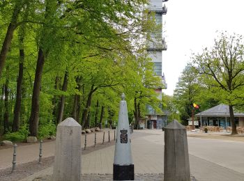
• Superbe boucle en direction de La Calamine. 📌 & 🅿️ au sommet de la route des Trois Bornes à Gemmenich. ℹ www.wande...

Randonnée A pied Aix-la-Chapelle - GrenzRouten: Naturerlebnispfad 4,4 km (Blau) - Photo
A pied 3.587
Km
PRO

A pied

Facile
Aix-la-Chapelle, Rhénanie-du-Nord-Westphalie, Région urbaine d'Aix-la-Chapelle, Allemagne
3,6 km | 4,7 km-effort
1h 4min
83 m
85 m
Oui
SityTrail - itinéraires balisés pédestres

Randonnée Marche Aix-la-Chapelle - België en Duitsland  - Photo
Marche 8.803
Km

Marche

Moyen
Aix-la-Chapelle, Rhénanie-du-Nord-Westphalie, Région urbaine d'Aix-la-Chapelle, Allemagne
8,8 km | 11,5 km-effort
2h 29min
202 m
205 m
Oui
gossim

• Boswandeling

Randonnée Marche Aix-la-Chapelle - La Gleize - Coo 15,4km - Photo
Marche 13.308
Km

Marche

Très facile
Aix-la-Chapelle, Rhénanie-du-Nord-Westphalie, Région urbaine d'Aix-la-Chapelle, Allemagne
13,3 km | 17,3 km-effort
Inconnu
301 m
299 m
Oui
wandelgidszuidlimburg

• More information on : http://www.wandelgidszuidlimburg.com

Randonnée Marche Aix-la-Chapelle - Vaalserquartier - Photo
Marche 13.147
Km

Marche

Facile
Aix-la-Chapelle, Rhénanie-du-Nord-Westphalie, Région urbaine d'Aix-la-Chapelle, Allemagne
13,1 km | 17,3 km-effort
3h 53min
314 m
315 m
Oui
flip96

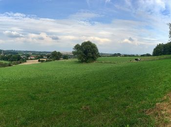
• Rondwandeling Vanuit Vaalserquartier, via 3 landenpunt, Gemmenich en door het Preuswald. Mooie, korte wandeling door ...

Randonnée Trail Aix-la-Chapelle - vaals - Photo
Trail 3.281
Km

Trail

Difficile
Aix-la-Chapelle, Rhénanie-du-Nord-Westphalie, Région urbaine d'Aix-la-Chapelle, Allemagne
3,3 km | 4,3 km-effort
1h 38min
77 m
84 m
Oui
Beek3739

Randonnée Marche Aix-la-Chapelle - boucle Aix la Chapelle  - Photo
Marche 4.526
Km

Marche

Facile
Aix-la-Chapelle, Rhénanie-du-Nord-Westphalie, Région urbaine d'Aix-la-Chapelle, Allemagne
4,5 km | 5,4 km-effort
1h 16min
69 m
62 m
Oui
Lychee

Randonnée Marche Aix-la-Chapelle - Boucle Aachen  - Photo
Marche 3.967
Km

Marche

Facile
Aix-la-Chapelle, Rhénanie-du-Nord-Westphalie, Région urbaine d'Aix-la-Chapelle, Allemagne
4 km | 5 km-effort
1h 0min
80 m
79 m
Oui
Lychee

Randonnée Marche Aix-la-Chapelle - boucle Aachen  - Photo
Marche 3.12
Km

Marche

Facile
Aix-la-Chapelle, Rhénanie-du-Nord-Westphalie, Région urbaine d'Aix-la-Chapelle, Allemagne
3,1 km | 4 km-effort
49min
66 m
66 m
Oui
Lychee

Randonnée Marche Aix-la-Chapelle - boucle Aachen  - Photo
Marche 1.947
Km

Marche

Facile
Aix-la-Chapelle, Rhénanie-du-Nord-Westphalie, Région urbaine d'Aix-la-Chapelle, Allemagne
1,9 km | 3,3 km-effort
49min
100 m
102 m
Oui
Lychee

10 randonnées affichées sur 10

Application GPS de randonnée GRATUITE

Logo SityTrail SityTrail

IGN / Instituts géographiques

Télécharger SityTrail sur l'App Store Télécharger SityTrail sur Google Play

Logo SityTrail SityTrail World

Le monde est à vous

Télécharger SityTrail sur l'App Store Télécharger SityTrail sur Google Play Télécharger SityTrail sur Huawei AppGallery

Activités

Fermer
Mes abonnements