![](/images/other/stat-length.png)
- Randonnées
- A pied
- Allemagne
- Brandebourg
- Dahme-Spreewald
- Lübben (Spreewald)
Lübben (Spreewald), Lübben (Spreewald), A pied : Les meilleures randonnées, itinéraires, parcours, balades et promenades
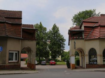
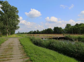
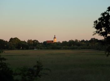
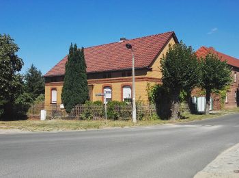
Lübben (Spreewald) : découvrez les meilleures randonnées : 9 a pied. Tous ces circuits, parcours, itinéraires et activités en plein air sont disponibles dans nos applications SityTrail pour smartphones et tablettes.
Les meilleurs parcours (9)
![Randonnée A pied Lübben (Spreewald) - Rundwanderweg (Lübben-Steinkirchen) - Photo](https://media.geolcdn.com/t/350/260/2c48456e-d7fe-4887-9579-c00da2b2f013.jpeg&format=jpg&maxdim=2)
![A pied A pied](https://static1.geolcdn.com/sitytour/trail-icons/100.png)
Km
A pied
![](/images/other/stat-length.png)
![](https://static1.geolcdn.com/siteimages/upload/files/1508320355ic_sort_den_pos_24dp.png)
![](https://static1.geolcdn.com/siteimages/upload/files/1508320355ic_sort_den_neg_24dp.png)
![](https://static1.geolcdn.com/siteimages/upload/files/16400158638029165_repeat_loop_refresh_sync_direction_icon.png)
• Symbole: grüner Punkt auf weißem Grund
![Randonnée A pied Lübben (Spreewald) - Wanderweg Lübben-Biebersdorf-Groß Leuthen - Photo](https://media.geolcdn.com/t/350/260/821a05b8-7bd8-4034-b2f0-81d96a9008a5.jpeg&format=jpg&maxdim=2)
![A pied A pied](https://static1.geolcdn.com/sitytour/trail-icons/100.png)
Km
A pied
![](/images/other/stat-length.png)
![](https://static1.geolcdn.com/siteimages/upload/files/1508320355ic_sort_den_pos_24dp.png)
![](https://static1.geolcdn.com/siteimages/upload/files/1508320355ic_sort_den_neg_24dp.png)
![](https://static1.geolcdn.com/siteimages/upload/files/16400158638029165_repeat_loop_refresh_sync_direction_icon.png)
• Symbole: horizontaler grüner Balken auf weißem Grund
![Randonnée A pied Lübben (Spreewald) - Wanderweg Lübben-Lübben/Ost - Eichkanalschleuse - Photo](https://media.geolcdn.com/t/350/260/55923653-5594-45f7-b322-a1f6af8e6b91.jpeg&format=jpg&maxdim=2)
![A pied A pied](https://static1.geolcdn.com/sitytour/trail-icons/100.png)
Km
A pied
![](/images/other/stat-length.png)
![](https://static1.geolcdn.com/siteimages/upload/files/1508320355ic_sort_den_pos_24dp.png)
![](https://static1.geolcdn.com/siteimages/upload/files/1508320355ic_sort_den_neg_24dp.png)
![](https://static1.geolcdn.com/siteimages/upload/files/16400158638029165_repeat_loop_refresh_sync_direction_icon.png)
• Symbole: horizontaler grüner Balken auf weißem Grund
![Randonnée A pied Lübben (Spreewald) - Wanderweg Lübben-Schönwalde - Photo](https://media.geolcdn.com/t/350/260/397a2a63-8478-434d-afa9-760c5597f3f4.jpeg&format=jpg&maxdim=2)
![A pied A pied](https://static1.geolcdn.com/sitytour/trail-icons/100.png)
Km
A pied
![](/images/other/stat-length.png)
![](https://static1.geolcdn.com/siteimages/upload/files/1508320355ic_sort_den_pos_24dp.png)
![](https://static1.geolcdn.com/siteimages/upload/files/1508320355ic_sort_den_neg_24dp.png)
![](https://static1.geolcdn.com/siteimages/upload/files/16400158638029165_repeat_loop_refresh_sync_direction_icon.png)
• Symbole: horizontaler gelber Balken auf weißem Grund
![Randonnée A pied Lübben (Spreewald) - Rundwanderweg Treppendorf - Photo](https://media.geolcdn.com/t/350/260/98d833fc-96b8-4c8f-aa16-13a7d68aacc6.jpeg&format=jpg&maxdim=2)
![A pied A pied](https://static1.geolcdn.com/sitytour/trail-icons/100.png)
Km
A pied
![](/images/other/stat-length.png)
![](https://static1.geolcdn.com/siteimages/upload/files/1508320355ic_sort_den_pos_24dp.png)
![](https://static1.geolcdn.com/siteimages/upload/files/1508320355ic_sort_den_neg_24dp.png)
![](https://static1.geolcdn.com/siteimages/upload/files/16400158638029165_repeat_loop_refresh_sync_direction_icon.png)
• Symbole: grüner Punkt auf weißem Grund
![Randonnée A pied Lübben (Spreewald) - Rundwanderweg Fischteiche - Photo](https://media.geolcdn.com/t/350/260/50c2e625-2e82-46c4-94c4-3821fd7ecacd.jpeg&format=jpg&maxdim=2)
![A pied A pied](https://static1.geolcdn.com/sitytour/trail-icons/100.png)
Km
A pied
![](/images/other/stat-length.png)
![](https://static1.geolcdn.com/siteimages/upload/files/1508320355ic_sort_den_pos_24dp.png)
![](https://static1.geolcdn.com/siteimages/upload/files/1508320355ic_sort_den_neg_24dp.png)
![](https://static1.geolcdn.com/siteimages/upload/files/16400158638029165_repeat_loop_refresh_sync_direction_icon.png)
• teilweise schlecht ausgeschildert Symbole: gelber Punkt auf weißem Quadrat
![Randonnée A pied Lübben (Spreewald) - Wanderweg gelber Balken - Photo](https://media.geolcdn.com/t/350/260/ee90af44-b14d-4b06-a8ea-33865dce245d.jpeg&format=jpg&maxdim=2)
![A pied A pied](https://static1.geolcdn.com/sitytour/trail-icons/100.png)
Km
A pied
![](/images/other/stat-length.png)
![](https://static1.geolcdn.com/siteimages/upload/files/1508320355ic_sort_den_pos_24dp.png)
![](https://static1.geolcdn.com/siteimages/upload/files/1508320355ic_sort_den_neg_24dp.png)
![](https://static1.geolcdn.com/siteimages/upload/files/16400158638029165_repeat_loop_refresh_sync_direction_icon.png)
![Randonnée A pied Lübben (Spreewald) - Wanderweg Radensdorf-Polenzschenke-Burg - Photo](https://media.geolcdn.com/t/350/260/4d9a77d1-3c2a-490d-8410-e5f54e163424.jpeg&format=jpg&maxdim=2)
![A pied A pied](https://static1.geolcdn.com/sitytour/trail-icons/100.png)
Km
A pied
![](/images/other/stat-length.png)
![](https://static1.geolcdn.com/siteimages/upload/files/1508320355ic_sort_den_pos_24dp.png)
![](https://static1.geolcdn.com/siteimages/upload/files/1508320355ic_sort_den_neg_24dp.png)
![](https://static1.geolcdn.com/siteimages/upload/files/16400158638029165_repeat_loop_refresh_sync_direction_icon.png)
![Randonnée A pied Lübben (Spreewald) - Rundwanderweg Batzlin - Photo](https://media.geolcdn.com/t/350/260/2fd0bfe4-47da-47ae-a2bd-58326d49cbcd.jpeg&format=jpg&maxdim=2)
![A pied A pied](https://static1.geolcdn.com/sitytour/trail-icons/100.png)
Km
A pied
![](/images/other/stat-length.png)
![](https://static1.geolcdn.com/siteimages/upload/files/1508320355ic_sort_den_pos_24dp.png)
![](https://static1.geolcdn.com/siteimages/upload/files/1508320355ic_sort_den_neg_24dp.png)
![](https://static1.geolcdn.com/siteimages/upload/files/16400158638029165_repeat_loop_refresh_sync_direction_icon.png)
9 randonnées affichées sur 9
Application GPS de randonnée GRATUITE