![](/images/other/stat-length.png)
- Randonnées
- A pied
- Allemagne
- Bade-Wurtemberg
- Landkreis Biberach
Landkreis Biberach, Bade-Wurtemberg, A pied : Les meilleures randonnées, itinéraires, parcours, balades et promenades
Landkreis Biberach : découvrez les meilleures randonnées : 23 a pied. Tous ces circuits, parcours, itinéraires et activités en plein air sont disponibles dans nos applications SityTrail pour smartphones et tablettes.
Les meilleurs parcours (23)
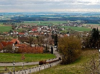
![Randonnée A pied Uttenweiler - blaues Dreieck Riedlingen- Unlingen - Parkplatz Oberer Esch- Möhringer Bächle - Bussen - Photo](https://media.geolcdn.com/t/350/260/f43822d5-e92a-4504-ad85-a18115a8ec41.jpeg&format=jpg&maxdim=2)
![A pied A pied](https://static1.geolcdn.com/sitytour/trail-icons/100.png)
Km
A pied
![](/images/other/stat-length.png)
![](https://static1.geolcdn.com/siteimages/upload/files/1508320355ic_sort_den_pos_24dp.png)
![](https://static1.geolcdn.com/siteimages/upload/files/1508320355ic_sort_den_neg_24dp.png)
![](https://static1.geolcdn.com/siteimages/upload/files/16400158638029165_repeat_loop_refresh_sync_direction_icon.png)
• Randonnée créée par Schwäbischer Albverein. Symbole: blaues Dreieck auf weißem Grund
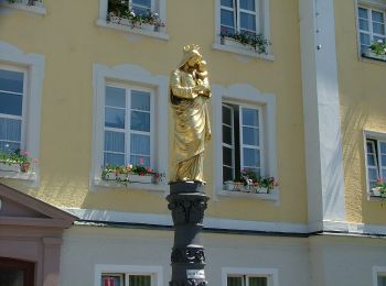
![Randonnée A pied Bad Schussenried - Bad Schussenried: Rundweg 7 - Photo](https://media.geolcdn.com/t/350/260/b52f1986-428c-409a-8c7d-428753bfa352.jpeg&format=jpg&maxdim=2)
![A pied A pied](https://static1.geolcdn.com/sitytour/trail-icons/100.png)
Km
A pied
![](/images/other/stat-length.png)
![](https://static1.geolcdn.com/siteimages/upload/files/1508320355ic_sort_den_pos_24dp.png)
![](https://static1.geolcdn.com/siteimages/upload/files/1508320355ic_sort_den_neg_24dp.png)
![](https://static1.geolcdn.com/siteimages/upload/files/16400158638029165_repeat_loop_refresh_sync_direction_icon.png)
• Randonnée créée par Bad Schussenried. Symbole: schwarze Zahl auf gelbem Hintergrund + weißer Löwe auf rotem Hintergr...
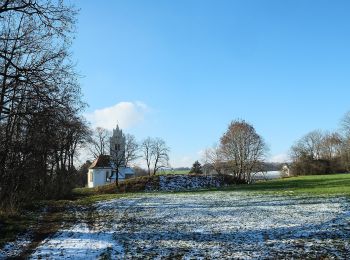
![Randonnée A pied Ingoldingen - Rindenmoos: Wanderweg 2 - Photo](https://media.geolcdn.com/t/350/260/1eb858ed-b98b-4692-9292-912434320f2f.jpeg&format=jpg&maxdim=2)
![A pied A pied](https://static1.geolcdn.com/sitytour/trail-icons/100.png)
Km
A pied
![](/images/other/stat-length.png)
![](https://static1.geolcdn.com/siteimages/upload/files/1508320355ic_sort_den_pos_24dp.png)
![](https://static1.geolcdn.com/siteimages/upload/files/1508320355ic_sort_den_neg_24dp.png)
![](https://static1.geolcdn.com/siteimages/upload/files/16400158638029165_repeat_loop_refresh_sync_direction_icon.png)
• Randonnée créée par Biberach. Symbole: blaue Zahl auf gelben Hintergrund
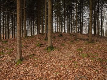
![Randonnée A pied Langenenslingen - Aeusserer Zugangsweg des Schwäbischen Albvereins (blaues Dreieck) - Photo](https://media.geolcdn.com/t/350/260/f3f4d85d-0089-455e-a05b-5d8962e2e0c3.jpeg&format=jpg&maxdim=2)
![A pied A pied](https://static1.geolcdn.com/sitytour/trail-icons/100.png)
Km
A pied
![](/images/other/stat-length.png)
![](https://static1.geolcdn.com/siteimages/upload/files/1508320355ic_sort_den_pos_24dp.png)
![](https://static1.geolcdn.com/siteimages/upload/files/1508320355ic_sort_den_neg_24dp.png)
![](https://static1.geolcdn.com/siteimages/upload/files/16400158638029165_repeat_loop_refresh_sync_direction_icon.png)
• Randonnée créée par Schwäbischer Albverein. Symbole: blaues Dreieck/ auf weißem Grund
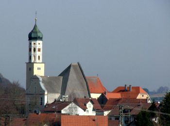
![Randonnée A pied Eberhardzell - Querweg des Schwäbischen Albvereins (blauer Punkt) - Photo](https://media.geolcdn.com/t/350/260/3d537d4e-8d4e-4b60-9c37-df23eed079e0.jpeg&format=jpg&maxdim=2)
![A pied A pied](https://static1.geolcdn.com/sitytour/trail-icons/100.png)
Km
A pied
![](/images/other/stat-length.png)
![](https://static1.geolcdn.com/siteimages/upload/files/1508320355ic_sort_den_pos_24dp.png)
![](https://static1.geolcdn.com/siteimages/upload/files/1508320355ic_sort_den_neg_24dp.png)
![](https://static1.geolcdn.com/siteimages/upload/files/16400158638029165_repeat_loop_refresh_sync_direction_icon.png)
• Randonnée créée par Schwäbische Albverein. Symbole: blauer Punkt auf weißem Grund
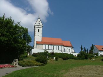
![Randonnée A pied Unlingen - Wanderweg um den Bussen - Photo](https://media.geolcdn.com/t/350/260/12f936a6-6067-44f5-8d69-fc4cfe713a76.jpeg&format=jpg&maxdim=2)
![A pied A pied](https://static1.geolcdn.com/sitytour/trail-icons/100.png)
Km
A pied
![](/images/other/stat-length.png)
![](https://static1.geolcdn.com/siteimages/upload/files/1508320355ic_sort_den_pos_24dp.png)
![](https://static1.geolcdn.com/siteimages/upload/files/1508320355ic_sort_den_neg_24dp.png)
![](https://static1.geolcdn.com/siteimages/upload/files/16400158638029165_repeat_loop_refresh_sync_direction_icon.png)
• Randonnée créée par unknown. Symbole: gelbe Raute auf weißem Grund
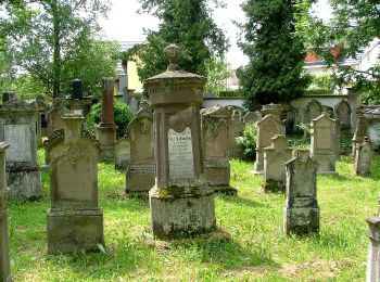
![Randonnée A pied Bad Buchau - Querweg des Schwäbischen Albvereins (blauer Punkt) - Photo](https://media.geolcdn.com/t/350/260/b3ad4959-3d3d-4b74-a1c3-b444f898304d.jpeg&format=jpg&maxdim=2)
![A pied A pied](https://static1.geolcdn.com/sitytour/trail-icons/100.png)
Km
A pied
![](/images/other/stat-length.png)
![](https://static1.geolcdn.com/siteimages/upload/files/1508320355ic_sort_den_pos_24dp.png)
![](https://static1.geolcdn.com/siteimages/upload/files/1508320355ic_sort_den_neg_24dp.png)
![](https://static1.geolcdn.com/siteimages/upload/files/16400158638029165_repeat_loop_refresh_sync_direction_icon.png)
• Randonnée créée par Schwäbische Albverein. Symbole: blauer Punkt auf weißem Grund
![Randonnée A pied Hochdorf - Querweg des Schwäbischen Albvereins (blauer Punkt) - Photo](https://media.geolcdn.com/t/350/260/3d537d4e-8d4e-4b60-9c37-df23eed079e0.jpeg&format=jpg&maxdim=2)
![A pied A pied](https://static1.geolcdn.com/sitytour/trail-icons/100.png)
Km
A pied
![](/images/other/stat-length.png)
![](https://static1.geolcdn.com/siteimages/upload/files/1508320355ic_sort_den_pos_24dp.png)
![](https://static1.geolcdn.com/siteimages/upload/files/1508320355ic_sort_den_neg_24dp.png)
![](https://static1.geolcdn.com/siteimages/upload/files/16400158638029165_repeat_loop_refresh_sync_direction_icon.png)
• Randonnée créée par Schwäbische Albverein. Symbole: blauer Punkt auf weißem Grund
![Randonnée A pied Bad Schussenried - Bad Schussenried: Wanderweg 6 - Photo](https://media.geolcdn.com/t/350/260/fb54c9fa-6c2f-4b7f-b857-03be69fa929c.jpeg&format=jpg&maxdim=2)
![A pied A pied](https://static1.geolcdn.com/sitytour/trail-icons/100.png)
Km
A pied
![](/images/other/stat-length.png)
![](https://static1.geolcdn.com/siteimages/upload/files/1508320355ic_sort_den_pos_24dp.png)
![](https://static1.geolcdn.com/siteimages/upload/files/1508320355ic_sort_den_neg_24dp.png)
![](https://static1.geolcdn.com/siteimages/upload/files/16400158638029165_repeat_loop_refresh_sync_direction_icon.png)
• Randonnée créée par Bad Schussenried. Symbole: rote Zahl auf weißem Hintergrund
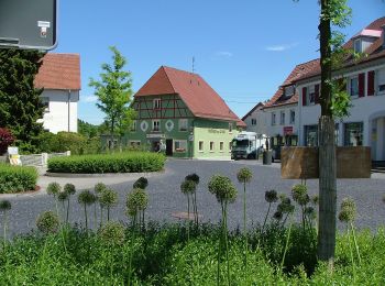
![Randonnée A pied Bad Schussenried - Bad Schussenried: Wanderweg 3 - Photo](https://media.geolcdn.com/t/350/260/11035e68-3d76-4e04-9fcb-77dd7226f146.jpeg&format=jpg&maxdim=2)
![A pied A pied](https://static1.geolcdn.com/sitytour/trail-icons/100.png)
Km
A pied
![](/images/other/stat-length.png)
![](https://static1.geolcdn.com/siteimages/upload/files/1508320355ic_sort_den_pos_24dp.png)
![](https://static1.geolcdn.com/siteimages/upload/files/1508320355ic_sort_den_neg_24dp.png)
![](https://static1.geolcdn.com/siteimages/upload/files/16400158638029165_repeat_loop_refresh_sync_direction_icon.png)
• Randonnée créée par Bad Schussenried. Symbole: rote Zahl auf weißem Hintergrund
![Randonnée A pied Ingoldingen - Querweg des Schwäbischen Albvereins (blauer Punkt) - Photo](https://media.geolcdn.com/t/350/260/1eb858ed-b98b-4692-9292-912434320f2f.jpeg&format=jpg&maxdim=2)
![A pied A pied](https://static1.geolcdn.com/sitytour/trail-icons/100.png)
Km
A pied
![](/images/other/stat-length.png)
![](https://static1.geolcdn.com/siteimages/upload/files/1508320355ic_sort_den_pos_24dp.png)
![](https://static1.geolcdn.com/siteimages/upload/files/1508320355ic_sort_den_neg_24dp.png)
![](https://static1.geolcdn.com/siteimages/upload/files/16400158638029165_repeat_loop_refresh_sync_direction_icon.png)
• Randonnée créée par Schwäbischer Albverein. Symbole: blauer Punkt auf weißem Grund
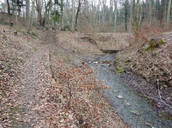
![Randonnée A pied Bad Schussenried - Bad Schussenried: Wanderweg 7 - Photo](https://media.geolcdn.com/t/350/260/ae95ff39-9d77-4ea1-ab09-dd9c855ee2ae.jpeg&format=jpg&maxdim=2)
![A pied A pied](https://static1.geolcdn.com/sitytour/trail-icons/100.png)
Km
A pied
![](/images/other/stat-length.png)
![](https://static1.geolcdn.com/siteimages/upload/files/1508320355ic_sort_den_pos_24dp.png)
![](https://static1.geolcdn.com/siteimages/upload/files/1508320355ic_sort_den_neg_24dp.png)
![](https://static1.geolcdn.com/siteimages/upload/files/16400158638029165_repeat_loop_refresh_sync_direction_icon.png)
• Randonnée créée par Bad Schussenried. Symbole: rote Zahl auf weißem Hintergrund
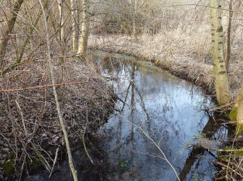
![Randonnée A pied Bad Schussenried - Bad Schussenried: Wanderweg 5 - Photo](https://media.geolcdn.com/t/350/260/f4cbfa20-ed04-4f60-aef3-1bdfe48f241c.jpeg&format=jpg&maxdim=2)
![A pied A pied](https://static1.geolcdn.com/sitytour/trail-icons/100.png)
Km
A pied
![](/images/other/stat-length.png)
![](https://static1.geolcdn.com/siteimages/upload/files/1508320355ic_sort_den_pos_24dp.png)
![](https://static1.geolcdn.com/siteimages/upload/files/1508320355ic_sort_den_neg_24dp.png)
![](https://static1.geolcdn.com/siteimages/upload/files/16400158638029165_repeat_loop_refresh_sync_direction_icon.png)
• Randonnée créée par Bad Schussenried. Symbole: rote Zahl auf weißem Hintergrund
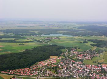
![Randonnée A pied Bad Schussenried - Bad Schussenried: Wanderweg 4 - Photo](https://media.geolcdn.com/t/350/260/544b115c-652c-4c81-a5e7-959f37e4da57.jpeg&format=jpg&maxdim=2)
![A pied A pied](https://static1.geolcdn.com/sitytour/trail-icons/100.png)
Km
A pied
![](/images/other/stat-length.png)
![](https://static1.geolcdn.com/siteimages/upload/files/1508320355ic_sort_den_pos_24dp.png)
![](https://static1.geolcdn.com/siteimages/upload/files/1508320355ic_sort_den_neg_24dp.png)
![](https://static1.geolcdn.com/siteimages/upload/files/16400158638029165_repeat_loop_refresh_sync_direction_icon.png)
• Randonnée créée par Bad Schussenried. Symbole: rote Zahl auf weißem Hintergrund
![Randonnée A pied Bad Schussenried - Bad Schussenried: Wanderweg 2 - Photo](https://media.geolcdn.com/t/350/260/544b115c-652c-4c81-a5e7-959f37e4da57.jpeg&format=jpg&maxdim=2)
![A pied A pied](https://static1.geolcdn.com/sitytour/trail-icons/100.png)
Km
A pied
![](/images/other/stat-length.png)
![](https://static1.geolcdn.com/siteimages/upload/files/1508320355ic_sort_den_pos_24dp.png)
![](https://static1.geolcdn.com/siteimages/upload/files/1508320355ic_sort_den_neg_24dp.png)
![](https://static1.geolcdn.com/siteimages/upload/files/16400158638029165_repeat_loop_refresh_sync_direction_icon.png)
• Randonnée créée par Bad Schussenried. Symbole: rote Zahl auf weißem Hintergrund
![Randonnée A pied Ingoldingen - Querweg des Schwäbischen Albvereins (blauer Punkt) - Photo](https://media.geolcdn.com/t/350/260/d8213e9c-556f-41cf-94cb-928f88a8a9c2.jpeg&format=jpg&maxdim=2)
![A pied A pied](https://static1.geolcdn.com/sitytour/trail-icons/100.png)
Km
A pied
![](/images/other/stat-length.png)
![](https://static1.geolcdn.com/siteimages/upload/files/1508320355ic_sort_den_pos_24dp.png)
![](https://static1.geolcdn.com/siteimages/upload/files/1508320355ic_sort_den_neg_24dp.png)
![](https://static1.geolcdn.com/siteimages/upload/files/16400158638029165_repeat_loop_refresh_sync_direction_icon.png)
• Randonnée créée par Schwäbischer Albverein. Symbole: blauer Punkt auf weißem Grund
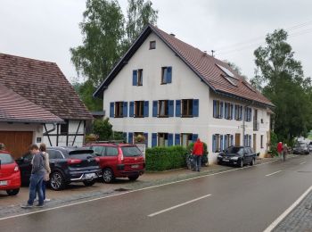
![Randonnée A pied Gutenzell-Hürbel - Nebenweg des Schwäbischen Albvereins (blaues Kreuz) - Photo](https://media.geolcdn.com/t/350/260/98be0aa1-0a08-4b73-a408-4ee164b643da.jpeg&format=jpg&maxdim=2)
![A pied A pied](https://static1.geolcdn.com/sitytour/trail-icons/100.png)
Km
A pied
![](/images/other/stat-length.png)
![](https://static1.geolcdn.com/siteimages/upload/files/1508320355ic_sort_den_pos_24dp.png)
![](https://static1.geolcdn.com/siteimages/upload/files/1508320355ic_sort_den_neg_24dp.png)
![](https://static1.geolcdn.com/siteimages/upload/files/16400158638029165_repeat_loop_refresh_sync_direction_icon.png)
• Randonnée créée par Schwäbischer Albverein. Symbole: blaues Kreuz/Plus auf weißem Grund
![Randonnée A pied Laupheim - Querweg des Schwäbischen Albvereins (blauer Punkt) - Photo](https://media.geolcdn.com/t/350/260/51c85c00-b653-4b8a-a34b-178b5ce8cce4.jpeg&format=jpg&maxdim=2)
![A pied A pied](https://static1.geolcdn.com/sitytour/trail-icons/100.png)
Km
A pied
![](/images/other/stat-length.png)
![](https://static1.geolcdn.com/siteimages/upload/files/1508320355ic_sort_den_pos_24dp.png)
![](https://static1.geolcdn.com/siteimages/upload/files/1508320355ic_sort_den_neg_24dp.png)
![](https://static1.geolcdn.com/siteimages/upload/files/16400158638029165_repeat_loop_refresh_sync_direction_icon.png)
• Randonnée créée par Schwäbischer Albverein. Symbole: Blauer Punkt auf weißem Grund
![Randonnée A pied Bad Schussenried - Bad Schussenried: Wanderweg 8 - Photo](https://media.geolcdn.com/t/350/260/544b115c-652c-4c81-a5e7-959f37e4da57.jpeg&format=jpg&maxdim=2)
![A pied A pied](https://static1.geolcdn.com/sitytour/trail-icons/100.png)
Km
A pied
![](/images/other/stat-length.png)
![](https://static1.geolcdn.com/siteimages/upload/files/1508320355ic_sort_den_pos_24dp.png)
![](https://static1.geolcdn.com/siteimages/upload/files/1508320355ic_sort_den_neg_24dp.png)
![](https://static1.geolcdn.com/siteimages/upload/files/16400158638029165_repeat_loop_refresh_sync_direction_icon.png)
• Randonnée créée par Bad Schussenried. Symbole: rote Zahl auf weißem Hintergrund
![Randonnée A pied Bad Schussenried - Bad Schussenried: Wanderweg 1 - Photo](https://media.geolcdn.com/t/350/260/544b115c-652c-4c81-a5e7-959f37e4da57.jpeg&format=jpg&maxdim=2)
![A pied A pied](https://static1.geolcdn.com/sitytour/trail-icons/100.png)
Km
A pied
![](/images/other/stat-length.png)
![](https://static1.geolcdn.com/siteimages/upload/files/1508320355ic_sort_den_pos_24dp.png)
![](https://static1.geolcdn.com/siteimages/upload/files/1508320355ic_sort_den_neg_24dp.png)
![](https://static1.geolcdn.com/siteimages/upload/files/16400158638029165_repeat_loop_refresh_sync_direction_icon.png)
• Randonnée créée par Bad Schussenried. Symbole: rote Zahl auf weißem Hintergrund
20 randonnées affichées sur 23
Application GPS de randonnée GRATUITE