![](/images/other/stat-length.png)
- Randonnées
- A pied
- Allemagne
- Bade-Wurtemberg
- Landkreis Böblingen
- Holzgerlingen
Holzgerlingen, Landkreis Böblingen, A pied : Les meilleures randonnées, itinéraires, parcours, balades et promenades
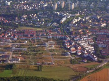
Holzgerlingen : découvrez les meilleures randonnées : 3 a pied. Tous ces circuits, parcours, itinéraires et activités en plein air sont disponibles dans nos applications SityTrail pour smartphones et tablettes.
Les meilleurs parcours (3)
![Randonnée A pied Holzgerlingen - Holzweg - Photo](https://media.geolcdn.com/t/350/260/4ef16a31-b9a6-46d9-9b25-eb050d7f4e9d.jpeg&format=jpg&maxdim=2)
![A pied A pied](https://static1.geolcdn.com/sitytour/trail-icons/100.png)
Km
A pied
![](/images/other/stat-length.png)
![](https://static1.geolcdn.com/siteimages/upload/files/1508320355ic_sort_den_pos_24dp.png)
![](https://static1.geolcdn.com/siteimages/upload/files/1508320355ic_sort_den_neg_24dp.png)
![](https://static1.geolcdn.com/siteimages/upload/files/16400158638029165_repeat_loop_refresh_sync_direction_icon.png)
• Symbole: Eule&Rabe
![Randonnée A pied Holzgerlingen - DE-SAV Blauer Punkt, Böblingen - Weil im Schönbuch - Photo](https://media.geolcdn.com/t/350/260/73a65faf-517f-4306-aebb-2054568e80fd.jpeg&format=jpg&maxdim=2)
![A pied A pied](https://static1.geolcdn.com/sitytour/trail-icons/100.png)
Km
A pied
![](/images/other/stat-length.png)
![](https://static1.geolcdn.com/siteimages/upload/files/1508320355ic_sort_den_pos_24dp.png)
![](https://static1.geolcdn.com/siteimages/upload/files/1508320355ic_sort_den_neg_24dp.png)
![](https://static1.geolcdn.com/siteimages/upload/files/16400158638029165_repeat_loop_refresh_sync_direction_icon.png)
• Randonnée créée par Schwäbischer Albverein. SAV Blauer Punkt, Böblingen - Weil im Schönbuch Symbole: Blauer Punkt a...
![Randonnée A pied Holzgerlingen - DE-SAV Blaues Hufeisen, Holzgerlingen - Böblingen - Photo](https://media.geolcdn.com/t/350/260/a987da4e-0647-4b3d-9a68-5e493489f8db.jpeg&format=jpg&maxdim=2)
![A pied A pied](https://static1.geolcdn.com/sitytour/trail-icons/100.png)
Km
A pied
![](/images/other/stat-length.png)
![](https://static1.geolcdn.com/siteimages/upload/files/1508320355ic_sort_den_pos_24dp.png)
![](https://static1.geolcdn.com/siteimages/upload/files/1508320355ic_sort_den_neg_24dp.png)
![](https://static1.geolcdn.com/siteimages/upload/files/16400158638029165_repeat_loop_refresh_sync_direction_icon.png)
• Randonnée créée par Schwäbischer Albverein. SAV Blaues Hufeisen, Holzgerlingen - Böblingen Symbole: liegendes blaue...
3 randonnées affichées sur 3
Application GPS de randonnée GRATUITE