![](/images/other/stat-length.png)
- Randonnées
- A pied
- Allemagne
- Bade-Wurtemberg
- Landkreis Ludwigsburg
- Kirchheim am Neckar
Kirchheim am Neckar, Landkreis Ludwigsburg, A pied : Les meilleures randonnées, itinéraires, parcours, balades et promenades
Kirchheim am Neckar : découvrez les meilleures randonnées : 2 a pied. Tous ces circuits, parcours, itinéraires et activités en plein air sont disponibles dans nos applications SityTrail pour smartphones et tablettes.
Les meilleurs parcours (2)
![Randonnée A pied Kirchheim am Neckar - Weinterrassen - Photo](https://media.geolcdn.com/t/350/260/35ba73c6-5a71-4f63-bf37-f4aa5f37458e.jpeg&format=jpg&maxdim=2)
![A pied A pied](https://static1.geolcdn.com/sitytour/trail-icons/100.png)
Km
A pied
![](/images/other/stat-length.png)
![](https://static1.geolcdn.com/siteimages/upload/files/1508320355ic_sort_den_pos_24dp.png)
![](https://static1.geolcdn.com/siteimages/upload/files/1508320355ic_sort_den_neg_24dp.png)
![](https://static1.geolcdn.com/siteimages/upload/files/16400158638029165_repeat_loop_refresh_sync_direction_icon.png)
• Randonnée créée par 3B-Tourismus-Team Bietigheim-Bissingen. Symbole: weiß/rotes Weinglas und weißer Zebrastreifen au...
![Randonnée A pied Kirchheim am Neckar - Kirchheimer Wanderweg - Photo](https://media.geolcdn.com/t/350/260/35ba73c6-5a71-4f63-bf37-f4aa5f37458e.jpeg&format=jpg&maxdim=2)
![A pied A pied](https://static1.geolcdn.com/sitytour/trail-icons/100.png)
Km
A pied
![](/images/other/stat-length.png)
![](https://static1.geolcdn.com/siteimages/upload/files/1508320355ic_sort_den_pos_24dp.png)
![](https://static1.geolcdn.com/siteimages/upload/files/1508320355ic_sort_den_neg_24dp.png)
![](https://static1.geolcdn.com/siteimages/upload/files/16400158638029165_repeat_loop_refresh_sync_direction_icon.png)
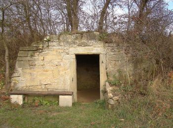
• Randonnée créée par Schwäbischer Albverein e.V., Ortsgruppe Kirchheim. Symbole: Kirchheimer Wappen: Weiße Kirche im ...
2 randonnées affichées sur 2
Application GPS de randonnée GRATUITE