![](/images/other/stat-length.png)
- Randonnées
- A pied
- Allemagne
- Bade-Wurtemberg
- Bodenseekreis
- Friedrichshafen
Friedrichshafen, Bodenseekreis, A pied : Les meilleures randonnées, itinéraires, parcours, balades et promenades
Friedrichshafen : découvrez les meilleures randonnées : 5 a pied. Tous ces circuits, parcours, itinéraires et activités en plein air sont disponibles dans nos applications SityTrail pour smartphones et tablettes.
Les meilleurs parcours (5)
![Randonnée A pied Friedrichshafen - Planetenweg Kluftern - Photo](https://media.geolcdn.com/t/350/260/46733009-a77d-469a-8bf1-fb80e19f2d17.jpeg&format=jpg&maxdim=2)
![A pied A pied](https://static1.geolcdn.com/sitytour/trail-icons/100.png)
Km
A pied
![](/images/other/stat-length.png)
![](https://static1.geolcdn.com/siteimages/upload/files/1508320355ic_sort_den_pos_24dp.png)
![](https://static1.geolcdn.com/siteimages/upload/files/1508320355ic_sort_den_neg_24dp.png)
![](https://static1.geolcdn.com/siteimages/upload/files/16400158638029165_repeat_loop_refresh_sync_direction_icon.png)
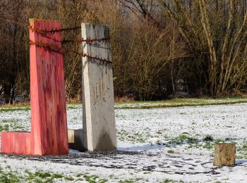
• Symbole: Planet
![Randonnée A pied Friedrichshafen - Teuringer Bächlepfad - Photo](https://media.geolcdn.com/t/350/260/658a6b00-cada-4a62-b9f7-1373ac7f923a.jpeg&format=jpg&maxdim=2)
![A pied A pied](https://static1.geolcdn.com/sitytour/trail-icons/100.png)
Km
A pied
![](/images/other/stat-length.png)
![](https://static1.geolcdn.com/siteimages/upload/files/1508320355ic_sort_den_pos_24dp.png)
![](https://static1.geolcdn.com/siteimages/upload/files/1508320355ic_sort_den_neg_24dp.png)
![](https://static1.geolcdn.com/siteimages/upload/files/16400158638029165_repeat_loop_refresh_sync_direction_icon.png)
• Randonnée créée par Oberteuringen.
![Randonnée A pied Friedrichshafen - Ortsrundweg Kluftern - Südrunde - Photo](https://media.geolcdn.com/t/350/260/24eac72b-5d33-4d11-abeb-8e8d2d4a2164.jpeg&format=jpg&maxdim=2)
![A pied A pied](https://static1.geolcdn.com/sitytour/trail-icons/100.png)
Km
A pied
![](/images/other/stat-length.png)
![](https://static1.geolcdn.com/siteimages/upload/files/1508320355ic_sort_den_pos_24dp.png)
![](https://static1.geolcdn.com/siteimages/upload/files/1508320355ic_sort_den_neg_24dp.png)
![](https://static1.geolcdn.com/siteimages/upload/files/16400158638029165_repeat_loop_refresh_sync_direction_icon.png)
• Symbole: schwarzer Buchstabe K in einem durch eine Pfeil unterbrochenen Kreis
![Randonnée A pied Friedrichshafen - Hirschlatter Runde - Photo](https://media.geolcdn.com/t/350/260/09582146-948f-4df4-ad5b-14d65b5403bd.jpeg&format=jpg&maxdim=2)
![A pied A pied](https://static1.geolcdn.com/sitytour/trail-icons/100.png)
Km
A pied
![](/images/other/stat-length.png)
![](https://static1.geolcdn.com/siteimages/upload/files/1508320355ic_sort_den_pos_24dp.png)
![](https://static1.geolcdn.com/siteimages/upload/files/1508320355ic_sort_den_neg_24dp.png)
![](https://static1.geolcdn.com/siteimages/upload/files/16400158638029165_repeat_loop_refresh_sync_direction_icon.png)
• Randonnée créée par Stadt Friedrichshafen. Symbole: Gelbe Raute auf weißem Grund, daruter Hirschlatter Runde in schw...
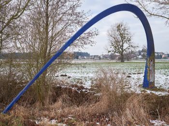
![Randonnée A pied Friedrichshafen - Ortsrundweg Kluftern - Nordrunde - Photo](https://media.geolcdn.com/t/350/260/a2a346b3-6d0a-41ec-bf52-3be9d53c8492.jpeg&format=jpg&maxdim=2)
![A pied A pied](https://static1.geolcdn.com/sitytour/trail-icons/100.png)
Km
A pied
![](/images/other/stat-length.png)
![](https://static1.geolcdn.com/siteimages/upload/files/1508320355ic_sort_den_pos_24dp.png)
![](https://static1.geolcdn.com/siteimages/upload/files/1508320355ic_sort_den_neg_24dp.png)
![](https://static1.geolcdn.com/siteimages/upload/files/16400158638029165_repeat_loop_refresh_sync_direction_icon.png)
• Symbole: schwarzer Buchstabe K in einem durch eine Pfeil unterbrochenen Kreis
5 randonnées affichées sur 5
Application GPS de randonnée GRATUITE