![](/images/other/stat-length.png)
- Randonnées
- A pied
- Allemagne
- Bade-Wurtemberg
- Landkreis Calw
- Bad Teinach-Zavelstein
Bad Teinach-Zavelstein, Landkreis Calw, A pied : Les meilleures randonnées, itinéraires, parcours, balades et promenades
Bad Teinach-Zavelstein : découvrez les meilleures randonnées : 4 a pied. Tous ces circuits, parcours, itinéraires et activités en plein air sont disponibles dans nos applications SityTrail pour smartphones et tablettes.
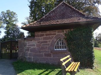
Les meilleurs parcours (4)
![Randonnée A pied Bad Teinach-Zavelstein - Alte Steige - Mittelbach - Photo](https://media.geolcdn.com/t/350/260/dbc5db38-c3f1-4810-a6fa-f6469b071c4a.jpeg&format=jpg&maxdim=2)
![A pied A pied](https://static1.geolcdn.com/sitytour/trail-icons/100.png)
Km
A pied
![](/images/other/stat-length.png)
![](https://static1.geolcdn.com/siteimages/upload/files/1508320355ic_sort_den_pos_24dp.png)
![](https://static1.geolcdn.com/siteimages/upload/files/1508320355ic_sort_den_neg_24dp.png)
![](https://static1.geolcdn.com/siteimages/upload/files/16400158638029165_repeat_loop_refresh_sync_direction_icon.png)
• Randonnée créée par Schwarzwaldverein. Symbole: Gelbe Raute auf weißem Grund
![Randonnée A pied Bad Teinach-Zavelstein - Der Teinacher - Photo](https://media.geolcdn.com/t/350/260/b5d64962-c315-45a2-8517-5a03de85b82a.jpeg&format=jpg&maxdim=2)
![A pied A pied](https://static1.geolcdn.com/sitytour/trail-icons/100.png)
Km
A pied
![](/images/other/stat-length.png)
![](https://static1.geolcdn.com/siteimages/upload/files/1508320355ic_sort_den_pos_24dp.png)
![](https://static1.geolcdn.com/siteimages/upload/files/1508320355ic_sort_den_neg_24dp.png)
![](https://static1.geolcdn.com/siteimages/upload/files/16400158638029165_repeat_loop_refresh_sync_direction_icon.png)
• Symbole: Symbol Schwarzwald-Genießerpfade auf weißem Grund mit Schriftzug Der Teinacher
![Randonnée A pied Bad Teinach-Zavelstein - Krokusweg - Photo](https://media.geolcdn.com/t/350/260/ed9ddac0-e2b7-4193-bb85-3696902c6c72.jpeg&format=jpg&maxdim=2)
![A pied A pied](https://static1.geolcdn.com/sitytour/trail-icons/100.png)
Km
A pied
![](/images/other/stat-length.png)
![](https://static1.geolcdn.com/siteimages/upload/files/1508320355ic_sort_den_pos_24dp.png)
![](https://static1.geolcdn.com/siteimages/upload/files/1508320355ic_sort_den_neg_24dp.png)
![](https://static1.geolcdn.com/siteimages/upload/files/16400158638029165_repeat_loop_refresh_sync_direction_icon.png)
• Site web: https://www.teinachtal.de/de/aktiv/wandern/spazierwanderungen/krokusweg/
![Randonnée A pied Bad Teinach-Zavelstein - Sägberg - Kirchhalde - Photo](https://media.geolcdn.com/t/350/260/3a013f2b-b3ed-4cad-a95d-fcc8957b7b43.jpeg&format=jpg&maxdim=2)
![A pied A pied](https://static1.geolcdn.com/sitytour/trail-icons/100.png)
Km
A pied
![](/images/other/stat-length.png)
![](https://static1.geolcdn.com/siteimages/upload/files/1508320355ic_sort_den_pos_24dp.png)
![](https://static1.geolcdn.com/siteimages/upload/files/1508320355ic_sort_den_neg_24dp.png)
![](https://static1.geolcdn.com/siteimages/upload/files/16400158638029165_repeat_loop_refresh_sync_direction_icon.png)
• Randonnée créée par Schwarzwaldverein. Symbole: Gelbe Raute auf weißem Grund
4 randonnées affichées sur 4
Application GPS de randonnée GRATUITE