![](/images/other/stat-length.png)
- Randonnées
- A pied
- Allemagne
- Bade-Wurtemberg
- Landkreis Freudenstadt
- Bad Rippoldsau-Schapbach
Bad Rippoldsau-Schapbach, Landkreis Freudenstadt, A pied : Les meilleures randonnées, itinéraires, parcours, balades et promenades
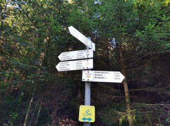
Bad Rippoldsau-Schapbach : découvrez les meilleures randonnées : 12 a pied et 2 marche. Tous ces circuits, parcours, itinéraires et activités en plein air sont disponibles dans nos applications SityTrail pour smartphones et tablettes.
Les meilleurs parcours (14)
![Randonnée A pied Bad Rippoldsau-Schapbach - Bad Rippoldsau - Burgbachhöhe (Mittelweg) - Photo](https://media.geolcdn.com/t/350/260/35019236-3d2a-4e92-a8c8-def75f614134.jpeg&format=jpg&maxdim=2)
![A pied A pied](https://static1.geolcdn.com/sitytour/trail-icons/100.png)
Km
A pied
![](/images/other/stat-length.png)
![](https://static1.geolcdn.com/siteimages/upload/files/1508320355ic_sort_den_pos_24dp.png)
![](https://static1.geolcdn.com/siteimages/upload/files/1508320355ic_sort_den_neg_24dp.png)
![](https://static1.geolcdn.com/siteimages/upload/files/16400158638029165_repeat_loop_refresh_sync_direction_icon.png)
• Randonnée créée par Schwarzwaldverein. Symbole: Blaue Raute auf weißem Grund
![Randonnée A pied Bad Rippoldsau-Schapbach - Klösterle-Schleife - Photo](https://media.geolcdn.com/t/350/260/35019236-3d2a-4e92-a8c8-def75f614134.jpeg&format=jpg&maxdim=2)
![A pied A pied](https://static1.geolcdn.com/sitytour/trail-icons/100.png)
Km
A pied
![](/images/other/stat-length.png)
![](https://static1.geolcdn.com/siteimages/upload/files/1508320355ic_sort_den_pos_24dp.png)
![](https://static1.geolcdn.com/siteimages/upload/files/1508320355ic_sort_den_neg_24dp.png)
![](https://static1.geolcdn.com/siteimages/upload/files/16400158638029165_repeat_loop_refresh_sync_direction_icon.png)
• Randonnée créée par Tourist-Information Bad Rippoldsau-Schapbach. Symbole: Bollenhut
![Randonnée A pied Bad Rippoldsau-Schapbach - Vor Seebach - Glaswaldsee - Photo](https://media.geolcdn.com/t/350/260/32ce469d-a806-4819-b37d-db55f9f1db0c.jpeg&format=jpg&maxdim=2)
![A pied A pied](https://static1.geolcdn.com/sitytour/trail-icons/100.png)
Km
A pied
![](/images/other/stat-length.png)
![](https://static1.geolcdn.com/siteimages/upload/files/1508320355ic_sort_den_pos_24dp.png)
![](https://static1.geolcdn.com/siteimages/upload/files/1508320355ic_sort_den_neg_24dp.png)
![](https://static1.geolcdn.com/siteimages/upload/files/16400158638029165_repeat_loop_refresh_sync_direction_icon.png)
• Randonnée créée par Schwarzwaldverein. Symbole: Blaue Raute auf weißem Grund
![Randonnée A pied Bad Rippoldsau-Schapbach - Schapbach - See Ebene - Photo](https://media.geolcdn.com/t/350/260/32ce469d-a806-4819-b37d-db55f9f1db0c.jpeg&format=jpg&maxdim=2)
![A pied A pied](https://static1.geolcdn.com/sitytour/trail-icons/100.png)
Km
A pied
![](/images/other/stat-length.png)
![](https://static1.geolcdn.com/siteimages/upload/files/1508320355ic_sort_den_pos_24dp.png)
![](https://static1.geolcdn.com/siteimages/upload/files/1508320355ic_sort_den_neg_24dp.png)
![](https://static1.geolcdn.com/siteimages/upload/files/16400158638029165_repeat_loop_refresh_sync_direction_icon.png)
• Randonnée créée par Schwarzwaldverein. Symbole: Blaue Raute auf weißem Grund
![Randonnée A pied Bad Rippoldsau-Schapbach - Wolftalweg - Photo](https://media.geolcdn.com/t/350/260/35019236-3d2a-4e92-a8c8-def75f614134.jpeg&format=jpg&maxdim=2)
![A pied A pied](https://static1.geolcdn.com/sitytour/trail-icons/100.png)
Km
A pied
![](/images/other/stat-length.png)
![](https://static1.geolcdn.com/siteimages/upload/files/1508320355ic_sort_den_pos_24dp.png)
![](https://static1.geolcdn.com/siteimages/upload/files/1508320355ic_sort_den_neg_24dp.png)
![](https://static1.geolcdn.com/siteimages/upload/files/16400158638029165_repeat_loop_refresh_sync_direction_icon.png)
• Randonnée créée par Schwarzwaldverein. Symbole: Gelbe Raute auf weißem Grund
![Randonnée A pied Bad Rippoldsau-Schapbach - Grenzweg - Photo](https://media.geolcdn.com/t/350/260/85b03675-5229-4e15-9715-c3e4e8d733cf.jpeg&format=jpg&maxdim=2)
![A pied A pied](https://static1.geolcdn.com/sitytour/trail-icons/100.png)
Km
A pied
![](/images/other/stat-length.png)
![](https://static1.geolcdn.com/siteimages/upload/files/1508320355ic_sort_den_pos_24dp.png)
![](https://static1.geolcdn.com/siteimages/upload/files/1508320355ic_sort_den_neg_24dp.png)
![](https://static1.geolcdn.com/siteimages/upload/files/16400158638029165_repeat_loop_refresh_sync_direction_icon.png)
• Randonnée créée par Schwarzwaldverein. Symbole: Blaue Raute auf weißem Grund
![Randonnée Marche Bad Rippoldsau-Schapbach - Bad Rippoldsau - cascade de Burgbach – lac de retenue Kinzig - cascade du Büstenloch - Photo](https://media.geolcdn.com/t/350/260/8aa0db77-9a41-4d70-a7c9-61e5dfa2ce55.jpg&format=jpg&maxdim=2)
![Marche Marche](https://static1.geolcdn.com/sitytour/trail-icons/101.png)
Km
Marche
![](/images/other/stat-length.png)
![](https://static1.geolcdn.com/siteimages/upload/files/1508320355ic_sort_den_pos_24dp.png)
![](https://static1.geolcdn.com/siteimages/upload/files/1508320355ic_sort_den_neg_24dp.png)
![](https://static1.geolcdn.com/siteimages/upload/files/16400158638029165_repeat_loop_refresh_sync_direction_icon.png)
• Belle rando assez physique pour découvrir à pied la région de Bad Rippoldsau. De belles découvertes comme les réserve...
![Randonnée A pied Bad Rippoldsau-Schapbach - Bad Rippoldsau-Bad - Holzwald - Photo](https://media.geolcdn.com/t/350/260/92faf645-c748-4220-928f-736f9ccc9657.jpeg&format=jpg&maxdim=2)
![A pied A pied](https://static1.geolcdn.com/sitytour/trail-icons/100.png)
Km
A pied
![](/images/other/stat-length.png)
![](https://static1.geolcdn.com/siteimages/upload/files/1508320355ic_sort_den_pos_24dp.png)
![](https://static1.geolcdn.com/siteimages/upload/files/1508320355ic_sort_den_neg_24dp.png)
![](https://static1.geolcdn.com/siteimages/upload/files/16400158638029165_repeat_loop_refresh_sync_direction_icon.png)
• Randonnée créée par Schwarzwaldverein. Symbole: Gelbe Raute auf weißem Grund
![Randonnée A pied Bad Rippoldsau-Schapbach - Panoramaweg Bad Rippoldsau - Photo](https://media.geolcdn.com/t/350/260/92faf645-c748-4220-928f-736f9ccc9657.jpeg&format=jpg&maxdim=2)
![A pied A pied](https://static1.geolcdn.com/sitytour/trail-icons/100.png)
Km
A pied
![](/images/other/stat-length.png)
![](https://static1.geolcdn.com/siteimages/upload/files/1508320355ic_sort_den_pos_24dp.png)
![](https://static1.geolcdn.com/siteimages/upload/files/1508320355ic_sort_den_neg_24dp.png)
![](https://static1.geolcdn.com/siteimages/upload/files/16400158638029165_repeat_loop_refresh_sync_direction_icon.png)
• Randonnée créée par Schwarzwaldverein. Symbole: Gelbe Raute auf weißem Grund
![Randonnée A pied Bad Rippoldsau-Schapbach - Bad Rippoldsau - Grüne Sitzbank - Photo](https://media.geolcdn.com/t/350/260/92faf645-c748-4220-928f-736f9ccc9657.jpeg&format=jpg&maxdim=2)
![A pied A pied](https://static1.geolcdn.com/sitytour/trail-icons/100.png)
Km
A pied
![](/images/other/stat-length.png)
![](https://static1.geolcdn.com/siteimages/upload/files/1508320355ic_sort_den_pos_24dp.png)
![](https://static1.geolcdn.com/siteimages/upload/files/1508320355ic_sort_den_neg_24dp.png)
![](https://static1.geolcdn.com/siteimages/upload/files/16400158638029165_repeat_loop_refresh_sync_direction_icon.png)
• Randonnée créée par Schwarzwaldverein. Symbole: Gelbe Raute auf weißem Grund
![Randonnée A pied Bad Rippoldsau-Schapbach - Bad Rippoldsau - Glaswald-Sattelege - Photo](https://media.geolcdn.com/t/350/260/ad89a840-b260-4d04-a6e2-3d195d17c289.jpeg&format=jpg&maxdim=2)
![A pied A pied](https://static1.geolcdn.com/sitytour/trail-icons/100.png)
Km
A pied
![](/images/other/stat-length.png)
![](https://static1.geolcdn.com/siteimages/upload/files/1508320355ic_sort_den_pos_24dp.png)
![](https://static1.geolcdn.com/siteimages/upload/files/1508320355ic_sort_den_neg_24dp.png)
![](https://static1.geolcdn.com/siteimages/upload/files/16400158638029165_repeat_loop_refresh_sync_direction_icon.png)
• Randonnée créée par Schwarzwaldverein. Symbole: Gelbe Raute auf weißem Grund
![Randonnée A pied Bad Rippoldsau-Schapbach - Am Wolfenberg - Kleiner Absbach - Photo](https://media.geolcdn.com/t/350/260/ext.jpg?maxdim=2&url=https%3A%2F%2Fstatic1.geolcdn.com%2Fsiteimages%2Fupload%2Ffiles%2F1545311037marcheuse_200dpi.jpg)
![A pied A pied](https://static1.geolcdn.com/sitytour/trail-icons/100.png)
Km
A pied
![](/images/other/stat-length.png)
![](https://static1.geolcdn.com/siteimages/upload/files/1508320355ic_sort_den_pos_24dp.png)
![](https://static1.geolcdn.com/siteimages/upload/files/1508320355ic_sort_den_neg_24dp.png)
![](https://static1.geolcdn.com/siteimages/upload/files/16400158638029165_repeat_loop_refresh_sync_direction_icon.png)
• Randonnée créée par Schwarzwaldverein. Symbole: Gelbe Raute auf weißem Grund
![Randonnée A pied Bad Rippoldsau-Schapbach - Bad Rippoldsau - Freudenstadt - Photo](https://media.geolcdn.com/t/350/260/ext.jpg?maxdim=2&url=https%3A%2F%2Fstatic1.geolcdn.com%2Fsiteimages%2Fupload%2Ffiles%2F1545311037marcheuse_200dpi.jpg)
![A pied A pied](https://static1.geolcdn.com/sitytour/trail-icons/100.png)
Km
A pied
![](/images/other/stat-length.png)
![](https://static1.geolcdn.com/siteimages/upload/files/1508320355ic_sort_den_pos_24dp.png)
![](https://static1.geolcdn.com/siteimages/upload/files/1508320355ic_sort_den_neg_24dp.png)
![](https://static1.geolcdn.com/siteimages/upload/files/16400158638029165_repeat_loop_refresh_sync_direction_icon.png)
• Randonnée créée par Schwarzwaldverein. Symbole: Blaue Raute auf weißem Grund
![Randonnée Marche Bad Rippoldsau-Schapbach - Kniebis shwarzwald - Photo](https://media.geolcdn.com/t/350/260/ext.jpg?maxdim=2&url=https%3A%2F%2Fstatic1.geolcdn.com%2Fsiteimages%2Fupload%2Ffiles%2F1553511878bg_sport_marche.png)
![Marche Marche](https://static1.geolcdn.com/sitytour/trail-icons/101.png)
Km
Marche
![](/images/other/stat-length.png)
![](https://static1.geolcdn.com/siteimages/upload/files/1508320355ic_sort_den_pos_24dp.png)
![](https://static1.geolcdn.com/siteimages/upload/files/1508320355ic_sort_den_neg_24dp.png)
![](https://static1.geolcdn.com/siteimages/upload/files/16400158638029165_repeat_loop_refresh_sync_direction_icon.png)
14 randonnées affichées sur 14
Application GPS de randonnée GRATUITE