


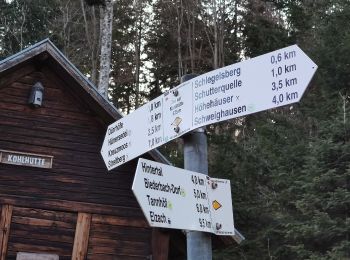
3,3 km | 4,3 km-effort
Landkreis Emmendingen : découvrez les meilleures randonnées : 35 a pied et 11 marche. Tous ces circuits, parcours, itinéraires et activités en plein air sont disponibles dans nos applications SityTrail pour smartphones et tablettes.
A pied


• Randonnée créée par Schwarzwaldverein. Symbole: Gelbe Raute auf weißem Grund
A pied
• Randonnée créée par Schwarzwaldverein. Symbole: Gelbe Raute auf weißem Grund
A pied
• Randonnée créée par Schwarzwaldverein. Symbole: Gelbe Raute auf weißem Grund
A pied
• Randonnée créée par Schwarzwaldverein. Symbole: Blaue Raute auf weißem Grund
A pied
• Randonnée créée par Schwarzwaldverein. Symbole: Blaue Raute auf weißem Grund
A pied
• Randonnée créée par Schwarzwaldverein. Symbole: Blaue Raute auf weißem Grund
A pied
• Randonnée créée par Schwarzwaldverein. Symbole: Gelbe Raute auf weißem Grund
A pied
• Randonnée créée par PLENUM Naturgarten Kaiserstuhl.
A pied
• Randonnée créée par Schwarzwaldverein. Symbole: Blaue Raute auf weißem Grund
A pied
• Randonnée créée par Schwarzwaldverein. Symbole: Blaue Raute auf weißem Grund
A pied
• Randonnée créée par Schwarzwaldverein. Symbole: Blaue Raute auf weißem Grund
A pied
• Randonnée créée par Schwarzwaldverein Waldkirch-Kandel.
A pied
• Der Kirschbaumpfad zum Wandern von Sasbach nach Riegel. Der Themenpfad am Kaiserstuhl verbindet das Wandern und die N...
A pied
• Symbole: green lime tree leaf
A pied
• Randonnée créée par Schwarzwaldverein. Symbole: Blaue Raute auf weißem Grund
A pied
• Randonnée créée par Schwarzwaldverein. Symbole: Blaue Raute auf weißem Grund
A pied
• Randonnée créée par Schwarzwaldverein. Symbole: Gelbe Raute auf weißem Grund
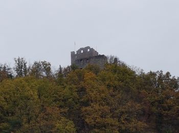
Marche
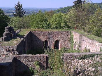
• Randonnée pour découvrir les ruines du château du Schwarzenburg, solitaire et romantique, avec de belles vues sur la ...
A pied
• Randonnée créée par Schwarzwaldverein. Symbole: Gelbe Raute auf weißem Grund
A pied
20 randonnées affichées sur 46
Application GPS de randonnée GRATUITE
 SityTrail
IGN / Instituts géographiques
SityTrail World
Le monde est à vous