![](/images/other/stat-length.png)
- Randonnées
- A pied
- Allemagne
- Bavière
- Landkreis Forchheim
- Gößweinstein
Gößweinstein, Landkreis Forchheim, A pied : Les meilleures randonnées, itinéraires, parcours, balades et promenades
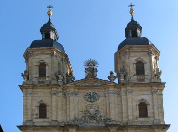
Gößweinstein : découvrez les meilleures randonnées : 10 a pied. Tous ces circuits, parcours, itinéraires et activités en plein air sont disponibles dans nos applications SityTrail pour smartphones et tablettes.
Les meilleurs parcours (10)
![Randonnée A pied Gößweinstein - Rundweg um Morschreuth - Photo](https://media.geolcdn.com/t/350/260/6412c81c-d049-48fc-b433-8fab5c4014dc.jpeg&format=jpg&maxdim=2)
![A pied A pied](https://static1.geolcdn.com/sitytour/trail-icons/100.png)
Km
A pied
![](/images/other/stat-length.png)
![](https://static1.geolcdn.com/siteimages/upload/files/1508320355ic_sort_den_pos_24dp.png)
![](https://static1.geolcdn.com/siteimages/upload/files/1508320355ic_sort_den_neg_24dp.png)
![](https://static1.geolcdn.com/siteimages/upload/files/16400158638029165_repeat_loop_refresh_sync_direction_icon.png)
• Randonnée créée par Gemeinde Gößweinstein. abgeschlossen (Mär. 2013 by cycling_zno) Symbole: Grüner Ring auf weißem...
![Randonnée A pied Gößweinstein - Morschreuth-Wolkenstein-Rödelfels - Photo](https://media.geolcdn.com/t/350/260/19b4dee6-6778-4da0-a1b4-6991c5ebaad3.jpeg&format=jpg&maxdim=2)
![A pied A pied](https://static1.geolcdn.com/sitytour/trail-icons/100.png)
Km
A pied
![](/images/other/stat-length.png)
![](https://static1.geolcdn.com/siteimages/upload/files/1508320355ic_sort_den_pos_24dp.png)
![](https://static1.geolcdn.com/siteimages/upload/files/1508320355ic_sort_den_neg_24dp.png)
![](https://static1.geolcdn.com/siteimages/upload/files/16400158638029165_repeat_loop_refresh_sync_direction_icon.png)
• Randonnée créée par Gemeinde Gößweinstein. abgeschlossen (Mär. 2013 by cycling_zno) Symbole: Blauer Ring auf weißem...
![Randonnée A pied Gößweinstein - Gößweinstein-Kohlstein - Photo](https://media.geolcdn.com/t/350/260/bc958317-6ee4-4c2b-a2eb-883a412a13bd.jpeg&format=jpg&maxdim=2)
![A pied A pied](https://static1.geolcdn.com/sitytour/trail-icons/100.png)
Km
A pied
![](/images/other/stat-length.png)
![](https://static1.geolcdn.com/siteimages/upload/files/1508320355ic_sort_den_pos_24dp.png)
![](https://static1.geolcdn.com/siteimages/upload/files/1508320355ic_sort_den_neg_24dp.png)
![](https://static1.geolcdn.com/siteimages/upload/files/16400158638029165_repeat_loop_refresh_sync_direction_icon.png)
• Randonnée créée par Gemeinde Gößweinstein. Symbole: Grüner Balken auf weißem Grund
![Randonnée A pied Gößweinstein - Rundwanderweg Behringersmühle-Moritz - Photo](https://media.geolcdn.com/t/350/260/a8c60082-5f68-4e63-99a5-fa587b7f14b2.jpeg&format=jpg&maxdim=2)
![A pied A pied](https://static1.geolcdn.com/sitytour/trail-icons/100.png)
Km
A pied
![](/images/other/stat-length.png)
![](https://static1.geolcdn.com/siteimages/upload/files/1508320355ic_sort_den_pos_24dp.png)
![](https://static1.geolcdn.com/siteimages/upload/files/1508320355ic_sort_den_neg_24dp.png)
![](https://static1.geolcdn.com/siteimages/upload/files/16400158638029165_repeat_loop_refresh_sync_direction_icon.png)
• Randonnée créée par Gemeinde Gößweinstein. abgeschlossen (Mär. 2013 by cycling_zno) Symbole: Blauer Ring auf weißem...
![Randonnée A pied Gößweinstein - Rundwanderweg Gößweinstein Förstelstein - Photo](https://media.geolcdn.com/t/350/260/6eb6ce27-8dd0-43ef-8cdf-da7c94364ef5.jpeg&format=jpg&maxdim=2)
![A pied A pied](https://static1.geolcdn.com/sitytour/trail-icons/100.png)
Km
A pied
![](/images/other/stat-length.png)
![](https://static1.geolcdn.com/siteimages/upload/files/1508320355ic_sort_den_pos_24dp.png)
![](https://static1.geolcdn.com/siteimages/upload/files/1508320355ic_sort_den_neg_24dp.png)
![](https://static1.geolcdn.com/siteimages/upload/files/16400158638029165_repeat_loop_refresh_sync_direction_icon.png)
• Randonnée créée par Gemeinde Gößweinstein. abgeschlossen (Mär. 2013 by cycling_zno) Symbole: Gelber Ring auf weißem...
![Randonnée A pied Gößweinstein - Rundweg um Leutzdorf - Photo](https://media.geolcdn.com/t/350/260/0d3edfe8-7ebc-483b-8901-0a6b13b7447d.jpeg&format=jpg&maxdim=2)
![A pied A pied](https://static1.geolcdn.com/sitytour/trail-icons/100.png)
Km
A pied
![](/images/other/stat-length.png)
![](https://static1.geolcdn.com/siteimages/upload/files/1508320355ic_sort_den_pos_24dp.png)
![](https://static1.geolcdn.com/siteimages/upload/files/1508320355ic_sort_den_neg_24dp.png)
![](https://static1.geolcdn.com/siteimages/upload/files/16400158638029165_repeat_loop_refresh_sync_direction_icon.png)
• Randonnée créée par Gemeinde Gößweinstein. Symbole: Blauer Ring auf gelbem Grund
![Randonnée A pied Gößweinstein - Rundwanderweg Gößweinstein Hühnerloh - Photo](https://media.geolcdn.com/t/350/260/87da6daa-5ec3-4d2f-a2c1-d7a57614b17c.jpeg&format=jpg&maxdim=2)
![A pied A pied](https://static1.geolcdn.com/sitytour/trail-icons/100.png)
Km
A pied
![](/images/other/stat-length.png)
![](https://static1.geolcdn.com/siteimages/upload/files/1508320355ic_sort_den_pos_24dp.png)
![](https://static1.geolcdn.com/siteimages/upload/files/1508320355ic_sort_den_neg_24dp.png)
![](https://static1.geolcdn.com/siteimages/upload/files/16400158638029165_repeat_loop_refresh_sync_direction_icon.png)
• Randonnée créée par Gemeinde Gößweinstein. abgeschlossen (Mär. 2013 by cycling_zno) Symbole: Schwarzer Punkt auf we...
![Randonnée A pied Gößweinstein - Von der Fellner-Doline zur Stempfermühlquelle - Photo](https://media.geolcdn.com/t/350/260/6837834a-3a9b-4dc8-87db-10fd4f8df6fc.jpeg&format=jpg&maxdim=2)
![A pied A pied](https://static1.geolcdn.com/sitytour/trail-icons/100.png)
Km
A pied
![](/images/other/stat-length.png)
![](https://static1.geolcdn.com/siteimages/upload/files/1508320355ic_sort_den_pos_24dp.png)
![](https://static1.geolcdn.com/siteimages/upload/files/1508320355ic_sort_den_neg_24dp.png)
![](https://static1.geolcdn.com/siteimages/upload/files/16400158638029165_repeat_loop_refresh_sync_direction_icon.png)
• Randonnée créée par Gemeinde Gößweinstein. abgeschlossen (Mär. 2013 by cycling_zno) Symbole: Höhlengang und Welle
![Randonnée A pied Gößweinstein - Rundwanderweg Gößweinstein-Pavillon - Photo](https://media.geolcdn.com/t/350/260/480cbf0c-7090-4f2e-9783-efbcbed501c6.jpeg&format=jpg&maxdim=2)
![A pied A pied](https://static1.geolcdn.com/sitytour/trail-icons/100.png)
Km
A pied
![](/images/other/stat-length.png)
![](https://static1.geolcdn.com/siteimages/upload/files/1508320355ic_sort_den_pos_24dp.png)
![](https://static1.geolcdn.com/siteimages/upload/files/1508320355ic_sort_den_neg_24dp.png)
![](https://static1.geolcdn.com/siteimages/upload/files/16400158638029165_repeat_loop_refresh_sync_direction_icon.png)
• Randonnée créée par Gemeinde Gößweinstein. abgeschlossen (Mär. 2013 by cycling_zno) Symbole: Roter Ring auf weißem ...
![Randonnée A pied Gößweinstein - Wichsenstein-Schlehenmühle - Photo](https://media.geolcdn.com/t/350/260/669949cc-2cae-4fcb-a87c-16ede380e473.jpeg&format=jpg&maxdim=2)
![A pied A pied](https://static1.geolcdn.com/sitytour/trail-icons/100.png)
Km
A pied
![](/images/other/stat-length.png)
![](https://static1.geolcdn.com/siteimages/upload/files/1508320355ic_sort_den_pos_24dp.png)
![](https://static1.geolcdn.com/siteimages/upload/files/1508320355ic_sort_den_neg_24dp.png)
![](https://static1.geolcdn.com/siteimages/upload/files/16400158638029165_repeat_loop_refresh_sync_direction_icon.png)
• Randonnée créée par Gemeinde Gößweinstein. abgeschlossen (Mär. 2013 by cycling_zno) Symbole: Blauer Ring auf weißem...
10 randonnées affichées sur 10
Application GPS de randonnée GRATUITE