Maxhütte-Haidhof, Landkreis Schwandorf, A pied : Les meilleures randonnées, itinéraires, parcours, balades et promenades

Maxhütte-Haidhof : découvrez les meilleures randonnées : 8 a pied. Tous ces circuits, parcours, itinéraires et activités en plein air sont disponibles dans nos applications SityTrail pour smartphones et tablettes.


Les meilleurs parcours (8)
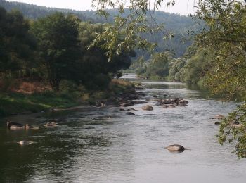
Randonnée A pied Maxhütte-Haidhof - Regentalsteig nach Hirschling (Gelbe 8) - Photo
A pied 8.307
Km
GUIDE+

A pied

Facile
Maxhütte-Haidhof, Bavière, Landkreis Schwandorf, Allemagne
8,3 km | 11,6 km-effort
2h 38min
260 m
220 m
Non
SityTrail - itinéraires balisés pédestres

• Randonnée créée par Stadt Burglengenfeld, Stadt Teublitz, Stadt Maxhütte-Haidhof.
Randonnée A pied Maxhütte-Haidhof - Ökumenischer Besinnungsweg Thema
A pied 4.424
Km
GUIDE+

A pied

Facile
Maxhütte-Haidhof, Bavière, Landkreis Schwandorf, Allemagne
4,4 km | 5,3 km-effort
1h 11min
60 m
76 m
Non
SityTrail - itinéraires balisés pédestres

• Randonnée créée par Stadt Burglengenfeld, Stadt Teublitz, Stadt Maxhütte-Haidhof. Symbole: yellow_round with white 14

Randonnée A pied Maxhütte-Haidhof - O 78 Leonberg - Ramspau (Rotes Rechteck) - Photo
A pied 5.235
Km
GUIDE+

A pied

Facile
Maxhütte-Haidhof, Bavière, Landkreis Schwandorf, Allemagne
5,2 km | 6,7 km-effort
1h 31min
96 m
162 m
Non
SityTrail - itinéraires balisés pédestres

• Randonnée créée par Waldverein Regensburg. Symbole: Rotes Rechteck auf weißem Grund
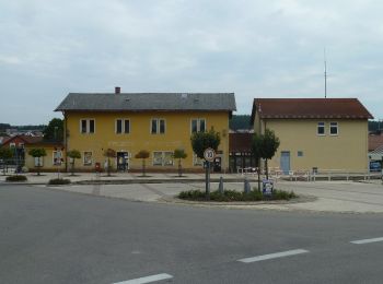
Randonnée A pied Maxhütte-Haidhof - O 46 Bahnhof Maxhütte-Haidhof - Knotenpunkt Geilenberg (Rotes Rechteck) - Photo
A pied 9.024
Km
GUIDE+

A pied

Facile
Maxhütte-Haidhof, Bavière, Landkreis Schwandorf, Allemagne
9 km | 12,8 km-effort
2h 54min
315 m
184 m
Non
SityTrail - itinéraires balisés pédestres

• Randonnée créée par Waldverein Regensburg. Symbole: Rotes Rechteck auf weißem Grund

Randonnée A pied Maxhütte-Haidhof - O 48 Bahnhof Maxhütte-Haidhof - Marienthal (Blaues Rechteck) - Photo
A pied 7.077
Km
GUIDE+

A pied

Facile
Maxhütte-Haidhof, Bavière, Landkreis Schwandorf, Allemagne
7,1 km | 9,4 km-effort
2h 8min
165 m
204 m
Non
SityTrail - itinéraires balisés pédestres

• Randonnée créée par Waldverein Regensburg. Symbole: Blaues Rechteck auf weißem Grund

Randonnée A pied Maxhütte-Haidhof - Sagensteig (Rote 7) - Photo
A pied 6.752
Km
GUIDE+

A pied

Facile
Maxhütte-Haidhof, Bavière, Landkreis Schwandorf, Allemagne
6,8 km | 9,1 km-effort
2h 3min
177 m
159 m
Non
SityTrail - itinéraires balisés pédestres

• Randonnée créée par Stadt Burglengenfeld, Stadt Teublitz, Stadt Maxhütte-Haidhof.
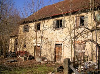
Randonnée A pied Maxhütte-Haidhof - Sauforstrunde (Lila 9) - Photo
A pied 11.871
Km
GUIDE+

A pied

Facile
Maxhütte-Haidhof, Bavière, Landkreis Schwandorf, Allemagne
11,9 km | 13,8 km-effort
3h 7min
142 m
145 m
Oui
SityTrail - itinéraires balisés pédestres

• Randonnée créée par Städte Burglengenfeld/Maxhütte-Haidhof/Teublitz.

Randonnée A pied Maxhütte-Haidhof - Leonberger Panoramaweg (Graue 11) - Photo
A pied 6.266
Km
GUIDE+

A pied

Facile
Maxhütte-Haidhof, Bavière, Landkreis Schwandorf, Allemagne
6,3 km | 8,3 km-effort
1h 53min
155 m
143 m
Oui
SityTrail - itinéraires balisés pédestres

8 randonnées affichées sur 8

Application GPS de randonnée GRATUITE

Logo SityTrail SityTrail

IGN / Instituts géographiques

Télécharger SityTrail sur l'App Store Télécharger SityTrail sur Google Play

Logo SityTrail SityTrail World

Le monde est à vous

Télécharger SityTrail sur l'App Store Télécharger SityTrail sur Google Play Télécharger SityTrail sur Huawei AppGallery

Activités

Fermer
Mes abonnements