Cobourg, Bavière, A pied : Les meilleures randonnées, itinéraires, parcours, balades et promenades

Cobourg : découvrez les meilleures randonnées : 2 a pied et 1 marche. Tous ces circuits, parcours, itinéraires et activités en plein air sont disponibles dans nos applications SityTrail pour smartphones et tablettes.


Les meilleurs parcours (3)
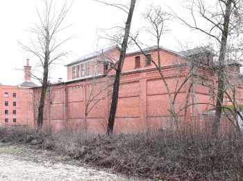
Randonnée A pied  - Coburger Rundwanderweg - Photo
A pied 34.022
Km
GUIDE+

A pied

Très difficile
, Bavière, Cobourg, Allemagne
34 km | 43 km-effort
9h 53min
712 m
704 m
Oui
SityTrail - itinéraires balisés pédestres

• mapped by roamingbecki 2014-03-16 Symbole: Red C on white ground Site web: http://www.wandern-im-coburger-land.de/...

Randonnée A pied  - Amtsbotenweg - Photo
A pied 49.188
Km
GUIDE+

A pied

Très difficile
, Bavière, Cobourg, Allemagne
49 km | 63 km-effort
14h 23min
1073 m
1013 m
Non
SityTrail - itinéraires balisés pédestres

• Symbole: Blauer Helm auf weißem Hintergrund

Randonnée Marche  - w-duitsland-wandelroute-coburg - Photo
Marche 17.077
Km

Marche

Très facile
, Bavière, Cobourg, Allemagne
17,1 km | 23 km-effort
Inconnu
407 m
409 m
Oui
gpstracks

• More information on GPStracks.nl : http://www.gpstracks.nl

3 randonnées affichées sur 3

Application GPS de randonnée GRATUITE

Logo SityTrail SityTrail

IGN / Instituts géographiques

Télécharger SityTrail sur l'App Store Télécharger SityTrail sur Google Play

Logo SityTrail SityTrail World

Le monde est à vous

Télécharger SityTrail sur l'App Store Télécharger SityTrail sur Google Play Télécharger SityTrail sur Huawei AppGallery

Activités

Fermer
Mes abonnements