![](/images/other/stat-length.png)
- Randonnées
- A pied
- Allemagne
- Bavière
- Landkreis Oberallgäu
- Oberstaufen
Oberstaufen, Landkreis Oberallgäu, A pied : Les meilleures randonnées, itinéraires, parcours, balades et promenades
Oberstaufen : découvrez les meilleures randonnées : 5 a pied. Tous ces circuits, parcours, itinéraires et activités en plein air sont disponibles dans nos applications SityTrail pour smartphones et tablettes.
Les meilleurs parcours (5)
![Randonnée A pied Oberstaufen - Premiumwanderweg Alpin Luftiger Grat - Photo](https://media.geolcdn.com/t/350/260/0bcdea94-1ecb-41e4-bdf1-76ae092b9e6e.jpeg&format=jpg&maxdim=2)
![A pied A pied](https://static1.geolcdn.com/sitytour/trail-icons/100.png)
Km
#1 - Premiumwanderweg Alpin Luftiger Grat
A pied
Facile
Oberstaufen,
Bavière,
Landkreis Oberallgäu,
Allemagne
![](/images/other/stat-length.png)
4,8 km | 7,9 km-effort
1h 48min
![](https://static1.geolcdn.com/siteimages/upload/files/1508320355ic_sort_den_pos_24dp.png)
227 m
![](https://static1.geolcdn.com/siteimages/upload/files/1508320355ic_sort_den_neg_24dp.png)
275 m
![](https://static1.geolcdn.com/siteimages/upload/files/16400158638029165_repeat_loop_refresh_sync_direction_icon.png)
Non
SityTrail - itinéraires balisés pédestres
![Randonnée A pied Oberstaufen - Wandergebiet Oberstaufen - Photo](https://media.geolcdn.com/t/350/260/d537e320-6082-48e4-be41-dfeda7669257.jpeg&format=jpg&maxdim=2)
![A pied A pied](https://static1.geolcdn.com/sitytour/trail-icons/100.png)
Km
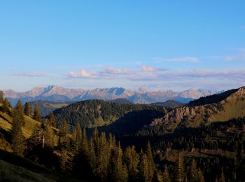
#2 - Wandergebiet Oberstaufen
A pied
Facile
Oberstaufen,
Bavière,
Landkreis Oberallgäu,
Allemagne
![](/images/other/stat-length.png)
11,1 km | 16,4 km-effort
3h 43min
![](https://static1.geolcdn.com/siteimages/upload/files/1508320355ic_sort_den_pos_24dp.png)
335 m
![](https://static1.geolcdn.com/siteimages/upload/files/1508320355ic_sort_den_neg_24dp.png)
595 m
![](https://static1.geolcdn.com/siteimages/upload/files/16400158638029165_repeat_loop_refresh_sync_direction_icon.png)
Non
SityTrail - itinéraires balisés pédestres
![Randonnée A pied Oberstaufen - Wandertrilogie Etappe 36 Oberstaufen-Oberreute - Photo](https://media.geolcdn.com/t/350/260/53888e86-e5b5-4f84-8e53-59849bc810b4.jpeg&format=jpg&maxdim=2)
![A pied A pied](https://static1.geolcdn.com/sitytour/trail-icons/100.png)
Km
#3 - Wandertrilogie Etappe 36 Oberstaufen-Oberreute
A pied
Facile
Oberstaufen,
Bavière,
Landkreis Oberallgäu,
Allemagne
![](/images/other/stat-length.png)
10,6 km | 16,5 km-effort
3h 44min
![](https://static1.geolcdn.com/siteimages/upload/files/1508320355ic_sort_den_pos_24dp.png)
453 m
![](https://static1.geolcdn.com/siteimages/upload/files/1508320355ic_sort_den_neg_24dp.png)
395 m
![](https://static1.geolcdn.com/siteimages/upload/files/16400158638029165_repeat_loop_refresh_sync_direction_icon.png)
Non
SityTrail - itinéraires balisés pédestres
![Randonnée A pied Oberstaufen - Premiumwanderweg Nagelfluhschleife Alpenfreiheit - Photo](https://media.geolcdn.com/t/350/260/0bcdea94-1ecb-41e4-bdf1-76ae092b9e6e.jpeg&format=jpg&maxdim=2)
![A pied A pied](https://static1.geolcdn.com/sitytour/trail-icons/100.png)
Km
#4 - Premiumwanderweg Nagelfluhschleife Alpenfreiheit
A pied
Moyen
Oberstaufen,
Bavière,
Landkreis Oberallgäu,
Allemagne
![](/images/other/stat-length.png)
14,1 km | 21 km-effort
4h 50min
![](https://static1.geolcdn.com/siteimages/upload/files/1508320355ic_sort_den_pos_24dp.png)
541 m
![](https://static1.geolcdn.com/siteimages/upload/files/1508320355ic_sort_den_neg_24dp.png)
545 m
![](https://static1.geolcdn.com/siteimages/upload/files/16400158638029165_repeat_loop_refresh_sync_direction_icon.png)
Oui
SityTrail - itinéraires balisés pédestres
![Randonnée A pied Oberstaufen - Premiumwanderweg Wildes Wasser - Photo](https://media.geolcdn.com/t/350/260/f74b8a1d-7cd5-4d8d-9cc9-ef591714e922.jpeg&format=jpg&maxdim=2)
![A pied A pied](https://static1.geolcdn.com/sitytour/trail-icons/100.png)
Km
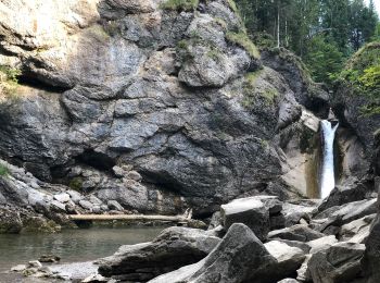
#5 - Premiumwanderweg Wildes Wasser
A pied
Facile
Oberstaufen,
Bavière,
Landkreis Oberallgäu,
Allemagne
![](/images/other/stat-length.png)
7 km | 10,1 km-effort
2h 17min
![](https://static1.geolcdn.com/siteimages/upload/files/1508320355ic_sort_den_pos_24dp.png)
176 m
![](https://static1.geolcdn.com/siteimages/upload/files/1508320355ic_sort_den_neg_24dp.png)
393 m
![](https://static1.geolcdn.com/siteimages/upload/files/16400158638029165_repeat_loop_refresh_sync_direction_icon.png)
Non
SityTrail - itinéraires balisés pédestres
5 randonnées affichées sur 5
Application GPS de randonnée GRATUITE