![](/images/other/stat-length.png)
Baunach, Landkreis Bamberg, A pied : Les meilleures randonnées, itinéraires, parcours, balades et promenades
Baunach : découvrez les meilleures randonnées : 11 a pied. Tous ces circuits, parcours, itinéraires et activités en plein air sont disponibles dans nos applications SityTrail pour smartphones et tablettes.
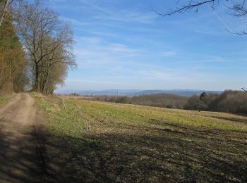
Les meilleurs parcours (11)
![Randonnée A pied Baunach - Brauersteig - Photo](https://media.geolcdn.com/t/350/260/ae44bd57-8cd7-4971-bf16-723f9dd87ea4.jpeg&format=jpg&maxdim=2)
![A pied A pied](https://static1.geolcdn.com/sitytour/trail-icons/100.png)
Km
A pied
![](/images/other/stat-length.png)
![](https://static1.geolcdn.com/siteimages/upload/files/1508320355ic_sort_den_pos_24dp.png)
![](https://static1.geolcdn.com/siteimages/upload/files/1508320355ic_sort_den_neg_24dp.png)
![](https://static1.geolcdn.com/siteimages/upload/files/16400158638029165_repeat_loop_refresh_sync_direction_icon.png)
• Randonnée créée par Naturpark Haßberge. Symbole: Roter Burgturm auf weißem Hintergrund
![Randonnée A pied Baunach - Querkeltour - Photo](https://media.geolcdn.com/t/350/260/caeb0628-07aa-48cc-9718-d1fd0de5c211.jpeg&format=jpg&maxdim=2)
![A pied A pied](https://static1.geolcdn.com/sitytour/trail-icons/100.png)
Km
A pied
![](/images/other/stat-length.png)
![](https://static1.geolcdn.com/siteimages/upload/files/1508320355ic_sort_den_pos_24dp.png)
![](https://static1.geolcdn.com/siteimages/upload/files/1508320355ic_sort_den_neg_24dp.png)
![](https://static1.geolcdn.com/siteimages/upload/files/16400158638029165_repeat_loop_refresh_sync_direction_icon.png)
• Randonnée créée par Naturpark Haßberge. Symbole: Roter Burgturm weißer Grund
![Randonnée A pied Baunach - Greifvogel-Wanderweg Baunach - Photo](https://media.geolcdn.com/t/350/260/ae44bd57-8cd7-4971-bf16-723f9dd87ea4.jpeg&format=jpg&maxdim=2)
![A pied A pied](https://static1.geolcdn.com/sitytour/trail-icons/100.png)
Km
A pied
![](/images/other/stat-length.png)
![](https://static1.geolcdn.com/siteimages/upload/files/1508320355ic_sort_den_pos_24dp.png)
![](https://static1.geolcdn.com/siteimages/upload/files/1508320355ic_sort_den_neg_24dp.png)
![](https://static1.geolcdn.com/siteimages/upload/files/16400158638029165_repeat_loop_refresh_sync_direction_icon.png)
• Randonnée créée par Wanderclub Baunach. Symbole: schwarzer Greifvogel auf gelbem Grund
![Randonnée A pied Baunach - Baunach Kraibergrunde (B 2) - Photo](https://media.geolcdn.com/t/350/260/b766143b-2814-4d32-ae00-2a13c9cb4968.jpeg&format=jpg&maxdim=2)
![A pied A pied](https://static1.geolcdn.com/sitytour/trail-icons/100.png)
Km
A pied
![](/images/other/stat-length.png)
![](https://static1.geolcdn.com/siteimages/upload/files/1508320355ic_sort_den_pos_24dp.png)
![](https://static1.geolcdn.com/siteimages/upload/files/1508320355ic_sort_den_neg_24dp.png)
![](https://static1.geolcdn.com/siteimages/upload/files/16400158638029165_repeat_loop_refresh_sync_direction_icon.png)
• Nordic Walking Symbole: schwarzes B 2 auf weißem Grund
![Randonnée A pied Baunach - Specht-Wanderweg - Photo](https://media.geolcdn.com/t/350/260/bd42662a-19cf-48d2-a88d-d90a933d759b.jpeg&format=jpg&maxdim=2)
![A pied A pied](https://static1.geolcdn.com/sitytour/trail-icons/100.png)
Km
A pied
![](/images/other/stat-length.png)
![](https://static1.geolcdn.com/siteimages/upload/files/1508320355ic_sort_den_pos_24dp.png)
![](https://static1.geolcdn.com/siteimages/upload/files/1508320355ic_sort_den_neg_24dp.png)
![](https://static1.geolcdn.com/siteimages/upload/files/16400158638029165_repeat_loop_refresh_sync_direction_icon.png)
• Randonnée créée par Wanderclub Baunach. Symbole: schwarzer Specht auf gelbem Grund
![Randonnée A pied Baunach - Baunach Stiefenberg (B 1) - Photo](https://media.geolcdn.com/t/350/260/b766143b-2814-4d32-ae00-2a13c9cb4968.jpeg&format=jpg&maxdim=2)
![A pied A pied](https://static1.geolcdn.com/sitytour/trail-icons/100.png)
Km
A pied
![](/images/other/stat-length.png)
![](https://static1.geolcdn.com/siteimages/upload/files/1508320355ic_sort_den_pos_24dp.png)
![](https://static1.geolcdn.com/siteimages/upload/files/1508320355ic_sort_den_neg_24dp.png)
![](https://static1.geolcdn.com/siteimages/upload/files/16400158638029165_repeat_loop_refresh_sync_direction_icon.png)
• Nordic Walking Symbole: rotes B 1 auf weißem Grund
![Randonnée A pied Baunach - Baunach Sembergrunde - Photo](https://media.geolcdn.com/t/350/260/a425f840-086e-4681-a5d6-9b99b27b6e44.jpeg&format=jpg&maxdim=2)
![A pied A pied](https://static1.geolcdn.com/sitytour/trail-icons/100.png)
Km
A pied
![](/images/other/stat-length.png)
![](https://static1.geolcdn.com/siteimages/upload/files/1508320355ic_sort_den_pos_24dp.png)
![](https://static1.geolcdn.com/siteimages/upload/files/1508320355ic_sort_den_neg_24dp.png)
![](https://static1.geolcdn.com/siteimages/upload/files/16400158638029165_repeat_loop_refresh_sync_direction_icon.png)
• Nordic Walking Symbole: schwarzes B3 auf weißem Grund
![Randonnée A pied Baunach - Wildschwein-Wanderweg Baunach - Photo](https://media.geolcdn.com/t/350/260/a425f840-086e-4681-a5d6-9b99b27b6e44.jpeg&format=jpg&maxdim=2)
![A pied A pied](https://static1.geolcdn.com/sitytour/trail-icons/100.png)
Km
A pied
![](/images/other/stat-length.png)
![](https://static1.geolcdn.com/siteimages/upload/files/1508320355ic_sort_den_pos_24dp.png)
![](https://static1.geolcdn.com/siteimages/upload/files/1508320355ic_sort_den_neg_24dp.png)
![](https://static1.geolcdn.com/siteimages/upload/files/16400158638029165_repeat_loop_refresh_sync_direction_icon.png)
• Randonnée créée par Wanderclub Baunach. Symbole: Schwarzes Wildschwein auf gelbem Hintergrund
![Randonnée A pied Baunach - Naturerlebnisweg Baunach - Photo](https://media.geolcdn.com/t/350/260/b766143b-2814-4d32-ae00-2a13c9cb4968.jpeg&format=jpg&maxdim=2)
![A pied A pied](https://static1.geolcdn.com/sitytour/trail-icons/100.png)
Km
A pied
![](/images/other/stat-length.png)
![](https://static1.geolcdn.com/siteimages/upload/files/1508320355ic_sort_den_pos_24dp.png)
![](https://static1.geolcdn.com/siteimages/upload/files/1508320355ic_sort_den_neg_24dp.png)
![](https://static1.geolcdn.com/siteimages/upload/files/16400158638029165_repeat_loop_refresh_sync_direction_icon.png)
![Randonnée A pied Baunach - Priegendorf Veitenstein kurz - Photo](https://media.geolcdn.com/t/350/260/0699b9dc-d15b-4ba8-8af5-9205cbefdb13.jpeg&format=jpg&maxdim=2)
![A pied A pied](https://static1.geolcdn.com/sitytour/trail-icons/100.png)
Km
A pied
![](/images/other/stat-length.png)
![](https://static1.geolcdn.com/siteimages/upload/files/1508320355ic_sort_den_pos_24dp.png)
![](https://static1.geolcdn.com/siteimages/upload/files/1508320355ic_sort_den_neg_24dp.png)
![](https://static1.geolcdn.com/siteimages/upload/files/16400158638029165_repeat_loop_refresh_sync_direction_icon.png)
• Nordic Walking Symbole: weiße P 1 auf rotem Grund
![Randonnée A pied Baunach - Reh-Wanderweg Baunach - Photo](https://media.geolcdn.com/t/350/260/bd42662a-19cf-48d2-a88d-d90a933d759b.jpeg&format=jpg&maxdim=2)
![A pied A pied](https://static1.geolcdn.com/sitytour/trail-icons/100.png)
Km
A pied
![](/images/other/stat-length.png)
![](https://static1.geolcdn.com/siteimages/upload/files/1508320355ic_sort_den_pos_24dp.png)
![](https://static1.geolcdn.com/siteimages/upload/files/1508320355ic_sort_den_neg_24dp.png)
![](https://static1.geolcdn.com/siteimages/upload/files/16400158638029165_repeat_loop_refresh_sync_direction_icon.png)
• Randonnée créée par Wanderclub Baunach. Symbole: Schwarzes Reh auf gelbem Grund
11 randonnées affichées sur 11
Application GPS de randonnée GRATUITE