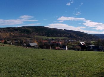
![](/images/other/stat-length.png)
- Randonnées
- A pied
- Allemagne
- Saxe
- Sächsische Schweiz-Osterzgebirge
Sächsische Schweiz-Osterzgebirge, Saxe, A pied : Les meilleures randonnées, itinéraires, parcours, balades et promenades
Sächsische Schweiz-Osterzgebirge : découvrez les meilleures randonnées : 109 a pied, 11 marche et 1 course à pied. Tous ces circuits, parcours, itinéraires et activités en plein air sont disponibles dans nos applications SityTrail pour smartphones et tablettes.
Les meilleurs parcours (121)
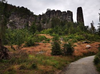
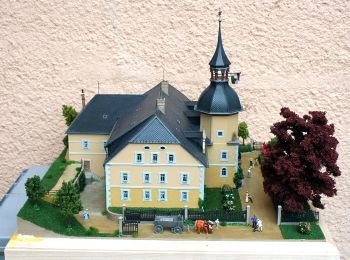
![Randonnée A pied Bad Gottleuba-Berggießhübel - [Z] okruh Oelsen - Špičák - Oelsen - Photo](https://media.geolcdn.com/t/350/260/84446251-a0ec-4b89-b1b1-9407074742c9.jpeg&format=jpg&maxdim=2)
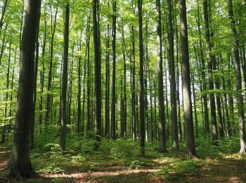
![A pied A pied](https://static1.geolcdn.com/sitytour/trail-icons/100.png)
Km
A pied
![](/images/other/stat-length.png)
![](https://static1.geolcdn.com/siteimages/upload/files/1508320355ic_sort_den_pos_24dp.png)
![](https://static1.geolcdn.com/siteimages/upload/files/1508320355ic_sort_den_neg_24dp.png)
![](https://static1.geolcdn.com/siteimages/upload/files/16400158638029165_repeat_loop_refresh_sync_direction_icon.png)
• Randonnée créée par cz:KČT.
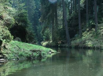
![Randonnée A pied Sebnitz - Rundweg Gelber Punkt - Photo](https://media.geolcdn.com/t/350/260/de03e73a-1e26-4a74-bd13-e46beb5905b6.jpeg&format=jpg&maxdim=2)
![A pied A pied](https://static1.geolcdn.com/sitytour/trail-icons/100.png)
Km
A pied
![](/images/other/stat-length.png)
![](https://static1.geolcdn.com/siteimages/upload/files/1508320355ic_sort_den_pos_24dp.png)
![](https://static1.geolcdn.com/siteimages/upload/files/1508320355ic_sort_den_neg_24dp.png)
![](https://static1.geolcdn.com/siteimages/upload/files/16400158638029165_repeat_loop_refresh_sync_direction_icon.png)
• Symbole: gelber Punkt auf weissem Grund
![Randonnée A pied Sebnitz - Hinterhermsdorfer Rundweg - Photo](https://media.geolcdn.com/t/350/260/1a8e8230-aa16-4757-be71-8e0ebbd9d9d6.jpeg&format=jpg&maxdim=2)
![A pied A pied](https://static1.geolcdn.com/sitytour/trail-icons/100.png)
Km
A pied
![](/images/other/stat-length.png)
![](https://static1.geolcdn.com/siteimages/upload/files/1508320355ic_sort_den_pos_24dp.png)
![](https://static1.geolcdn.com/siteimages/upload/files/1508320355ic_sort_den_neg_24dp.png)
![](https://static1.geolcdn.com/siteimages/upload/files/16400158638029165_repeat_loop_refresh_sync_direction_icon.png)
• Symbole: Gelber Strich auf weißem Grund
![Randonnée A pied Freital - Freitaler Rundweg 5 - Photo](https://media.geolcdn.com/t/350/260/48f19956-02cc-4004-ae0e-535559eb1722.jpeg&format=jpg&maxdim=2)
![A pied A pied](https://static1.geolcdn.com/sitytour/trail-icons/100.png)
Km
A pied
![](/images/other/stat-length.png)
![](https://static1.geolcdn.com/siteimages/upload/files/1508320355ic_sort_den_pos_24dp.png)
![](https://static1.geolcdn.com/siteimages/upload/files/1508320355ic_sort_den_neg_24dp.png)
![](https://static1.geolcdn.com/siteimages/upload/files/16400158638029165_repeat_loop_refresh_sync_direction_icon.png)
• noch detailierter Verlauf korrigieren
![Randonnée A pied Glashütte - DE-Fragment, End- und Zielpunkt unklar - Photo](https://media.geolcdn.com/t/350/260/de8fd8db-7b41-4d91-8d1d-da6ee6fea9fc.jpeg&format=jpg&maxdim=2)
![A pied A pied](https://static1.geolcdn.com/sitytour/trail-icons/100.png)
Km
A pied
![](/images/other/stat-length.png)
![](https://static1.geolcdn.com/siteimages/upload/files/1508320355ic_sort_den_pos_24dp.png)
![](https://static1.geolcdn.com/siteimages/upload/files/1508320355ic_sort_den_neg_24dp.png)
![](https://static1.geolcdn.com/siteimages/upload/files/16400158638029165_repeat_loop_refresh_sync_direction_icon.png)
• Fragment, End- und Zielpunkt unklar
![Randonnée A pied Sebnitz - Grüner Punkt - Photo](https://media.geolcdn.com/t/350/260/9002a7e5-c65d-497b-8716-1fdae825f6a6.jpeg&format=jpg&maxdim=2)
![A pied A pied](https://static1.geolcdn.com/sitytour/trail-icons/100.png)
Km
A pied
![](/images/other/stat-length.png)
![](https://static1.geolcdn.com/siteimages/upload/files/1508320355ic_sort_den_pos_24dp.png)
![](https://static1.geolcdn.com/siteimages/upload/files/1508320355ic_sort_den_neg_24dp.png)
![](https://static1.geolcdn.com/siteimages/upload/files/16400158638029165_repeat_loop_refresh_sync_direction_icon.png)
• Symbole: Grüner Punkt auf weißem Grund
![Randonnée A pied Bad Schandau - Grüner Punkt - Photo](https://media.geolcdn.com/t/350/260/394526b7-5063-4e3f-985c-cb5ed76c61fc.jpeg&format=jpg&maxdim=2)
![A pied A pied](https://static1.geolcdn.com/sitytour/trail-icons/100.png)
Km
A pied
![](/images/other/stat-length.png)
![](https://static1.geolcdn.com/siteimages/upload/files/1508320355ic_sort_den_pos_24dp.png)
![](https://static1.geolcdn.com/siteimages/upload/files/1508320355ic_sort_den_neg_24dp.png)
![](https://static1.geolcdn.com/siteimages/upload/files/16400158638029165_repeat_loop_refresh_sync_direction_icon.png)
• Symbole: Grüner Punkt auf weißem Grund
![Randonnée A pied Hohnstein - Geopfad Goßdorf - Photo](https://media.geolcdn.com/t/350/260/1d8ddd97-e633-4947-b2f3-c425f6b2b512.jpeg&format=jpg&maxdim=2)
![A pied A pied](https://static1.geolcdn.com/sitytour/trail-icons/100.png)
Km
A pied
![](/images/other/stat-length.png)
![](https://static1.geolcdn.com/siteimages/upload/files/1508320355ic_sort_den_pos_24dp.png)
![](https://static1.geolcdn.com/siteimages/upload/files/1508320355ic_sort_den_neg_24dp.png)
![](https://static1.geolcdn.com/siteimages/upload/files/16400158638029165_repeat_loop_refresh_sync_direction_icon.png)
• Randonnée créée par Freibadverein Goßdorf.
![Randonnée A pied Freital - Freitaler Rundweg 4 - Photo](https://media.geolcdn.com/t/350/260/34296c8e-4343-4989-b1c3-962701cd0ad0.jpeg&format=jpg&maxdim=2)
![A pied A pied](https://static1.geolcdn.com/sitytour/trail-icons/100.png)
Km
A pied
![](/images/other/stat-length.png)
![](https://static1.geolcdn.com/siteimages/upload/files/1508320355ic_sort_den_pos_24dp.png)
![](https://static1.geolcdn.com/siteimages/upload/files/1508320355ic_sort_den_neg_24dp.png)
![](https://static1.geolcdn.com/siteimages/upload/files/16400158638029165_repeat_loop_refresh_sync_direction_icon.png)
• Symbole: neu grüne 4 - alt: Grüne Tanne im grünen Ring auf weißem Grund Site web: https://www.kleinnaundorf.de/auf-...
![Randonnée A pied Hohnstein - Rund um Ulbersdorf - Photo](https://media.geolcdn.com/t/350/260/7e3bd684-240d-49d9-a626-551e129ea995.jpeg&format=jpg&maxdim=2)
![A pied A pied](https://static1.geolcdn.com/sitytour/trail-icons/100.png)
Km
A pied
![](/images/other/stat-length.png)
![](https://static1.geolcdn.com/siteimages/upload/files/1508320355ic_sort_den_pos_24dp.png)
![](https://static1.geolcdn.com/siteimages/upload/files/1508320355ic_sort_den_neg_24dp.png)
![](https://static1.geolcdn.com/siteimages/upload/files/16400158638029165_repeat_loop_refresh_sync_direction_icon.png)
• bluepoint
![Randonnée A pied Bad Gottleuba-Berggießhübel - Blauer Strich - Photo](https://media.geolcdn.com/t/350/260/d63f0d81-8190-49fa-bfd5-3caa815c422b.jpeg&format=jpg&maxdim=2)
![A pied A pied](https://static1.geolcdn.com/sitytour/trail-icons/100.png)
Km
A pied
![](/images/other/stat-length.png)
![](https://static1.geolcdn.com/siteimages/upload/files/1508320355ic_sort_den_pos_24dp.png)
![](https://static1.geolcdn.com/siteimages/upload/files/1508320355ic_sort_den_neg_24dp.png)
![](https://static1.geolcdn.com/siteimages/upload/files/16400158638029165_repeat_loop_refresh_sync_direction_icon.png)
• Blauer Strich Symbole: Blauer Strich auf weißem Grund
![Randonnée A pied Bad Schandau - Rundweg Gelber Punkt - Photo](https://media.geolcdn.com/t/350/260/691fe921-8767-4ac4-b4b2-0f3a82376aa7.jpeg&format=jpg&maxdim=2)
![A pied A pied](https://static1.geolcdn.com/sitytour/trail-icons/100.png)
Km
A pied
![](/images/other/stat-length.png)
![](https://static1.geolcdn.com/siteimages/upload/files/1508320355ic_sort_den_pos_24dp.png)
![](https://static1.geolcdn.com/siteimages/upload/files/1508320355ic_sort_den_neg_24dp.png)
![](https://static1.geolcdn.com/siteimages/upload/files/16400158638029165_repeat_loop_refresh_sync_direction_icon.png)
• Symbole: Gelber Punkt auf weißem Grund
![Randonnée A pied Bahretal - Grüner Punkt - Photo](https://media.geolcdn.com/t/350/260/d7ea6b18-3366-4176-9eef-331b211120cc.jpeg&format=jpg&maxdim=2)
![A pied A pied](https://static1.geolcdn.com/sitytour/trail-icons/100.png)
Km
A pied
![](/images/other/stat-length.png)
![](https://static1.geolcdn.com/siteimages/upload/files/1508320355ic_sort_den_pos_24dp.png)
![](https://static1.geolcdn.com/siteimages/upload/files/1508320355ic_sort_den_neg_24dp.png)
![](https://static1.geolcdn.com/siteimages/upload/files/16400158638029165_repeat_loop_refresh_sync_direction_icon.png)
• Symbole: Grüner Punkt auf weißem Grund
![Randonnée A pied Stolpen - Märzenbecher-Rundweg Heeselicht - Photo](https://media.geolcdn.com/t/350/260/a3191f9d-417f-4447-aa9d-3ec7b7c437ac.jpeg&format=jpg&maxdim=2)
![A pied A pied](https://static1.geolcdn.com/sitytour/trail-icons/100.png)
Km
A pied
![](/images/other/stat-length.png)
![](https://static1.geolcdn.com/siteimages/upload/files/1508320355ic_sort_den_pos_24dp.png)
![](https://static1.geolcdn.com/siteimages/upload/files/1508320355ic_sort_den_neg_24dp.png)
![](https://static1.geolcdn.com/siteimages/upload/files/16400158638029165_repeat_loop_refresh_sync_direction_icon.png)
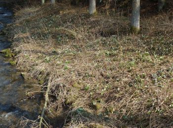
• Symbole: Märzenbecher
![Randonnée A pied Altenberg - Hirschsprung - Geising - Photo](https://media.geolcdn.com/t/350/260/3e69ccf1-0b65-4c11-8f13-69e67c0e4d38.jpeg&format=jpg&maxdim=2)
![A pied A pied](https://static1.geolcdn.com/sitytour/trail-icons/100.png)
Km
A pied
![](/images/other/stat-length.png)
![](https://static1.geolcdn.com/siteimages/upload/files/1508320355ic_sort_den_pos_24dp.png)
![](https://static1.geolcdn.com/siteimages/upload/files/1508320355ic_sort_den_neg_24dp.png)
![](https://static1.geolcdn.com/siteimages/upload/files/16400158638029165_repeat_loop_refresh_sync_direction_icon.png)
• von Geisingberg nach Geising unklar - müsste über Erbstollen in Geising führen Symbole: Grüner Balken auf weißem Grund
![Randonnée A pied Tharandt - Sekundenweg Tharandt - Hartha - Photo](https://media.geolcdn.com/t/350/260/3a0c761c-60ba-411e-ad77-f23ef09b9edb.jpeg&format=jpg&maxdim=2)
![A pied A pied](https://static1.geolcdn.com/sitytour/trail-icons/100.png)
Km
A pied
![](/images/other/stat-length.png)
![](https://static1.geolcdn.com/siteimages/upload/files/1508320355ic_sort_den_pos_24dp.png)
![](https://static1.geolcdn.com/siteimages/upload/files/1508320355ic_sort_den_neg_24dp.png)
![](https://static1.geolcdn.com/siteimages/upload/files/16400158638029165_repeat_loop_refresh_sync_direction_icon.png)
• Randonnée créée par Uhrentechnische Lehrschau Hennig e. V.. Symbole: Grüner Rückstrich auf weißem Grund
![Randonnée A pied Neustadt in Sachsen - Grüner Punkt, Valtenberg - Photo](https://media.geolcdn.com/t/350/260/ace165d4-0984-4204-88b5-b3e6453e36e2.jpeg&format=jpg&maxdim=2)
![A pied A pied](https://static1.geolcdn.com/sitytour/trail-icons/100.png)
Km
A pied
![](/images/other/stat-length.png)
![](https://static1.geolcdn.com/siteimages/upload/files/1508320355ic_sort_den_pos_24dp.png)
![](https://static1.geolcdn.com/siteimages/upload/files/1508320355ic_sort_den_neg_24dp.png)
![](https://static1.geolcdn.com/siteimages/upload/files/16400158638029165_repeat_loop_refresh_sync_direction_icon.png)
• Symbole: Grüner Punkt auf weißem Grund
![Randonnée A pied Dippoldiswalde - Obercarsdorf - Sadisdorf - Photo](https://media.geolcdn.com/t/350/260/12bd6c63-2948-4abd-a54a-b71a94d88137.jpeg&format=jpg&maxdim=2)
![A pied A pied](https://static1.geolcdn.com/sitytour/trail-icons/100.png)
Km
A pied
![](/images/other/stat-length.png)
![](https://static1.geolcdn.com/siteimages/upload/files/1508320355ic_sort_den_pos_24dp.png)
![](https://static1.geolcdn.com/siteimages/upload/files/1508320355ic_sort_den_neg_24dp.png)
![](https://static1.geolcdn.com/siteimages/upload/files/16400158638029165_repeat_loop_refresh_sync_direction_icon.png)
• Randonnée créée par Gemeinde Schmiedberg. Symbole: Grüner Balken auf weißem Grund
![Randonnée A pied Dippoldiswalde - Obercarsdorf - Schloss Naundorf - Photo](https://media.geolcdn.com/t/350/260/899290e9-86a5-4c9b-a854-716c38851633.jpeg&format=jpg&maxdim=2)
![A pied A pied](https://static1.geolcdn.com/sitytour/trail-icons/100.png)
Km
A pied
![](/images/other/stat-length.png)
![](https://static1.geolcdn.com/siteimages/upload/files/1508320355ic_sort_den_pos_24dp.png)
![](https://static1.geolcdn.com/siteimages/upload/files/1508320355ic_sort_den_neg_24dp.png)
![](https://static1.geolcdn.com/siteimages/upload/files/16400158638029165_repeat_loop_refresh_sync_direction_icon.png)
• Randonnée créée par Gemeinde Schmiedberg. Symbole: Grüner Balken auf weißem Grund
![Randonnée A pied Dippoldiswalde - Rundweg Obercarsdorf - Photo](https://media.geolcdn.com/t/350/260/98761bc5-7cbc-4d6c-aa61-bf7ba8208d86.jpeg&format=jpg&maxdim=2)
![A pied A pied](https://static1.geolcdn.com/sitytour/trail-icons/100.png)
Km
A pied
![](/images/other/stat-length.png)
![](https://static1.geolcdn.com/siteimages/upload/files/1508320355ic_sort_den_pos_24dp.png)
![](https://static1.geolcdn.com/siteimages/upload/files/1508320355ic_sort_den_neg_24dp.png)
![](https://static1.geolcdn.com/siteimages/upload/files/16400158638029165_repeat_loop_refresh_sync_direction_icon.png)
• Randonnée créée par Gemeinde Schmiedberg. Site web: https://www.schmiedeberg.net/inhalte/schmiedeberg/_inhalt/tour...
20 randonnées affichées sur 121
Application GPS de randonnée GRATUITE
Activités
Régions proches
- Altenberg
- Bad Gottleuba-Berggießhübel
- Bad Schandau
- Bahretal
- Bannewitz
- Dippoldiswalde
- Dohma
- Dohna
- Dürrröhrsdorf-Dittersbach
- Freital
- Glashütte
- Gohrisch
- Hartmannsdorf-Reichenau
- Hermsdorf/Erzgebirge
- Hohnstein
- Klingenberg
- Königstein
- Kreischa
- Liebstadt
- Lohmen
- Neustadt in Sachsen
- Pirna
- Rabenau
- Rathen
- Reinhardtsdorf-Schöna
- Rosenthal-Bielatal
- Sebnitz
- Stolpen
- Tharandt
- Wehlen