![](/images/other/stat-length.png)
- Randonnées
- A pied
- République Tchèque
- Severovýchod
- Královéhradecký kraj
Královéhradecký kraj, Severovýchod, A pied : Les meilleures randonnées, itinéraires, parcours, balades et promenades
Královéhradecký kraj : découvrez les meilleures randonnées : 108 a pied. Tous ces circuits, parcours, itinéraires et activités en plein air sont disponibles dans nos applications SityTrail pour smartphones et tablettes.
Les meilleurs parcours (108)
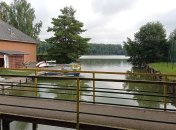
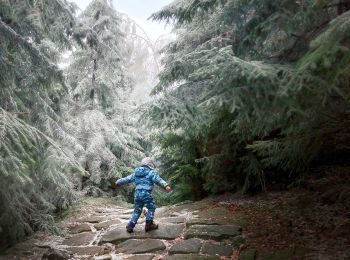
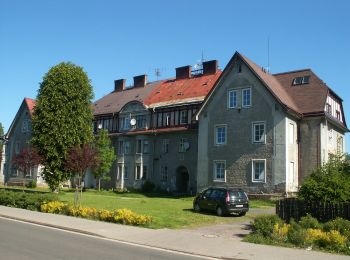
![Randonnée A pied Radim - [Ž] Nová Paka - Újezdec - Photo](https://media.geolcdn.com/t/350/260/b5ba9cb6-95f5-4442-82ef-b9a562598b84.jpeg&format=jpg&maxdim=2)
![A pied A pied](https://static1.geolcdn.com/sitytour/trail-icons/100.png)
Km
A pied
![](/images/other/stat-length.png)
![](https://static1.geolcdn.com/siteimages/upload/files/1508320355ic_sort_den_pos_24dp.png)
![](https://static1.geolcdn.com/siteimages/upload/files/1508320355ic_sort_den_neg_24dp.png)
![](https://static1.geolcdn.com/siteimages/upload/files/16400158638029165_repeat_loop_refresh_sync_direction_icon.png)
• Randonnée créée par cz:KČT.
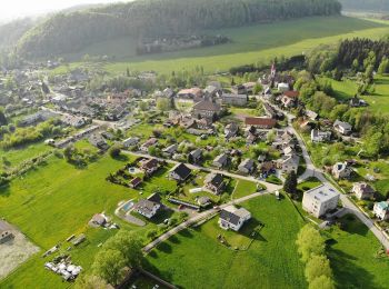
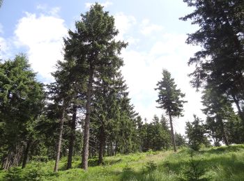
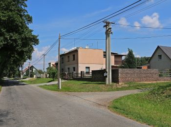
![Randonnée A pied Chvalkovice - [Ž] Dolní Vlčkovice - U Střeziměřic - Photo](https://media.geolcdn.com/t/350/260/e2dbb83a-d120-4cf8-9e9d-3f10ec2cbc30.jpeg&format=jpg&maxdim=2)
![A pied A pied](https://static1.geolcdn.com/sitytour/trail-icons/100.png)
Km
A pied
![](/images/other/stat-length.png)
![](https://static1.geolcdn.com/siteimages/upload/files/1508320355ic_sort_den_pos_24dp.png)
![](https://static1.geolcdn.com/siteimages/upload/files/1508320355ic_sort_den_neg_24dp.png)
![](https://static1.geolcdn.com/siteimages/upload/files/16400158638029165_repeat_loop_refresh_sync_direction_icon.png)
• Randonnée créée par cz:KČT.
![Randonnée A pied Opočno - Semechnický okruh - Photo](https://media.geolcdn.com/t/350/260/0de50771-fa51-4017-81ff-83c624e77321.jpeg&format=jpg&maxdim=2)
![A pied A pied](https://static1.geolcdn.com/sitytour/trail-icons/100.png)
Km
A pied
![](/images/other/stat-length.png)
![](https://static1.geolcdn.com/siteimages/upload/files/1508320355ic_sort_den_pos_24dp.png)
![](https://static1.geolcdn.com/siteimages/upload/files/1508320355ic_sort_den_neg_24dp.png)
![](https://static1.geolcdn.com/siteimages/upload/files/16400158638029165_repeat_loop_refresh_sync_direction_icon.png)
• Randonnée créée par cz:KČT.
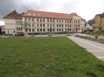
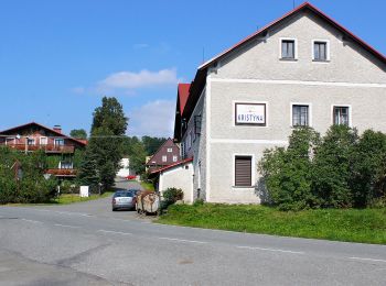
![Randonnée A pied Špindlerův Mlýn - [Ž] U Dívčí lávky - Petrovka - Photo](https://media.geolcdn.com/t/350/260/91b68d01-a844-4304-8b0a-cdbf9b9a2dc9.jpeg&format=jpg&maxdim=2)
![A pied A pied](https://static1.geolcdn.com/sitytour/trail-icons/100.png)
Km
A pied
![](/images/other/stat-length.png)
![](https://static1.geolcdn.com/siteimages/upload/files/1508320355ic_sort_den_pos_24dp.png)
![](https://static1.geolcdn.com/siteimages/upload/files/1508320355ic_sort_den_neg_24dp.png)
![](https://static1.geolcdn.com/siteimages/upload/files/16400158638029165_repeat_loop_refresh_sync_direction_icon.png)
• Randonnée créée par cz:KČT.
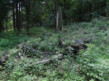
![Randonnée A pied Špindlerův Mlýn - [Č] Medvědín okruh - Photo](https://media.geolcdn.com/t/350/260/c3362a18-9b51-4a00-857c-f7322a3307a7.jpeg&format=jpg&maxdim=2)
![A pied A pied](https://static1.geolcdn.com/sitytour/trail-icons/100.png)
Km
A pied
![](/images/other/stat-length.png)
![](https://static1.geolcdn.com/siteimages/upload/files/1508320355ic_sort_den_pos_24dp.png)
![](https://static1.geolcdn.com/siteimages/upload/files/1508320355ic_sort_den_neg_24dp.png)
![](https://static1.geolcdn.com/siteimages/upload/files/16400158638029165_repeat_loop_refresh_sync_direction_icon.png)
• Randonnée créée par cz:KČT.
![Randonnée A pied Špindlerův Mlýn - [M] Medvědín okruh - Photo](https://media.geolcdn.com/t/350/260/b2ec24c5-bbdd-4d62-9592-5f70359022aa.jpeg&format=jpg&maxdim=2)
![A pied A pied](https://static1.geolcdn.com/sitytour/trail-icons/100.png)
Km
A pied
![](/images/other/stat-length.png)
![](https://static1.geolcdn.com/siteimages/upload/files/1508320355ic_sort_den_pos_24dp.png)
![](https://static1.geolcdn.com/siteimages/upload/files/1508320355ic_sort_den_neg_24dp.png)
![](https://static1.geolcdn.com/siteimages/upload/files/16400158638029165_repeat_loop_refresh_sync_direction_icon.png)
• Randonnée créée par cz:KČT.
![Randonnée A pied Machov - NS Machov - Photo](https://media.geolcdn.com/t/350/260/3394ec2c-be26-46d4-acaa-1285c9f486f1.jpeg&format=jpg&maxdim=2)
![A pied A pied](https://static1.geolcdn.com/sitytour/trail-icons/100.png)
Km
A pied
![](/images/other/stat-length.png)
![](https://static1.geolcdn.com/siteimages/upload/files/1508320355ic_sort_den_pos_24dp.png)
![](https://static1.geolcdn.com/siteimages/upload/files/1508320355ic_sort_den_neg_24dp.png)
![](https://static1.geolcdn.com/siteimages/upload/files/16400158638029165_repeat_loop_refresh_sync_direction_icon.png)
• Randonnée créée par cz:KČT.
![Randonnée A pied Trutnov - Fit stezka Poříčský hřbet - Photo](https://media.geolcdn.com/t/350/260/8e23482a-1d32-4911-811d-afd87e608a56.jpeg&format=jpg&maxdim=2)
![A pied A pied](https://static1.geolcdn.com/sitytour/trail-icons/100.png)
Km
A pied
![](/images/other/stat-length.png)
![](https://static1.geolcdn.com/siteimages/upload/files/1508320355ic_sort_den_pos_24dp.png)
![](https://static1.geolcdn.com/siteimages/upload/files/1508320355ic_sort_den_neg_24dp.png)
![](https://static1.geolcdn.com/siteimages/upload/files/16400158638029165_repeat_loop_refresh_sync_direction_icon.png)
• Randonnée créée par cz:KČT.
![Randonnée A pied Trutnov - NS Babí - Nové Dvory - Photo](https://media.geolcdn.com/t/350/260/b3608b26-b891-4d34-876e-0ac4b502ff4f.jpeg&format=jpg&maxdim=2)
![A pied A pied](https://static1.geolcdn.com/sitytour/trail-icons/100.png)
Km
A pied
![](/images/other/stat-length.png)
![](https://static1.geolcdn.com/siteimages/upload/files/1508320355ic_sort_den_pos_24dp.png)
![](https://static1.geolcdn.com/siteimages/upload/files/1508320355ic_sort_den_neg_24dp.png)
![](https://static1.geolcdn.com/siteimages/upload/files/16400158638029165_repeat_loop_refresh_sync_direction_icon.png)
• Randonnée créée par cz:KČT.
![Randonnée A pied Křinice - NS Proč chodit daleko - Photo](https://media.geolcdn.com/t/350/260/eaec7990-63a9-4606-bfbd-fb0277109630.jpeg&format=jpg&maxdim=2)
![A pied A pied](https://static1.geolcdn.com/sitytour/trail-icons/100.png)
Km
A pied
![](/images/other/stat-length.png)
![](https://static1.geolcdn.com/siteimages/upload/files/1508320355ic_sort_den_pos_24dp.png)
![](https://static1.geolcdn.com/siteimages/upload/files/1508320355ic_sort_den_neg_24dp.png)
![](https://static1.geolcdn.com/siteimages/upload/files/16400158638029165_repeat_loop_refresh_sync_direction_icon.png)
• Randonnée créée par cz:KČT.
![Randonnée A pied Deštné v Orlických horách - NS Okolím Deštného - Photo](https://media.geolcdn.com/t/350/260/0176fee2-7329-40d4-91f0-e2dbb8b4ce79.jpeg&format=jpg&maxdim=2)
![A pied A pied](https://static1.geolcdn.com/sitytour/trail-icons/100.png)
Km
A pied
![](/images/other/stat-length.png)
![](https://static1.geolcdn.com/siteimages/upload/files/1508320355ic_sort_den_pos_24dp.png)
![](https://static1.geolcdn.com/siteimages/upload/files/1508320355ic_sort_den_neg_24dp.png)
![](https://static1.geolcdn.com/siteimages/upload/files/16400158638029165_repeat_loop_refresh_sync_direction_icon.png)
• Randonnée créée par cz:KČT.
![Randonnée A pied Deštné v Orlických horách - NS Deštné v Orlických horách - Photo](https://media.geolcdn.com/t/350/260/2477e2fe-8d15-48c3-a66c-070bb59c3de9.jpeg&format=jpg&maxdim=2)
![A pied A pied](https://static1.geolcdn.com/sitytour/trail-icons/100.png)
Km
A pied
![](/images/other/stat-length.png)
![](https://static1.geolcdn.com/siteimages/upload/files/1508320355ic_sort_den_pos_24dp.png)
![](https://static1.geolcdn.com/siteimages/upload/files/1508320355ic_sort_den_neg_24dp.png)
![](https://static1.geolcdn.com/siteimages/upload/files/16400158638029165_repeat_loop_refresh_sync_direction_icon.png)
• Randonnée créée par cz:KČT.
![Randonnée A pied Deštné v Orlických horách - CZ-NS Po hřebeni Orlických hor - Photo](https://media.geolcdn.com/t/350/260/abb98e6b-4459-4346-bb7f-ccad3f8afe80.jpeg&format=jpg&maxdim=2)
![A pied A pied](https://static1.geolcdn.com/sitytour/trail-icons/100.png)
Km
A pied
![](/images/other/stat-length.png)
![](https://static1.geolcdn.com/siteimages/upload/files/1508320355ic_sort_den_pos_24dp.png)
![](https://static1.geolcdn.com/siteimages/upload/files/1508320355ic_sort_den_neg_24dp.png)
![](https://static1.geolcdn.com/siteimages/upload/files/16400158638029165_repeat_loop_refresh_sync_direction_icon.png)
• Randonnée créée par cz:KČT. NS Po hřebeni Orlických hor
![Randonnée A pied Rokytnice v Orlických horách - NS Opevnění Rokytnicka - Photo](https://media.geolcdn.com/t/350/260/a0c96dca-eb28-4f93-abc6-4ce39ab56662.jpeg&format=jpg&maxdim=2)
![A pied A pied](https://static1.geolcdn.com/sitytour/trail-icons/100.png)
Km
A pied
![](/images/other/stat-length.png)
![](https://static1.geolcdn.com/siteimages/upload/files/1508320355ic_sort_den_pos_24dp.png)
![](https://static1.geolcdn.com/siteimages/upload/files/1508320355ic_sort_den_neg_24dp.png)
![](https://static1.geolcdn.com/siteimages/upload/files/16400158638029165_repeat_loop_refresh_sync_direction_icon.png)
• Randonnée créée par cz:KČT.
![Randonnée A pied Orlické Záhoří - NS Historie tavení skla - Photo](https://media.geolcdn.com/t/350/260/1df4eccc-857e-4a3b-a069-75ba71efdf11.jpeg&format=jpg&maxdim=2)
![A pied A pied](https://static1.geolcdn.com/sitytour/trail-icons/100.png)
Km
A pied
![](/images/other/stat-length.png)
![](https://static1.geolcdn.com/siteimages/upload/files/1508320355ic_sort_den_pos_24dp.png)
![](https://static1.geolcdn.com/siteimages/upload/files/1508320355ic_sort_den_neg_24dp.png)
![](https://static1.geolcdn.com/siteimages/upload/files/16400158638029165_repeat_loop_refresh_sync_direction_icon.png)
• Randonnée créée par cz:KČT.
![Randonnée A pied Libel - NS Ovocná stezka - Photo](https://media.geolcdn.com/t/350/260/daee5e00-8280-4983-8fd9-520c10ca8ef1.jpeg&format=jpg&maxdim=2)
![A pied A pied](https://static1.geolcdn.com/sitytour/trail-icons/100.png)
Km
A pied
![](/images/other/stat-length.png)
![](https://static1.geolcdn.com/siteimages/upload/files/1508320355ic_sort_den_pos_24dp.png)
![](https://static1.geolcdn.com/siteimages/upload/files/1508320355ic_sort_den_neg_24dp.png)
![](https://static1.geolcdn.com/siteimages/upload/files/16400158638029165_repeat_loop_refresh_sync_direction_icon.png)
• Randonnée créée par cz:KČT.
![Randonnée A pied Rychnov nad Kněžnou - PPP Stezka - Photo](https://media.geolcdn.com/t/350/260/3b8acea2-8e53-464b-9838-a97d5e19febe.jpeg&format=jpg&maxdim=2)
![A pied A pied](https://static1.geolcdn.com/sitytour/trail-icons/100.png)
Km
A pied
![](/images/other/stat-length.png)
![](https://static1.geolcdn.com/siteimages/upload/files/1508320355ic_sort_den_pos_24dp.png)
![](https://static1.geolcdn.com/siteimages/upload/files/1508320355ic_sort_den_neg_24dp.png)
![](https://static1.geolcdn.com/siteimages/upload/files/16400158638029165_repeat_loop_refresh_sync_direction_icon.png)
• Randonnée créée par cz:KČT. zelená: Rychnov n. K. - Červená Voda
![Randonnée A pied Mladé Buky - NS okolo Pekelského vrchu - Photo](https://media.geolcdn.com/t/350/260/6b959fef-5b34-4d3a-80e6-abf757b8f4ad.jpeg&format=jpg&maxdim=2)
![A pied A pied](https://static1.geolcdn.com/sitytour/trail-icons/100.png)
Km
A pied
![](/images/other/stat-length.png)
![](https://static1.geolcdn.com/siteimages/upload/files/1508320355ic_sort_den_pos_24dp.png)
![](https://static1.geolcdn.com/siteimages/upload/files/1508320355ic_sort_den_neg_24dp.png)
![](https://static1.geolcdn.com/siteimages/upload/files/16400158638029165_repeat_loop_refresh_sync_direction_icon.png)
• Randonnée créée par cz:KČT.
![Randonnée A pied Nové Město nad Metují - [Z] Novoměstský okruh - Photo](https://media.geolcdn.com/t/350/260/a26ca317-f753-4c6c-b887-15195e5e1c6b.jpeg&format=jpg&maxdim=2)
![A pied A pied](https://static1.geolcdn.com/sitytour/trail-icons/100.png)
Km
A pied
![](/images/other/stat-length.png)
![](https://static1.geolcdn.com/siteimages/upload/files/1508320355ic_sort_den_pos_24dp.png)
![](https://static1.geolcdn.com/siteimages/upload/files/1508320355ic_sort_den_neg_24dp.png)
![](https://static1.geolcdn.com/siteimages/upload/files/16400158638029165_repeat_loop_refresh_sync_direction_icon.png)
• Randonnée créée par cz:KČT.
![Randonnée A pied Týniště nad Orlicí - Poorlická NS - Photo](https://media.geolcdn.com/t/350/260/e040fbfa-7619-48b5-83bf-c6ad79a1d10b.jpeg&format=jpg&maxdim=2)
![A pied A pied](https://static1.geolcdn.com/sitytour/trail-icons/100.png)
Km
A pied
![](/images/other/stat-length.png)
![](https://static1.geolcdn.com/siteimages/upload/files/1508320355ic_sort_den_pos_24dp.png)
![](https://static1.geolcdn.com/siteimages/upload/files/1508320355ic_sort_den_neg_24dp.png)
![](https://static1.geolcdn.com/siteimages/upload/files/16400158638029165_repeat_loop_refresh_sync_direction_icon.png)
• Pěší turistika: Štěpánovsko - Suté Břehy - Štěpánovsko (15,3 km) Site web: https://www.hkregion.cz/dr-cs/100319-poor...
20 randonnées affichées sur 108
Application GPS de randonnée GRATUITE
Activités
Régions proches
- Adršpach
- Bartošovice v Orlických horách
- Brada-Rybníček
- Brzice
- Černý Důl
- Červená Třemešná
- Červený Kostelec
- Česká Metuje
- Česká Skalice
- Chvalkovice
- Deštné v Orlických horách
- Dětenice
- Havlovice
- Holín
- Holovousy
- Hořičky
- Horní Maršov
- Hřibojedy
- Janské Lázně
- Jičín
- Jívka
- Kněžnice
- Kohoutov
- Kopidlno
- Kovač
- Křinice
- Lázně Bělohrad
- Libáň
- Libel
- Litíč
- Lochenice
- Machov
- Malá Úpa
- Martínkovice
- Máslojedy
- Miletín
- Mladé Buky
- Náchod
- Nové Město nad Metují
- Olešnice v Orlických horách
- Opočno
- Orlické Záhoří
- Pec pod Sněžkou
- Pecka
- Police nad Metují
- Polom
- Radim
- Říčky v Orlických horách
- Rokytnice v Orlických horách
- Rtyně v Podkrkonoší
- Rychnov nad Kněžnou
- Sedloňov
- Slatina nad Úpou
- Šonov
- Špindlerův Mlýn
- Stárkov
- Svoboda nad Úpou
- Teplice nad Metují
- Trutnov
- Týniště nad Orlicí
- Vamberk
- Velké Petrovice
- Vernéřovice
- Vítězná
- Vrchlabí
- Vysoká nad Labem
- Vysokov
- Zábrodí
- Žacléř
- Zámostí-Blata
- Železnice
- Žernov