![](/images/other/stat-length.png)
- Randonnées
- A pied
- République Tchèque
- Severovýchod
- Liberecký kraj
- Rokytnice nad Jizerou
Rokytnice nad Jizerou, Liberecký kraj, A pied : Les meilleures randonnées, itinéraires, parcours, balades et promenades
Rokytnice nad Jizerou : découvrez les meilleures randonnées : 3 a pied. Tous ces circuits, parcours, itinéraires et activités en plein air sont disponibles dans nos applications SityTrail pour smartphones et tablettes.
Les meilleurs parcours (3)
![Randonnée A pied Rokytnice nad Jizerou - CZ-4326 - Photo](https://media.geolcdn.com/t/350/260/1492e975-cff4-4f55-839c-204e234ac61c.jpeg&format=jpg&maxdim=2)
![A pied A pied](https://static1.geolcdn.com/sitytour/trail-icons/100.png)
Km
A pied
![](/images/other/stat-length.png)
![](https://static1.geolcdn.com/siteimages/upload/files/1508320355ic_sort_den_pos_24dp.png)
![](https://static1.geolcdn.com/siteimages/upload/files/1508320355ic_sort_den_neg_24dp.png)
![](https://static1.geolcdn.com/siteimages/upload/files/16400158638029165_repeat_loop_refresh_sync_direction_icon.png)
• Randonnée créée par cz:KČT.
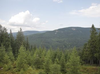
![Randonnée A pied Rokytnice nad Jizerou - [Z] Vosecká bouda - Pod Dívčí strání - Photo](https://media.geolcdn.com/t/350/260/da6881f4-4ab0-41f2-96c7-428bc31eae9f.jpeg&format=jpg&maxdim=2)
![A pied A pied](https://static1.geolcdn.com/sitytour/trail-icons/100.png)
Km
A pied
![](/images/other/stat-length.png)
![](https://static1.geolcdn.com/siteimages/upload/files/1508320355ic_sort_den_pos_24dp.png)
![](https://static1.geolcdn.com/siteimages/upload/files/1508320355ic_sort_den_neg_24dp.png)
![](https://static1.geolcdn.com/siteimages/upload/files/16400158638029165_repeat_loop_refresh_sync_direction_icon.png)
• Randonnée créée par cz:KČT.
![Randonnée A pied Rokytnice nad Jizerou - CZ-4286 - Photo](https://media.geolcdn.com/t/350/260/82553bd1-58f9-426b-9875-b7c7cda85736.jpeg&format=jpg&maxdim=2)
![A pied A pied](https://static1.geolcdn.com/sitytour/trail-icons/100.png)
Km
A pied
![](/images/other/stat-length.png)
![](https://static1.geolcdn.com/siteimages/upload/files/1508320355ic_sort_den_pos_24dp.png)
![](https://static1.geolcdn.com/siteimages/upload/files/1508320355ic_sort_den_neg_24dp.png)
![](https://static1.geolcdn.com/siteimages/upload/files/16400158638029165_repeat_loop_refresh_sync_direction_icon.png)
• Randonnée créée par cz:KČT.
3 randonnées affichées sur 3
Application GPS de randonnée GRATUITE